

- Usage in publication:
-
- Grandfather Mountain formation*
- Modifications:
-
- Named
- Dominant lithology:
-
- Arkose
- Siltstone
- Shale
- Volcanics
- Schist
- Quartz latite
- AAPG geologic province:
-
- Piedmont-Blue Ridge province
Summary:
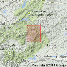
Named for Grandfather Mountain, Avery Co., north-central NC. Part of Grandfather Mountain window. Lower part of formation exposed in many places on Grandfather Mountain; upper parts exposed on ridges northwest of Grandfather Mountain. Basal arkose unit consists of light-green, tan, and gray, fine- to coarse-grained, thin-bedded to massive, sericitic arkose and arkosic quartzite, and minor beds of green sericite phyllite. Arkose is overlain or interfingers with dark-blue-gray, fine-grained, thin-bedded biotite- and chlorite-bearing siltstone, phyllite, and graywacke, locally containing calcareous or dolomitic layers and lenses or sandy marble lenses. Montezuma schist of Keith (1903) is here reduced in rank to member of this formation; consists of green, blue-green, or blue-gray, fine-grained metabasalt (greenstone or greenschist). On Big Ridge, greenish-gray, metamorphosed, porphyritic quartz latite underlies Montezuma member. Entire thickness estimated to range from 10,000 to 30,000 ft. Upper contact with Chilhowee group rocks is thrust fault on northwestern side of window; lower contact is unconformity folded and cut by cleavage. Resembles and probably correlates with rocks of late Precambrian Ocoee series (particularly Snowbird group) in Great Smoky region, western NC. Also resembles some rocks of Mount Rogers volcanic group, but little is known about stratigraphic relationship. Age is tentatively assigned as late Precambrian.
Source: GNU records (USGS DDS-6; Reston GNULEX).
- Usage in publication:
-
- Grandfather Mountain Formation*
- Modifications:
-
- Age modified
- Geochronologic dating
- AAPG geologic province:
-
- Piedmont-Blue Ridge province
Summary:
Five zircon samples from PA, VA, and NC yield discordant U-Pb ages suggesting original age of 820 m.y. Samples of felsic volcanic rocks were taken from Grandfather Mountain Formation in northwestern NC, Mount Rogers Formation in southwestern VA, and Catoctin Formation in southernmost PA. All in turn rest on billion-year-old rocks and are overlain by Lower Cambrian(?) rocks of Chilhowee Group. From the coherence of concordia of the samples, authors suggest that felsic volcanism in the Blue Ridge is essentially coeval and that the Grandfather Mountain Formation, Mount Rogers Formation, and Catoctin Formation north of Potomac River in MD and PA are Precambrian rather than Cambrian. A major hiatus is inferred between felsic volcanism and deposition of Chilhowee rocks. In addition, granitic basement of the Blue Ridge is everywhere older than 820 m.y. and, as a corollary, all stratified units unconformably overlying basement are younger than 1050 m.y. (based on two zircon samples from basement rocks under Grandfather Mountain Formation dated by Davis and others, 1962).
Source: GNU records (USGS DDS-6; Reston GNULEX).
- Usage in publication:
-
- Grandfather Mountain Formation*
- Modifications:
-
- Areal extent
- Overview
- AAPG geologic province:
-
- Piedmont-Blue Ridge province
Summary:
Mapped in southwestern corner of quadrangle in Avery, Caldwell, and Watauga Cos., northwestern NC, in Grandfather Mountain window. Mapped in undivided belts in eastern part of window. Elsewhere in window, divided into five unnamed units: 1) maroon arkose, grit, and interbedded siltstone, slate, sandy slate, and some laminated pebbly mudstone; 2) greenstone and minor interbedded sedimentary rock; includes Montezuma Member in upper part of formation; 3) porphyritic felsic volcanic rock; 4) siltstone, phyllite, and graywacke, locally containing calcareous layers and arkosic beds; and 5) graywacke and sericitic arkose; graywacke and conglomerate locally abundant. Contains minor interbeds of phyllite and siltstone. Age is late Precambrian.
Source: GNU records (USGS DDS-6; Reston GNULEX).
- Usage in publication:
-
- Grandfather Mountain Formation*
- Modifications:
-
- Revised
- Overview
- AAPG geologic province:
-
- Piedmont-Blue Ridge province
Summary:
Consists of interlayered and intertonguing arkose, graywacke, conglomerate, siltstone, and volcanic rocks, 3000 to 9000 m thick. Volcanic rocks in Grandfather Mountain Formation belong to informal Crossnore plutonic-volcanic group. Gross stratigraphy resembles that of Mount Rogers Formation. Colors in both formations trend from green to maroon toward the northwest, also the direction of decreasing metamorphism. Grandfather Mountain Formation has smaller percentage of volcanic rocks than Mount Rogers Formation. General regional correlation of these formations with Ashe Formation is still possible, although Ashe may span a longer period of time. All formations are younger Precambrian [late Precambrian].
Source: GNU records (USGS DDS-6; Reston GNULEX).
- Usage in publication:
-
- Grandfather Mountain Formation*
- Modifications:
-
- Age modified
- AAPG geologic province:
-
- Piedmont-Blue Ridge province
Summary:
Age changed from late Precambrian to Proterozoic Z in accordance with accepted subdivisions of the Precambrian.
Source: GNU records (USGS DDS-6; Reston GNULEX).
- Usage in publication:
-
- Grandfather Mountain Formation*
- Modifications:
-
- Revised
- AAPG geologic province:
-
- Piedmont-Blue Ridge province
Summary:
Assigned to Crossnore Plutonic-Volcanic Complex. Formation is structurally isolated from stratigraphically younger rocks, but Mount Rogers and Catoctin Formations (correlatives of Grandfather Mountain and included in the Crossnore) are overlain by Chilhowee Group rocks.
Source: GNU records (USGS DDS-6; Reston GNULEX).
- Usage in publication:
-
- Grandfather Mountain Formation
- Modifications:
-
- Age modified
- Overview
- AAPG geologic province:
-
- Piedmont-Blue Ridge province
Summary:
Grandfather Mountain Formation divided into six unnamed units in Grandfather Mountain window: 1) meta-arkose, 2) greenstone (including Montezuma Member, a metabasalt, in upper part), 3) porphyritic felsic volcanic rock, 4) metasiltstone, 5) metagraywacke, and 6) felsic metavolcanic rocks and metasedimentary rocks (this subdivision tentatively included in formation). Age is Late Proterozoic based on zircon dates of Rankin and others (1969).
Source: GNU records (USGS DDS-6; Reston GNULEX).
- Usage in publication:
-
- Grandfather Mountain Formation*
- Modifications:
-
- Revised
- Overview
- AAPG geologic province:
-
- Piedmont-Blue Ridge province
Summary:
Grandfather Mountain Formation assignment changed from Crossnore Plutonic-Volcanic Complex to Crossnore Complex because Crossnore contains two classes of rocks, sedimentary and igneous (North American Code of Stratigraphic Nomenclature, 1983, art. 37). Divided into four unnamed units: 1) metamorphosed arkose, pebbly arkose, and subordinate siltstone; slate or sandy slate; and laminated pebbly mudstone; 2) metasiltstone, phyllite, and metagraywacke, locally containing calcareous layers and arkosic beds; 3) metagraywacke and sericitic arkose; and 4) felsic metavolcanic rocks. Age is Late Proterozoic.
Source: GNU records (USGS DDS-6; Reston GNULEX).
- Usage in publication:
-
- Grandfather Mountain Formation
- Modifications:
-
- Revised
- AAPG geologic province:
-
- Piedmont-Blue Ridge province
Summary:
The Grandfather Mountain Formation is correlative with the Ocoee Supergroup to the southeast and the Mount Rogers and Konnarock Formations to the north. Conglomerate units within the Grandfather Mountain were informally named by Neton (1992: Univ. of Tennessee M.S. thesis). The Fall Hollow, Poplar Grove, Snakeden Ridge conglomerates, and Norwood Hollow sandstone occur in the lower portion of the formation. Above the Montezuma Basalt Member in the upper portion of the Grandfather Mountain are the Banner Elk conglomerate and the Broadstone Lodge diamictite. All have designated type localities, shown in table 6-1. Age referred to as Neoproterozoic.
Source: GNU records (USGS DDS-6; Reston GNULEX).
For more information, please contact Nancy Stamm, Geologic Names Committee Secretary.
Asterisk (*) indicates published by U.S. Geological Survey authors.
"No current usage" (†) implies that a name has been abandoned or has fallen into disuse. Former usage and, if known, replacement name given in parentheses ( ).
Slash (/) indicates name conflicts with nomenclatural guidelines (CSN, 1933; ACSN, 1961, 1970; NACSN, 1983, 2005, 2021). May be explained within brackets ([ ]).