

- Usage in publication:
-
- Gouldbusk limestone member
- Modifications:
-
- Original reference
- Dominant lithology:
-
- Limestone
- AAPG geologic province:
-
- Bend arch
Summary:
Sheets 3, 4. Gouldbusk limestone member of Moran formation. New name replacing Drake's Horse Creek limestone. Underlies Santa Anna shale member; overlies Watts Creek shale member. [Age is Early Permian (Wolfcamp).]
Source: US geologic names lexicon (USGS Bull. 1200, p. 1553).

- Usage in publication:
-
- Gouldbusk limestone member*
- Modifications:
-
- Original reference
- Dominant lithology:
-
- Limestone
- Shale
- AAPG geologic province:
-
- Bend arch
Summary:
Sheet 2. Gouldbusk limestone member of Moran formation. Name applied to limestone beds and included thin shale that were called Horse Creek limestone by Drake (1893). Sellards (Univ. Texas Bull., no. 3232, 1933) pointed out duplication by Drake in use of this name, as applied to beds in his Strawn division farther east in Colorado River Valley and to limestone, now considered Permian(?) in age, exposed in Coleman County; Sellards restricted application of Horse Creek to beds in Strawn sequence but did not rename the upper beds, which have continued to be called Horse Creek. Member consists of (1) lower massive blue-gray limestone, 1 to 2 feet thick, that is medium-grained and weathers brownish; (2) gray to yellowish clay shale, 2 to 6 feet thick, that is unfossiliferous; and (3) upper gray irregularly thin-bedded limestone of fine-grained texure that weathers in slabs and shelly fragments of light-gray color splotched with tan; average thickness of this bed 3 feet. Thickness about 8 feet. Age is Early Permian (Wolfcamp).
Source: Publication; US geologic names lexicon (USGS Bull. 1200, p. 1553).

- Usage in publication:
-
- Gouldbusk Limestone [unranked]
- Modifications:
-
- Mapped 1:250k
- Dominant lithology:
-
- Limestone
- Shale
- AAPG geologic province:
-
- Bend arch
Summary:
Gouldbusk Limestone [unranked] in Moran Formation of Cisco Group. Upper part, thinly interbedded argillaceous limestone and gray shale; lower part, gray, fine-grained limestone, 5 to 6 feet thick. Total thickness about 15 feet. Age is Early Permian (Wolfcamp).
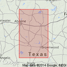
Mapped along southern edge of map sheet across Brown-Coleman Co. line, central northern TX. [See also adjacent Geol. Atlas Texas, Brownwood sheet, 1976, to south.]
Source: Publication.
For more information, please contact Nancy Stamm, Geologic Names Committee Secretary.
Asterisk (*) indicates published by U.S. Geological Survey authors.
"No current usage" (†) implies that a name has been abandoned or has fallen into disuse. Former usage and, if known, replacement name given in parentheses ( ).
Slash (/) indicates name conflicts with nomenclatural guidelines (CSN, 1933; ACSN, 1961, 1970; NACSN, 1983, 2005, 2021). May be explained within brackets ([ ]).