- Usage in publication:
-
- Goshute Limestone*
- Modifications:
-
- Named
- Biostratigraphic dating
- Dominant lithology:
-
- Limestone
- AAPG geologic province:
-
- Great Basin province
Summary:
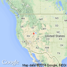
Named for Goshute Mountains. Type section designated as 65-m-thick cliff-forming, light- to medium-gray limestone sequence exposed one km west of Morgan Pass, sec 21, T32N, R68E, Morgan Pass 7.5 min quad, northern Goshute Mountains, Elko Co, NV, Great Basin province. Is equivalent to unit A of Day and others (1987). Also occurs in Deep Creek Mountains where lowermost 85 m of dolomitic limestone and dolomite formerly of Hicks Formation of Nolan (1935) are here reassigned to Goshute Limestone. [Thus Hicks Formation is here abandoned; its remaining (non-Goshute) strata are reassigned as unnamed beds.] Overlies Ola Sandstone (new). Underlies Dunderberg Shale in northern Goshute Mountains. Underlies Candland Formation in Deep Creek Mountains. CREPICEPHALUS Assemblage Zone fauna occur 10 m below top surface of unit. Therefore Goshute Limestone is considered to be entirely early Late Cambrian in age.
Source: GNU records (USGS DDS-6; Denver GNULEX).
For more information, please contact Nancy Stamm, Geologic Names Committee Secretary.
Asterisk (*) indicates published by U.S. Geological Survey authors.
"No current usage" (†) implies that a name has been abandoned or has fallen into disuse. Former usage and, if known, replacement name given in parentheses ( ).
Slash (/) indicates name conflicts with nomenclatural guidelines (CSN, 1933; ACSN, 1961, 1970; NACSN, 1983, 2005, 2021). May be explained within brackets ([ ]).

