- Usage in publication:
-
- Goodland limestone
- Modifications:
-
- Original reference
- Dominant lithology:
-
- Limestone
- AAPG geologic province:
-
- Ouachita folded belt
Summary:
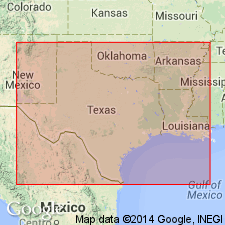
Pg. 504, 514. Goodland limestone. Single persistent layer, representing Fredericksburg or Comanche Peak [of Shumard] division. Resembles Caprina [Edwards] limestone in hardness but has Comanche Peak fauna. Considered northern attenuation of Comanche Peak beds. Overlies EXOGYRA TEXANA beds (Walnut clays and GYRPHAEA breccia) or, where they are absent, Paluxy sands.
Named from Goodland, Choctaw Co., OK; not present-day Goodland, 3 mi southwest of Hugo.
[According to US geologic names lexicon (USGS Bull. 1200, p. 1543), old settlement of Goodland is present site of Good Switch (no longer exists) on St. Louis and San Francisco RR, 3 mi south of Hugo. Old settlement of Goodland (Good Land) was probably north of Hugo, on St. Louis and San Francisco RR, present site of quarry, approx. Lat. 34 deg. 03 min. 00 sec. N., Long. 95 deg. 31 min. 50 sec. W., Hugo 7.5-min quadrangle (located using USGS GNIS, AcmeMapper2.0, late-1890's and early-1900's atlases available from Alabama Maps, alabamamaps.ua.edu, and David Rumsey Map Collection, davidrumsey.com).]
Source: US geologic names lexicon (USGS Bull. 896, p. 837-838).

- Usage in publication:
-
- Goodland limestone
- Modifications:
-
- Revised
Summary:
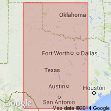
Pg. 241-261 (Chapter I, Fredericksburg division). Goodland limestone of R.T. Hill is = TEXANA limestone [Walnut clay] and perhaps Comanche Peak limestone.
Source: US geologic names lexicon (USGS Bull. 896, p. 837-838).

- Usage in publication:
-
- Goodland Limestone
- Modifications:
-
- Mapped 1:250k
- Dominant lithology:
-
- Limestone
- AAPG geologic province:
-
- Arkla basin
- Ouachita folded belt
Summary:
Goodland Limestone. Limestone, mostly fine grained, chalky, thick irregular beds, white, weathers various shades of gray and pale orange; in upper part, some thin coarse-grained beds, hard, oolitic in part, grayish-white to pale orange; marine megafossils abundant; thickness 30 feet, feathers out eastward. Lies above Antlers Sand and below Washita Group, undivided. Age is Early Cretaceous.
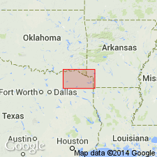
[Mapped north of Red River in northern part of map sheet, in McCurtain Co., southeastern OK, and Sevier Co., southwestern AR. Not mapped in TX.]
Source: Publication.

- Usage in publication:
-
- Goodland Limestone
- Modifications:
-
- Mapped 1:250k
- Dominant lithology:
-
- Limestone
- Clay
- AAPG geologic province:
-
- Fort Worth syncline
- Strawn basin
Summary:
Goodland Limestone. Intergradational laterally with Comanche Peak Limestone and differs from it chiefly in that the Goodland is more coarsely nodular, contains fewer and thinner clay beds, and massive resistant limestone beds are more numerous; upper 5 feet, massive, bioclast-packed aphanitic limestone and limestone composed of oolites in sparry calcite. Thickness 90+/- feet. Lies above Walnut Clay and below Kiamichi Formation. Age is Early Cretaceous.
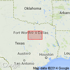
[Mapped in Johnson, Parker, and Tarrant Cos., eastern TX.]
Source: Publication.

- Usage in publication:
-
- Goodland Limestone
- Modifications:
-
- Areal extent
- Dominant lithology:
-
- Limestone
- AAPG geologic province:
-
- Fort Worth syncline
- South Oklahoma folded belt
Summary:
Pamphlet [p. 6]. Goodland Limestone and Walnut Clay, [undifferentiated]. Map unit is mostly Goodland Limestone, fine-grained, well-indurated, massive, nodular toward base, grades downward to Walnut Clay, interbedded coquinite and dark-gray, marly shale. Thickness of Goodland Limestone and Walnut Clay, [undifferentiated] in Texas 13 to 20 feet, 20 to 25 feet thick in Oklahoma. Lies above Paluxy Sand and below Kiamichi Formation. Age is Early Cretaceous.
[Mapped in mostly continuous exposures in northern part and in western half of map sheet; in Cooke, Denton, Grayson, Montague, and Wise Cos., central northern TX, and Love and Marshall Cos., southeastern OK.]
Source: Publication.
For more information, please contact Nancy Stamm, Geologic Names Committee Secretary.
Asterisk (*) indicates published by U.S. Geological Survey authors.
"No current usage" (†) implies that a name has been abandoned or has fallen into disuse. Former usage and, if known, replacement name given in parentheses ( ).
Slash (/) indicates name conflicts with nomenclatural guidelines (CSN, 1933; ACSN, 1961, 1970; NACSN, 1983, 2005, 2021). May be explained within brackets ([ ]).

