

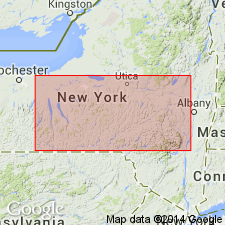
- Usage in publication:
-
- Glenerie limestone
- Modifications:
-
- Original reference
- Dominant lithology:
-
- Limestone
- AAPG geologic province:
-
- Appalachian basin
Chadwick, G.H., 1908, Revision of "the New York series": Science, new series, v. 28, p. 346-348.
Summary:
Named the Glenerie limestone in NY for Glenerie mills at Glenerie Falls, Ulster Co., NY. Name is used for limestone occurring in the Oriskany group. Overlies the Connelly conglomerate and underlies the Esopus grit. The Glenerie is of Early Devonian age.
Source: GNU records (USGS DDS-6; Reston GNULEX).
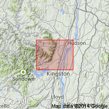
- Usage in publication:
-
- Glenerie limestone and chert
- Modifications:
-
- Areal extent
- AAPG geologic province:
-
- Appalachian basin
Summary:
Composition of the Glenerie limestone ranges from limestone to solid chert beds, soft shale, and conglomerate. Beds are very blue to nearly black in fresh exposures; characteristically weather buff brown. Thickness is about 30 ft in type exposure. Overlies the Port Ewen beds in type area, but overlies the Connelly conglomerate farther to south.
Source: GNU records (USGS DDS-6; Reston GNULEX).
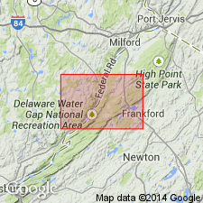
- Usage in publication:
-
- Glenerie Formation
- Modifications:
-
- Revised
- Areal extent
- AAPG geologic province:
-
- Appalachian basin
Summary:
Glenerie Formation mapped in northwestern NJ as lowest of three units in Oriskany Group. [Glenerie was originally assigned to the Oriskany by Chadwick (1908), but GNU records show no other reference with this allocation.] Described as medium- to dark-gray, fossiliferous, thin- to medium-bedded, cherty, fine-grained silty limestone. Unit is thin in the southwest and thickens to the northeast where it constitutes most of the Oriskany Group. Formation thickness ranges from 55 to 170 ft. Lower contact with Port Ewen Shale of Helderberg Group is gradational. Underlies Shriver Chert (middle unit of Oriskany), Ridgeley Sandstone (upper unit of Oriskany), or Esopus Formation. Age is Early Devonian.
Source: GNU records (USGS DDS-6; Reston GNULEX).
For more information, please contact Nancy Stamm, Geologic Names Committee Secretary.
Asterisk (*) indicates published by U.S. Geological Survey authors.
"No current usage" (†) implies that a name has been abandoned or has fallen into disuse. Former usage and, if known, replacement name given in parentheses ( ).
Slash (/) indicates name conflicts with nomenclatural guidelines (CSN, 1933; ACSN, 1961, 1970; NACSN, 1983, 2005, 2021). May be explained within brackets ([ ]).