

- Usage in publication:
-
- Glencairn shale member*
- Modifications:
-
- Named
- Dominant lithology:
-
- Shale
- AAPG geologic province:
-
- Denver basin
Summary:
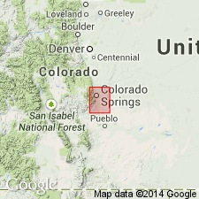
Named for a small tract of land a few mi north of Lytle (sec 2, T17S, R68W), southwest corner El Paso Co, CO in the Denver basin, as the upper member of Purgatoire formation. Overlies Lytle sandstone member (new) of Purgatoire. Underlies Dakota sandstone. No type locality designated. [Area called Glencairn not shown on topographic map.] Mapped on geologic map as two bands of exposures in southwest and northwest part of quad. Has a maximum thickness of 145 ft, but in places is less than 10 ft thick. Consists of slope-forming black shale and a little sandstone. Twelve ft of purple-black, cracked shale veined with gypsum at base is succeeded by 18 ft of grayish sandy shale with gray or yellow sandstone layers, purple-black shale, drab clay[stone], one friable ocher-stained sandstone 18 in thick 110 ft above base, and at top 25 ft of paper-thin purple-black shale with gypsum-filled cracks. Fossiliferous--LINGULA. Early Cretaceous-Washita-age. Stratigraphic tables. These rocks were formerly assigned to the Dakota sandstone in this area.
Source: GNU records (USGS DDS-6; Denver GNULEX).
- Usage in publication:
-
- Glencairn shale member*
- Modifications:
-
- Areal extent
- AAPG geologic province:
-
- Denver basin
- Las Vegas-Raton basin
Summary:
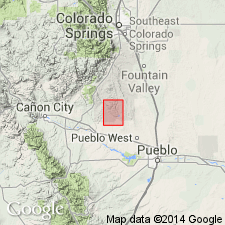
Extended as the upper member of the Purgatoire formation south of the Colorado Springs area in Fremont and Pueblo Cos of Denver basin, and into Huerfano Co of Las Vegas-Raton basin. Fossils from upper part in Canyon City area are of marine origin and indicate an Early Cretaceous age.
Source: GNU records (USGS DDS-6; Denver GNULEX).
- Usage in publication:
-
- Glencairn Shale Member*
- Modifications:
-
- Areal extent
- AAPG geologic province:
-
- Denver basin
Summary:
Mapped with overlying Dakota Sandstone in the northeast and north-central parts of the quad in the Webster Park graben, Eightmile Park, and along the east border of the quad in Fremont Co, CO in the Denver basin. Two members recognized but not mapped. The Lytle Sandstone Member at the base contains white, fine- to coarse-grained sandstone, variegated clay, and pebbly beds 120 ft thick. The Glencairn Shale Member at the top is an olive-brown, thin-bedded sandstone, gray and black shale and clay 80 ft thick. Dakota unconformably overlies Morrison Formation. Of Early Cretaceous age.
Source: GNU records (USGS DDS-6; Denver GNULEX).
- Usage in publication:
-
- Glencairn Shale Member*
- Modifications:
-
- Biostratigraphic dating
- Overview
- Areal extent
- AAPG geologic province:
-
- Anadarko basin
Summary:
Is uppermost of two members of Purgatoire Formation. Is areally extended to Baca Co, CO in Anadarko basin. Accepts recommendation by Scott (1970) that Glencairn nomenclature replace Kiowa in southeastern CO. Outcrops along Horse Creek were mapped by McLaughlin (1954, pl. 1) as Dakota Sandstone; Scott (1968) later assigned them to undifferentiated Dakota Sandstone and Purgatoire Formation. Measured section on south side of Horse Creek 3 1/2 mi south of Two Buttes in SE1/4 sec 19, T29S, R44W. Unusual ammonites include GOODHALLITES (known only from upper Albian rocks) and IDIOHAMITES (known only from upper Albian to Cenomanian rocks). Holotype of I. FREMONTI noted to be from rocks now assigned to Duck Creek Limestone of Washita Group in northern TX. Age is Early Cretaceous (late Albian).
Source: GNU records (USGS DDS-6; Denver GNULEX).
- Usage in publication:
-
- Glencairn Formation
- Modifications:
-
- Revised
- Reference
- AAPG geologic province:
-
- Palo Duro basin
- Sierra Grande uplift
Summary:
Revised in stratigraphic rank from upper member of Purgatoire Formation to formation rank. Removed from Purgatoire, a term abandoned in this report. Overlies Lytle Sandstone. Underlies Mesa Rica Sandstone of Dakota Group. Reference section designated in NE1/4 SW1/4 SW1/4 sec 18, T15N, R2E, Cimarron Co, OK where Glencairn is 20+ m thick. Consists of Long Canyon Sandstone Bed (new) at base and an unnamed upper part. At reference section, Long Canyon is a 2.7 m orange to brown, very fine to fine grained quartzose sandstone, and the overlying part is dark-gray shale, fossiliferous orange sandstone, and gray siltstone; the sandstone is fine grained, quartzose, subround, and well sorted. Other measured sections. Is a slope-forming unit recognized along the Dry Cimarron from Union Co, NM on the Sierra Grande uplift, east into Cimarron Co, OK in the Palo Duro basin. Is as much as 22 m thick in the valley. Contains the marine invertebrate TEXIGRYPHAEA. Correlation chart.
Source: GNU records (USGS DDS-6; Denver GNULEX).
For more information, please contact Nancy Stamm, Geologic Names Committee Secretary.
Asterisk (*) indicates published by U.S. Geological Survey authors.
"No current usage" (†) implies that a name has been abandoned or has fallen into disuse. Former usage and, if known, replacement name given in parentheses ( ).
Slash (/) indicates name conflicts with nomenclatural guidelines (CSN, 1933; ACSN, 1961, 1970; NACSN, 1983, 2005, 2021). May be explained within brackets ([ ]).