- Usage in publication:
-
- Gladeville sandstone*
- Modifications:
-
- Named
- Dominant lithology:
-
- Sandstone
- AAPG geologic province:
-
- Appalachian basin
Summary:
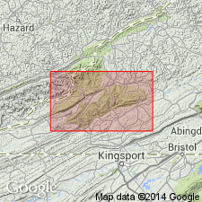
Named as a formation in Pottsville group. Named for Gladeville [now called Wise], Wise Co., southwestern VA. Consists of heavy, coarse, white sandstone. Thickness is 100 ft; upper portion is massive, becoming thin-bedded toward bottom, but carries no shale. Underlies Wise formation and overlies Norton formation in Big Stone Gap coal field of VA and KY. Age is Pennsylvanian.
Source: GNU records (USGS DDS-6; Reston GNULEX).

- Usage in publication:
-
- Gladeville Sandstone
- Modifications:
-
- Overview
- Areal extent
- AAPG geologic province:
-
- Appalachian basin
Summary:
Gladeville has been commonly misidentified. Recent work by Miller (1969: USGS Bull. 1280) and Whitlock and Lovett (personal commun, 1986) has helped resolve the problem of the Gladeville. Unit is now restricted to limited areas of central and western Dickenson, Wise, and western Buchanan Cos. Currently defined as the uppermost quartzose sandstone, which lies below the Dorchester coal bed and above the Norton coal bed with a thickness of 30 to 50 ft. (Thickness according to original definition was 75 to 120 ft.) Formation pinches out northward in central Pound quad. The sandstone is medium gray to white, fine to medium grained, massive, quartzose to feldspathic with mica, heavy minerals, and carbonaceous matter. Commonly trough cross-bedded. Overlies Norton Formation with a sharp contact. To the northeast and northwest of its type locality, the Gladeville grades laterally into siltstones of the Norton. Conformably underlies Wise Formation. Age is Middle Pennsylvanian.
Source: GNU records (USGS DDS-6; Reston GNULEX).

- Usage in publication:
-
- Gladeville Sandstone*
- Modifications:
-
- Areal extent
- AAPG geologic province:
-
- Appalachian basin
Summary:
Gladeville Sandstone is difficult to identify beyond its type area. Used only in VA, between Norton and Wise Formations.
Source: GNU records (USGS DDS-6; Reston GNULEX).
For more information, please contact Nancy Stamm, Geologic Names Committee Secretary.
Asterisk (*) indicates published by U.S. Geological Survey authors.
"No current usage" (†) implies that a name has been abandoned or has fallen into disuse. Former usage and, if known, replacement name given in parentheses ( ).
Slash (/) indicates name conflicts with nomenclatural guidelines (CSN, 1933; ACSN, 1961, 1970; NACSN, 1983, 2005, 2021). May be explained within brackets ([ ]).

