

- Usage in publication:
-
- Gibson Jack Formation*
- Modifications:
-
- Named
- Dominant lithology:
-
- Siltstone
- Argillite
- Quartzite
- Sandstone
- AAPG geologic province:
-
- Snake River basin
Summary:
Pg. 586-587. Gibson Jack Formation. Present in Pocatello area, Bannock County, southeastern Idaho. Consists of tan to brown, argillaceous siltstone and papery-weathering argillite; contains minor interbeds of sandstone or quartzite. Is more than 1,000 feet thick. Conformably and transitionally overlies Camelback Mountain Quartzite (new); basal contact placed at base of first thick siltstone or argillite. Upper contact is at base of first thick limestone or dolomite equivalent to Langston or Ute Formations. Age is Early Cambrian. Cambrian arthropod NAROIA found approx. 300 feet above base. Oriel reported occurrence of Early Cambrian OLENELLUS in beds equivalent to Gibson Jack. (Gibson Jack Formation adopted by the USGS.)
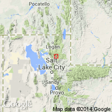
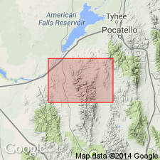
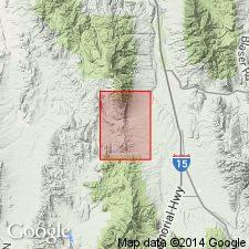
Type locality: at head of Gibson Jack Creek, about 8 mi (12.8 km) south-southwest of Pocatello, in sec. 33, T. 7 S., R. 34 E., near Bannock-Power Co. line, ID (Snake River basin). Named from exposures on Gibson Jack Creek, south of the Portneuf River, about 5 mi south of Pocatello, Bannock Co., ID.
Source: US geologic names lexicon (USGS Bull. 1520, p. 112-113); GNU records (USGS DDS-6; Denver GNULEX); Changes in stratigraphic nomenclature, 1971 (USGS Bull. 1372-A, p. A8-A9).
- Usage in publication:
-
- Gibson Jack Formation*
- Modifications:
-
- Revised
- AAPG geologic province:
-
- Snake River basin
Summary:
Underlies in the Snake River basin the newly named Elkhead Limestone, a term considered equivalent to Langston, Ute, and Blacksmith Limestones. Assigned to the Early Cambrian on basis of correlation with Olenellus-bearing beds in rocks thought to be equivalent to the Gibson Jack.
Source: GNU records (USGS DDS-6; Denver GNULEX).
- Usage in publication:
-
- Gibson Jack Formation*
- Modifications:
-
- Age modified
- AAPG geologic province:
-
- Snake River basin
Summary:
Age changed from Early Cambrian --to-- Early and Middle Cambrian. Shale in the upper part of the Gibson Jack is equivalent to shales in the Middle Cambrian Lead Bell Shale of the Bancroft and Soda Springs quadrangles to the east.
Source: GNU records (USGS DDS-6; Denver GNULEX).
- Usage in publication:
-
- Gibson Jack Formation
- Modifications:
-
- Revised
- AAPG geologic province:
-
- Snake River basin
Summary:
Newly assigned as the upper formation (of 6) to the Brigham Group (extended as group rank into ID) in the northern Bannock and Portneuf Ranges, ID in the Snake River basin. Overlies Gibson Jack Formation of Brigham, a contact that is locally gradational. Underlies Elkhead Limestone. Is poorly exposed; no complete section exists; 1,510-2,300 ft thick (estimate). Newly included with Brigham because: 1) Anderson (1928) included all rocks below Cambrian limestone and above Blackrock Canyon Limestone in his Brigham Quartzite; 2) Oriel and Armstrong (1971) included equivalents of upper members of Gibson Jack--the Windy Pass Argillite and Sedgwick Quartzite Members--in their Brigham Quartzite; 3) Gibson Jack contains poorly sorted black-weathering quartzites similar to other Brigham quartzites. Cross section. Is an offshore marine deposit, assigned to upper part of depositional sequence 4. Of Cambrian age.
Source: GNU records (USGS DDS-6; Denver GNULEX).
For more information, please contact Nancy Stamm, Geologic Names Committee Secretary.
Asterisk (*) indicates published by U.S. Geological Survey authors.
"No current usage" (†) implies that a name has been abandoned or has fallen into disuse. Former usage and, if known, replacement name given in parentheses ( ).
Slash (/) indicates name conflicts with nomenclatural guidelines (CSN, 1933; ACSN, 1961, 1970; NACSN, 1983, 2005, 2021). May be explained within brackets ([ ]).