- Usage in publication:
-
- Furner Valley Limestone*
- Modifications:
-
- Named
- Reference
- Dominant lithology:
-
- Limestone
- Dolomite
- Quartzite
- AAPG geologic province:
-
- Great Basin province
Summary:
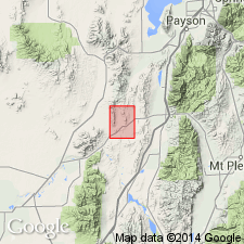
Named as upper formation of Oquirrh Group for Furner Valley, Juab Co, UT, Great Basin province. Type section measured on east side, Jericho Ridge, secs 6, 7, and 8, T13S, R2W, Furner Ridge quad. Base is placed at base of gray thin-bedded cherty silty limestone above the red-brown weathering limy quartzite at top of underlying Bingham Mine Formation. Top is placed at base of pink-red weathering limy siltstone of the disconformably overlying Diamond Creek Sandstone. Is 5,454 ft thick at type. Is 90 percent limestone and dolomite, and 10 percent quartzite, sandstone, and siltstone. Limestone is gray to buff brown, can be silty, locally dolomitic, fossiliferous, fine grained, thin to medium bedded. Dolomite is gray to brown and it can be: silty; sandy; cherty; fine, medium to coarse grained; thin, medium bedded to massive. Quartzite is red to olive brown weathered and it can be fine to medium grained, and limy. Sandstone is buff to yellow, fine grained. Siltstone is yellow to brown, fine grained, and it can be limy, dolomitic, to cherty. Reference section 5,454 ft thick measured in secs. 6, 7, 18, T13S, R2W. May correlate with Ferguson Mountain Formation, Callville Limestone, and Pakoon Dolomite. Contains fusulinid fauna (listed) of Missourian into Wolfcampian, or Late Pennsylvanian and Early Permian. Cross sections. Geologic map.
Source: GNU records (USGS DDS-6; Denver GNULEX).
For more information, please contact Nancy Stamm, Geologic Names Committee Secretary.
Asterisk (*) indicates published by U.S. Geological Survey authors.
"No current usage" (†) implies that a name has been abandoned or has fallen into disuse. Former usage and, if known, replacement name given in parentheses ( ).
Slash (/) indicates name conflicts with nomenclatural guidelines (CSN, 1933; ACSN, 1961, 1970; NACSN, 1983, 2005, 2021). May be explained within brackets ([ ]).

