- Usage in publication:
-
- Frenck shale member
- Modifications:
-
- Original reference
- Dominant lithology:
-
- Shale
- AAPG geologic province:
-
- Nemaha anticline
Summary:
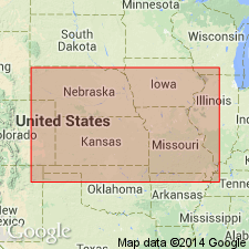
Pg. 94, 96. Frenck shale member of McKissick Grove shale of Wabaunsee group. Age is Late Pennsylvanian (Virgil). Overlies Maple Hill limestone member and underlies Dover limestone member, both of the McKissick Grove. [See under Dover limestone, Moore 1932 entry. On p. 58 thickness is given as 21 feet.]
Named from Frenck [French] Creek, northwest of town of Onaga, Pottawatomie Co., northeastern KS.
Source: US geologic names lexicon (USGS Bull. 896, p. 780); GNC KS-NE Pennsylvanian Corr. Chart, sheet 2, Oct. 1936.
- Usage in publication:
-
- Frenck shale
- Modifications:
-
- Errata
Summary:
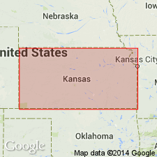
Transposed Frenck shale and Table Creek shale [restricted] by applying Frenck to shale overlying Dover limestone and Table Creek to shale underlying Dover limestone.
[Origin of name not stated.]
Source: US geologic names lexicon (USGS Bull. 896, p. 780); GNC KS-NE Pennsylvanian Corr. Chart, sheet 2, Oct. 1936.
- Usage in publication:
-
- French Creek shale member
- Modifications:
-
- Revised
- AAPG geologic province:
-
- Forest City basin
- Nemaha anticline
Summary:
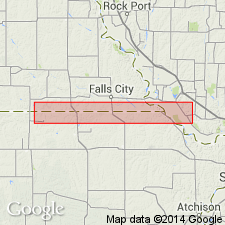
(Late in 1935.) Pg. 9-10. French Creek shale member of Pony Creek shale of Wabaunsee group. About 7 miles south of Humboldt [Richardson Co., southeastern Nebraska?], 16 feet. Divided into (descending): gray sandy shale, 2 feet; Lorton coal, 2 to 4 inches; dull-gray argillaceous shale, 6+ feet; dull-gray irregular impure limestone, grading laterally into sandstone, 10 inches; sandstone or shale, gray green, bedded locally with plant remains, 6 feet. Underlies Nebraska City limestone and overlies Jim Creek limestone members of Pony Creek. Age is Late Pennsylvanian (Virgil).
Source: US geologic names lexicon (USGS Bull. 896, p. 780); GNC KS-NE Pennsylvanian Corr. Chart, sheet 2, Oct. 1936.

- Usage in publication:
-
- Frenck shale
- Modifications:
-
- Not used
Summary:
(Late in 1935.) Pg. 10. Called the shale overlying Dover limestone the [/]Friedrich-Dry shale and the shale underlying Dover limestone the Table Creek shale and did not use Frenck shale.
[The use of a hyphen between undifferentiated [members] is not considered proper notation (CSN, 1933).]
Source: US geologic names lexicon (USGS Bull. 896, p. 780); GNC KS-NE Pennsylvanian Corr. Chart, sheet 2, Oct. 1936.
- Usage in publication:
-
- French Creek shale
- Modifications:
-
- Revised
Summary:
(May 1, 1935.) Table opp. p. 14. French Creek shale underlies Caneyville limestone and overlies Jim Creek limestone [true]; all included in Wabaunsee formation. Age is Late Pennsylvanian (Virgil).
Source: US geologic names lexicon (USGS Bull. 896, p. 780); GNC KS-NE Pennsylvanian Corr. Chart, sheet 2, Oct. 1936.

- Usage in publication:
-
- French Creek shale
- Modifications:
-
- Principal reference
Summary:
Pg. 49, 240. French Creek shale of Wabaunsee group. French Creek shale overlies Jim Creek and underlies Caneyville limestone. It is bluish gray or yellowish brown, clayey to sandy; some light-brownish or tan sandstone in upper part; Lorton coal near top. Average thickness 30+/- feet. Is recognized across all of Kansas. Age is Late Pennsylvanian (Virgil).
Type locality: French Creek, northeastern part of Pottawatomie Co., northeastern KS.
[See "Modern classifications of the Pennsylvanian rocks of eastern Kansas and southeastern Nebraska," compiled by M.G. Wilmarth, Secretary of Committee on Geologic Names, USGS unpub. corr. chart, Oct. 1936, sheet 2.]
Source: US geologic names lexicon (USGS Bull. 896, p. 780); GNC KS-NE Pennsylvanian Corr. Chart, sheet 2, Oct. 1936.

- Usage in publication:
-
- Frenck shale†
- Modifications:
-
- Abandoned
Summary:
Pg. 238, 240. †Frenck shale (derived from erroneous spelling of French Creek on maps) was applied to beds between Dover limestone below and Jim Creek (Nebraska City) limestone above, and is abandoned. French Creek shale comprises upper part of what was termed "Frenck shale" in 1932 Guide Book.
[See "Modern classifications of the Pennsylvanian rocks of eastern Kansas and southeastern Nebraska," compiled by M.G. Wilmarth, Secretary of Committee on Geologic Names, USGS unpub. corr. chart, Oct. 1936, sheet 2.]
Source: US geologic names lexicon (USGS Bull. 896, p. 780); GNC KS-NE Pennsylvanian Corr. Chart, sheet 2, Oct. 1936.
- Usage in publication:
-
- French Creek limestone member*
- Modifications:
-
- Revised
Summary:
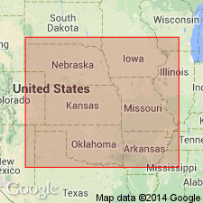
Pg. 2274 (fig. 1), 2275. French Creek shale member of Root shale. Rank reduced to member status in Root shale (new). Overlies Jim Creek limestone member; underlies Nebraska City limestone member of Wood Siding formation (redefined). Age is Late Pennsylvanian (Virgilian).
Source: US geologic names lexicon (USGS Bull. 1200, p. 1428).
- Usage in publication:
-
- French Creek shale
- Modifications:
-
- Areal extent
Summary:
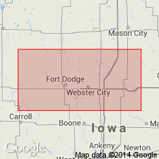
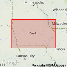
Pg. 11, fig. 5. French Creek shale of Wabaunsee group. Geographically extended into southwestern Iowa where it is uppermost unit in Wabaunsee group. Overlies Jim Creek limestone. Age is Late Pennsylvanian (Virgilian).
Source: US geologic names lexicon (USGS Bull. 1200, p. 1428).
For more information, please contact Nancy Stamm, Geologic Names Committee Secretary.
Asterisk (*) indicates published by U.S. Geological Survey authors.
"No current usage" (†) implies that a name has been abandoned or has fallen into disuse. Former usage and, if known, replacement name given in parentheses ( ).
Slash (/) indicates name conflicts with nomenclatural guidelines (CSN, 1933; ACSN, 1961, 1970; NACSN, 1983, 2005, 2021). May be explained within brackets ([ ]).

