The National Geologic Map Database is migrating to a new infrastructure. We apologize for any service disruptions during this process.
|
|---|


- Usage in publication:
-
- Fountain formation*
- Modifications:
-
- Original reference
- Dominant lithology:
-
- Sandstone
- Conglomerate
- Grit
- AAPG geologic province:
-
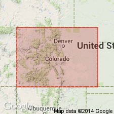
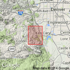
- Denver basin
Summary:
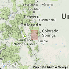
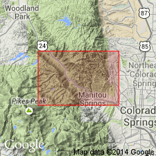
Fountain formation. Series of red sandstones, grits, and conglomerates, a part of so-called "Red beds," found in typical development on Fountain Creek below Manitou Springs [in Colorado Springs quadrangle] and at head of same stream in northeast corner of Pikes Peak quadrangle. The beds of upper exposures on Fountain Creek belong to basin of Manitou Park. They are chiefly coarse-grained, crumbling arkose sandstones, in heavy banks showing cross-bedding; are locally conglomeratic, mottled with gray and various light shades of red; near base and at intervals throughout the series are very dark-red or purplish layers of arenaceous shale or fine-grained sandstone. Thickness near Woodland Park estimated at nearly 1,000 feet. The characteristics above noted are also found in lower 1,000 feet of section of reddish sandstones and grits to east of Manitou Springs, referred by Hayden to Upper Carboniferous, while the finer grained "Red beds" succeeding them, together with the strata of Manitou Park, were called "Triassic." In Garden Park the Fountain beds reach maximum thickness of about 1,000 feet; they are heavy bedded, with much feldspathic material derived from adjacent granite; the conglomerate layers contain many pebbles of hard Algonkian quartzites, while a few limestone and chert pebbles were noted in lower part; dark shale is less prominent than in Manitou Park. The Fountain beds rest unconformably on edges of entire Silurian section in Red ridge, at upper end of Garden Park; along south end of Colorado Range they rest on Harding sandstone. While greater part of "Red beds" series east of Colorado Range has been considered Triassic, no fossil or other definite evidence has as yet been found to show correctness of this conclusion. It is more probable lower part at least of these "Red beds" belong to Carboniferous than that the whole complex is Triassic.
Source: US geologic names lexicon (USGS Bull. 896, p. 764-765).
- Usage in publication:
-
- Fountain formation
- Modifications:
-
- Contact revised
- Age modified
- AAPG geologic province:
-
- Denver basin
Summary:
Upper contact revised. Fountain unconformably overlies the newly-named Gleneyrie formation of Pennsylvanian age near Manitou, El Paso Co, CO in the Denver basin. Thought to be Pennsylvanian rather than Carboniferous as assigned by Cross in an earlier report. Fossil brachiopods. Age of upper layers of formation uncertain; they may be Permian or Triassic.
Source: GNU records (USGS DDS-6; Denver GNULEX).
- Usage in publication:
-
- Fountain formation
- Modifications:
-
- Contact revised
- AAPG geologic province:
-
- Denver basin
Summary:
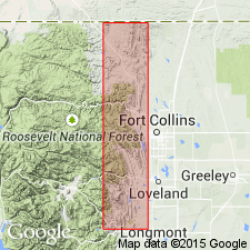
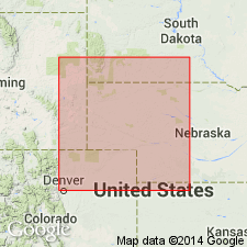
Upper contact revised. Fountain underlies the newly named Ingleside formation of Pennsylvanian age north of Lyons, Boulder Co, CO and north into Larimer Co, CO to the CO-WY State line in the Denver basin. At most places the Fountain Ingleside contact is distinct. Contact placed at top of last prominent arkosic conglomerate. Unconformably overlies pre-Cambrian at most places but may also overlie rocks that range from Cambrian to Mississippian age. At base of formation near WY line there is a shale less than 20 ft thick with chert boulders which have Mississippian fossils. Derivation of boulders discussed. Columnar and local sections from North Table Mountain to Four mile Canyon north of Boulder of Fountain. Of "Upper Carboniferous" age.
Source: GNU records (USGS DDS-6; Denver GNULEX).
- Usage in publication:
-
- Fountain formation*
- Modifications:
-
- Revised
- Areal extent
- AAPG geologic province:
-
- Denver basin
Summary:
[GNC remark (ca. 1938, US geologic names lexicon, USGS Bull. 896, p. 765): The geologic map of Colorado Springs folio (no. 203) shows that Fountain Creek cuts across Fountain formation for 2 miles east of Manitou Springs, and that about 2 miles east of latter place it cuts across Lyons sandstone and Lykins formation as described in that folio. From this it would appear that Lyons sandstone and Lykins formation of that folio were included in foregoing original definition of Fountain formation. But Cross distinctly states that his Fountain formation is only a part of the "Red beds." The latter term was replaced by "Wyoming formation" in 1896, and still later was subdivided into Lykins, Lyons, and Fountain formations. There are also differences in the thicknesses. The Fountain of Colorado Springs quadrangle is 800 to 4,500 feet thick, while Lyons sandstone of that folio is 850 feet thick, and Lykins formation is 180 feet thick. The author of Colorado Springs folio (G.I. Finlay) interpreted the Fountain formation as originally defined to be = Fountain formation plus lower part of Lyons sandstone as mapped by him in Colorado Springs folio. Age is Pennsylvanian.]
Source: US geologic names lexicon (USGS Bull. 896, p. 764-765).
- Usage in publication:
-
- Fountain formation
- Modifications:
-
- Areal extent
- AAPG geologic province:
-
- Denver basin
- Powder River basin
Summary:
Recognized beneath Ingleside(?) formation and above pre-Cambrian granite in sections from Owl Canyon, Larimer County, Colorado (Denver basin), north to the Laramie Range, Laramie County, Wyoming, to La Bonte Post Office [sec. 5, T. 29 N., R. 72 W.] Converse County, Wyoming (in the Powder River basin). Age is Pennsylvanian. Report includes measured sections.
Source: Modified from GNU records (USGS DDS-6; Denver GNULEX).

- Usage in publication:
-
- Fountain formation*
- Modifications:
-
- Areal extent
- AAPG geologic province:
-
- Las Animas arch
Summary:
Extended into subsurface of Otero County, Colorado, on the Las Animas arch. Overlies Glen Eyrie shale of Pennsylvanian age; underlies Lyons sandstone of Permian age. Age is Pennsylvanian. Report includes correlation chart.
Source: Modified from GNU records (USGS DDS-6; Denver GNULEX).
- Usage in publication:
-
- Fountain formation
- Modifications:
-
- Overview
- AAPG geologic province:
-
- Denver basin
Summary:
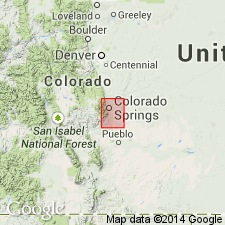
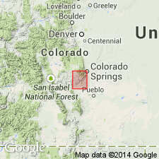
In the southwest part of Denver basin in Fremont and El Paso Cos, CO, the Early Permian and Pennsylvanian Fountain formation is 4,500 ft thick at Colorado Springs, 1,000 ft thick east of Canon City to southwest, and is missing at Grape Ridge southwest of Canon City. The upper part of Fountain is shown as intertonguing with Permian Lyons sandstone (also called Lyons formation in this report). Underlies Permian Lykins Formation west of Beaver Creek (T17S, R68W). Fountain overlies Beulah formation of Mississippian age. Geologic map. Stratigraphic chart.
Source: GNU records (USGS DDS-6; Denver GNULEX).
- Usage in publication:
-
- Fountain formation*
- Modifications:
-
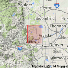
- Mapped 1:24k (Golden quad, Jefferson Co, CO)
- Dominant lithology:
-
- Sandstone
- Conglomerate
- Mudstone
- AAPG geologic province:
-
- Denver basin
Summary:
Is Pennsylvanian formation mapped in northern Jefferson Co, CO (Denver basin). Outcrops as a northwesterly striking belt in southwestern part of quad. Overlies Idaho Springs formation (Precambrian) with an angular unconformity; unconformably? underlies Lyons sandstone (Permian). Consists mainly of conglomerate and mudstone. Composed of pink to reddish-orange, coarse-grained, conglomeratic, cross-bedded, arkosic sandstone and conglomerate interbedded with lenticular, dark reddish-brown, micaceous, silty, indurated mudstones. Occasional lenticular, pinkish-gray, fine-grained, cross-bedded, quartzose sandstone beds, very similar to sandstone in overlying Lyons, occur in upper 30 ft. Coarse fraction, which includes cobbles up to 7 inches in diameter, is composed of quartz and pink feldspar and minor schist, gneiss, quartzite, granite, and limestone. Prominent pink color is due to iron oxide and pink feldspar. Lenticularity, cross-bedding, and coarse nature of deposits indicate terrestrial origin. Thickness is about 800 ft.
Source: GNU records (USGS DDS-6; Denver GNULEX).

- Usage in publication:
-
- Fountain formation*
- Modifications:
-
- Mapped 1:24k (Jefferson quad, Jefferson Co, CO)
- Dominant lithology:
-
- Conglomerate
- Sandstone
- AAPG geologic province:
-
- Denver basin
Summary:
Is Pennsylvanian and Permian formation mapped in east-central Jefferson Co, CO (Denver basin). Outcrops in southwest corner of quad where it is best developed in sec 21, T6S, R69W. Map unit consists of moderate-reddish-brown arkosic conglomerate, coarse sandstone, and thin layers of dark reddish-brown shale; quartz, feldspar, and muscovite are common. Conglomerate beds are crudely sorted, discontinuous, and cross-bedded. Shaly beds are common at base. Difference in hardness of individual beds causes weathering and erosion into "grotesquely" shaped slabs and monuments. Thickness is about 2000 ft, but some of unit may have been removed by strike fault that parallels Front Range. Nonconformably overlies Precambrian rocks; unconformably underlies Lyons sandstone.
Source: GNU records (USGS DDS-6; Denver GNULEX).
- Usage in publication:
-
- Fountain formation*
- Modifications:
-
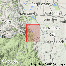
- Mapped 1:24k (Kassler quad, Douglas and Jefferson Cos, CO)
- Dominant lithology:
-
- Sandstone
- Conglomerate
- Siltstone
- Shale
- AAPG geologic province:
-
- Denver basin
Summary:
Is Pennsylvanian and Permian formation mapped in northwestern Douglas and southeastern Jefferson Cos, CO (Denver basin). Outcrops as northwesterly striking, easterly dipping belt 1,500-3,000 ft wide along Hogback in central part of quad. Overlies Precambrian crystalline rocks with an erosional unconformity; unconformably underlies Lyons sandstone (Permian). In general unit is not well exposed and forms valley; within valley hogbacks, ridges, and spires of more resistant sandstone are conspicuous. Consists of moderate reddish-brown arkosic conglomeratic sandstone and minor amounts of arkosic conglomerate, siltstone, and dark reddish-brown shale. Thickness ranges from 1,150-2,250 ft. Contains no fossils. Age is based on Permian fossils in Ingleside formation with which Fountain intertongues in northern CO, and on Pennsylvanian fossils in Glen Eyrie shale member of Fountain in Colorado Springs area.
Source: GNU records (USGS DDS-6; Denver GNULEX).
- Usage in publication:
-
- Fountain Formation
- Modifications:
-
- Age modified
- AAPG geologic province:
-
- Denver basin
Summary:
Fauna of Morrowan age discovered in a limestone member of the Fountain Formation in Perry Park, S1/2 NW1/4 sec 1, T10S, R68W, Douglas Co, CO in the Denver basin. The limestone member lies 250 ft above the base of the Fountain. The member is divisible into a lower pink, thin-bedded, fossiliferous limestone interbedded with quartzose, micaceous, fine-grained, resistant siltstone 15 ft thick, and an upper grayish-orange-pink, resistant, persistent, fossiliferous dolomite 5 ft thick. The member, traceable for two miles, forms a low hogback. The same calcareous interval has not been identified elsewhere. The limestone contains an abundant microfauna with every major invertebrate phylum represented. The siltstone has bryozoans, brachiopods, crinoids, echinoids, and gastropods. The dolomite contains gastropods, crinoids, echinoderms, but the fossils in it are not as well preserved as in the limestone. The faunal assemblage suggests a marine environment with normal salinity and adequate circulation that was interrupted from time to time by silty sediment.
Source: GNU records (USGS DDS-6; Denver GNULEX).

- Usage in publication:
-
- Fountain Formation*
- Modifications:
-
- Mapped 1:24k (Morrison quad, Jefferson Co, CO)
- Dominant lithology:
-
- Sandstone
- Conglomerate
- AAPG geologic province:
-
- Denver basin
Summary:
Is Permian and Pennsylvanian formation mapped in north-central Jefferson Co, CO (Denver basin). Outcrops along west side of Hogback. Is oldest formal unit mapped; overlies Precambrian X [Early Proterozoic] gneiss units with major unconformity and uplift noted; unconformably underlies Lyons Sandstone (Permian). Described as maroon arkosic thick-bedded coarse-grained sandstone and conglomerate containing thin layers of dark-maroon micaceous silty fine-grained sandstone becoming more abundant in lower part. Characterized by festooned and torrential cross-bedding. Composed primarily of Precambrian detritus, but contains rare fragments of lower Paleozoic rocks in lower part. Conglomerate near base contains boulders as large as 10 inches in diameter. Thickness is 1,600 ft.
Source: GNU records (USGS DDS-6; Denver GNULEX).
- Usage in publication:
-
- Fountain Formation*
- Modifications:
-
- Mapped 1:24k (Indian Hills quad, Jefferson Co, CO)
- Dominant lithology:
-
- Conglomerate
- Sandstone
- Shale
- AAPG geologic province:
-
- Denver basin
Summary:
Is Pennsylvanian and Permian formation mapped in central Jefferson Co, CO (Denver basin). Outcrops in eastern part of quad following northwest strike of Hogback. Is oldest Phanerozoic unit in quad; younger than Precambrian lamprophyre and Silver Plume Quartz Monzonite (Precambrian Y [Middle Proterozoic]); conformably underlies Lyons Sandstone (Permian). Map unit described as moderate-reddish-brown iron-stained arkosic conglomerate and moderately hard coarse sandstone containing thin layers of dark-reddish-brown (purplish) shale. Sandstone and conglomerate are locally cemented by calcium carbonate. Numerous outcrops in valley west of Lyons Sandstone ridge north and south of Deer Creek display bleached coarse sandstone, probably owing to greater permeability within coarser sandstone. Pinnacles and monuments formed by differential weathering are characteristic. Thickness about 2000 ft.
Source: GNU records (USGS DDS-6; Denver GNULEX).
- Usage in publication:
-
- Fountain Formation
- Modifications:
-
- Overview
- AAPG geologic province:
-
- Denver basin
Summary:
Fossil plants of Pennsylvanian age found at two localities in Garden Park north of Canon City in NE1/4 SE1/4 NE1/4 sec 4, T17S, R70W and in NE1/4 SW1/4 NE1/4 sec 4, T17S, R70W, Fremont Co, CO in the Denver basin, are figured and described for the first time. Flora includes LEPIDOPHLOIOS LARICINUS, several SIGILLARIA, SYRINGODENDRON sp., LEPIDOPHYLLOIDES sp., LEPIDOSTROBUS sp., LEPIDOSTROBOPHYLLUM sp., several CALAMITES, NEUROPTERUS cf. N. GIGANTEA, CYCLOPTERIS sp., cf. MARIOPTERIS PYGMAEA, and STIGMARIA FICOIDES. Various plant impressions at the first locality were found in arkosic red sandstone and maroon to buff siltstone adjacent to the lower contact of the Fountain. Only casts of STIGMARIA FICOIDES were found at the second locality in red mudstone above the lowermost arkosic sandstone. Regarded as a fluvial unit with a few carbonaceous zones in its Glen Eyrie Member. Base of the Fountain has been regarded as Atokan in southeast WY and as Morrowan in the Denver basin and Canon City Embayment. Plant fossils are consistent with age assignment applied in Canon City Embayment.
Source: GNU records (USGS DDS-6; Denver GNULEX).
For more information, please contact Nancy Stamm, Geologic Names Committee Secretary.
Asterisk (*) indicates published by U.S. Geological Survey authors.
"No current usage" (†) implies that a name has been abandoned or has fallen into disuse. Former usage and, if known, replacement name given in parentheses ( ).
Slash (/) indicates name conflicts with nomenclatural guidelines (CSN, 1933; ACSN, 1961, 1970; NACSN, 1983, 2005, 2021). May be explained within brackets ([ ]).