- Usage in publication:
-
- Fort Crittenden formation
- Modifications:
-
- Original reference
- AAPG geologic province:
-
- Basin-and-Range province
Summary:
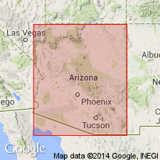
Pg. 297 (table). Fort Crittenden formation of Sonoita group. Soft red and yellow clay and sandstone. Age is early Tertiary.
Source: US geologic names lexicon (USGS Bull. 1200, p. 1392).
- Usage in publication:
-
- Fort Crittenden formation
- Modifications:
-
- Principal reference
- Dominant lithology:
-
- Conglomerate
- Sandstone
- Shale
- AAPG geologic province:
-
- Basin-and-Range province
Summary:
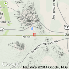
Pg. 59. Fort Crittenden formation of Sonoita group. Consists of a (ascending) alternating yellow thin-bedded shales and hard sandstones, 600 feet thick; yellow, red, and black shale alternating with hard yellow and pink sandstone, 200 feet thick; light-colored conglomerate, 350 feet thick; thin-bedded sandstone, 80 feet thick; soft light-colored shale and gray and buff sandstone and shale; conglomerate composed of large boulders, probably over 1,000 feet thick; and south of the Greaterville fault, terminates in a thick series of scarlet-red strata. Upper division of Sonoita group; overlies Fort Buchanan formation (new). Geographical area given. Fossils. Age is Late Cretaceous.
Notable exposures in Casa Blanca Canyon, Patagonia Mountains, southeastern AZ. Name adopted from the nearby ruins of an old fort.
Source: US geologic names lexicon (USGS Bull. 1200, p. 1392).
- Usage in publication:
-
- Fort Crittenden Formation*
- Modifications:
-
- Revised
- Reference
- AAPG geologic province:
-
- Basin-and-Range province
- Pedregosa basin
Summary:
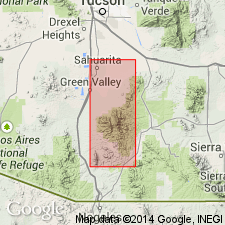
Revised in Santa Rita Mountains, southern Pima and northern Santa Cruz Cos, Basin-and-Range province and Pedregosa basin to include about 3,000 ft of conglomerate, sandstone, and siltstone above 1,000 ft sequence originally described [original description, though vague, included more, possibly much more than 2,230 ft of rock. Probably Fort Crittenden as described by Drewes entails no real revision of original]. Divided into five members--shale, lower red conglomerate, brown conglomerate, and upper red conglomerate members. A tuff member occurs on west side of Santa Ritas. Reference section designated between El Pilar Tank in Adobe Canyon, SE1/4, NW1/4, sec 24, T20S, R15E, and triangulation marker YOUNG on the east side of Hog Canyon. Unconformably overlies Bisbee Formation and overlain by Salero Formation (new) with probable conformity. Is of Late Cretaceous age.
Source: GNU records (USGS DDS-6; Denver GNULEX).
- Usage in publication:
-
- Fort Crittenden Formation*
- Modifications:
-
- Areal extent
- Age modified
- AAPG geologic province:
-
- Pedregosa basin
- Basin-and-Range province
Summary:
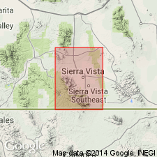
Of Stoyanow (1949). Extended to Huachuca Mountains, Cochise Co, AZ in the Pedregosa basin, and Canelo Hills, Santa Cruz Co, AZ in the Basin-and-Range province. Age changed from Late Cretaceous to Cretaceous age.
Source: GNU records (USGS DDS-6; Denver GNULEX).
- Usage in publication:
-
- Fort Crittenden Formation*
- Modifications:
-
- Overview
- AAPG geologic province:
-
- Basin-and-Range province
Summary:
Is oldest Upper Cretaceous formation in Santa Rita Mountains-Canelo Hills-Huachuca Mountains area, Pima, Santa Cruz, and Cochise Cos, AZ in Basin-and-Range province and Pedregosa basin. Unconformably overlies folded and faulted strata of Bisbee Group (Lower Cretaceous); overlain with apparent conformity by Salero Formation (Upper Cretaceous) and correlative strata. On southwest side of Huachuca Mountains and northeast side of Canelo Hills is divided into three informal members: 1) a basal conglomerate, as much as 600 ft thick; 2) a shale member, 650-1,200 ft thick, with fossil freshwater mollusks near base; and 3) an upper conglomerate member, at least 2,700 ft thick. In Santa Rita Mountains is divided into five informal members: 1) shale member, as much as 550 ft thick, with fossil freshwater invertebrates and wood, 2) red conglomeratic member, as much as 1,000 ft thick; 3) brown-weathering conglomerate member, 2,030 ft thick; 4) another red conglomerate member, at least 1,400 ft thick; and 5) rhyolitic tuff, about 65 ft thick. Rocks appear to be mostly of fluvial origin but may include beds deposited in lakes and marshes. Considered equivalent to part or all of numerous units in Basin-and-range province and Pedregosa basin [See fig. 5 for regional correlations.] Is early Campanian (Late Cretaceous) age on basis of fossils and stratigraphic position dating.
Source: GNU records (USGS DDS-6; Denver GNULEX).
- Usage in publication:
-
- Fort Crittenden Formation*
- Modifications:
-
- Areal extent
- Overview
- AAPG geologic province:
-
- Basin-and-Range province
- Pedregosa basin
Summary:
Extended to Empire and Whetstone Mountains in the Basin-and-Range province and Mustang Mountains in the Pedregosa basin. Correlation chart. Is of Late Cretaceous age.
Source: GNU records (USGS DDS-6; Denver GNULEX).
For more information, please contact Nancy Stamm, Geologic Names Committee Secretary.
Asterisk (*) indicates published by U.S. Geological Survey authors.
"No current usage" (†) implies that a name has been abandoned or has fallen into disuse. Former usage and, if known, replacement name given in parentheses ( ).
Slash (/) indicates name conflicts with nomenclatural guidelines (CSN, 1933; ACSN, 1961, 1970; NACSN, 1983, 2005, 2021). May be explained within brackets ([ ]).

