

- Usage in publication:
-
- Foote Creek Formation*
- Modifications:
-
- Named
- Dominant lithology:
-
- Sandstone
- Siltstone
- Shale
- Coal
- AAPG geologic province:
-
- Green River basin
Summary:
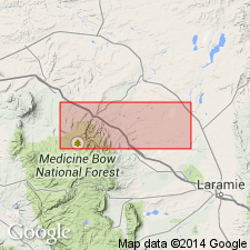
Named for exposures measured near Foote Creek in NE1/4 sec 13, T20N, R79W and NW1/4 sec 18, T20N, R78W (type locality), Carbon Co, Greater Green River basin, WY. Consists of light gray to white, locally ocher, fine- and medium-grained sandstone, dark shale, siltstone, and coal. Sandstone occurs in lenticular beds and grades into siltstone. Coal grades locally into carbonaceous shale or siltstone, and is lenticular. Calcareous ironstone concretions present in zones or in beds. Is 227.8 ft thick, at type; ranges from 0 to about 400 ft thick. Overlies Lewis Shale; underlies Dutton Creek Formation (a new unit). Is of Late Cretaceous and Paleocene age; macrofossils, and pollen and spore fossils. Deposited in a lagoonal shoreline environment at edge of Lewis sea. Replaces use of Medicine Bow and Hanna Formations in Laramie and Carbon basins, WY.
Source: GNU records (USGS DDS-6; Denver GNULEX).

- Usage in publication:
-
- Foote Creek Formation*†
- Modifications:
-
- Abandoned
- AAPG geologic province:
-
- Green River basin
- Wind River basin
Summary:
Abandoned as a formal name. Rocks formerly assigned to Foote Creek now recognized as remnants of the lower coal-bearing part of Medicine Bow Formation of Greater Green River and Wind River basins, WY.
Source: GNU records (USGS DDS-6; Denver GNULEX).
For more information, please contact Nancy Stamm, Geologic Names Committee Secretary.
Asterisk (*) indicates published by U.S. Geological Survey authors.
"No current usage" (†) implies that a name has been abandoned or has fallen into disuse. Former usage and, if known, replacement name given in parentheses ( ).
Slash (/) indicates name conflicts with nomenclatural guidelines (CSN, 1933; ACSN, 1961, 1970; NACSN, 1983, 2005, 2021). May be explained within brackets ([ ]).