


- Usage in publication:
-
- Finis shale member
- Modifications:
-
- Original reference
- Dominant lithology:
-
- Shale
- AAPG geologic province:
-
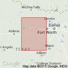
- Fort Worth syncline
Summary:
Pg. 24, 31; Univ. Texas Bull., no. 2132, p. 127-128. Finis shale member of Graham formation. Sandy shale with interbedded sandstone comprising basal portion of Graham formation. Thickness 45 to 100 or more feet. Rests on Home Creek limestone member of Caddo Creek formation. Underlies Jacksboro limestone member of Graham formation (of Canyon group). [Age is Pennsylvanian.]
[Named from Finis, Jack Co., Brazos River region, central northern TX. (Finis now a ghost town, http://www.texasescapes.com/).]
Source: US geologic names lexicon (USGS Bull. 896, p. 731).

- Usage in publication:
-
- Finis shale member
- Modifications:
-
- Revised
- AAPG geologic province:
-
- Fort Worth syncline
Summary:
Pg. 104. Finis shale member of Graham formation. Transferred Jacksboro limestone and Finis shale to underlying Caddo Creek formation, and stated that Home Creek limestone includes Jacksboro limestone. But F.M. Bullard and R.H. Cuyler, 1935 (Univ. Texas Bull., no. 3501), and F.B. Plummer and J. Hornberger, Jr., 1936 (Univ. Texas Bull., no. 3534), drew base of Graham formation at top of Home Creek limestone (which is where the boundary is at present drawn by the USGS), and divided lower part of Graham formation in Palo Pinto County into following member (descending): Bunger limestone, 6 feet; Gonzales Creek shale, 116 feet; Eastland sandstone, 10 to 15 feet; and Finis shale, 50 feet. [Age is Pennsylvanian.]
Source: US geologic names lexicon (USGS Bull. 896, p. 731).
- Usage in publication:
-
- Finis formation
- Modifications:
-
- Revised
Summary:
Pg. 4. Referred to as Finis formation in Caddo Creek group, Canyon series [Pennsylvanian].
Source: US geologic names lexicon (USGS Bull. 1200, p. 1349).

- Usage in publication:
-
- Finis Shale [unranked]
- Modifications:
-
- Areal extent
- AAPG geologic province:
-
- Bend arch
- Fort Worth syncline
Summary:
[See also adjacent Geol. Atlas Texas sheet Abilene (Barnes, 1972).]
Finis Shale [unranked] in Cisco Group. Not separately mapped. Consists of mudstone and shale; locally includes thin sandstone and bioclastic limestone lentils. [Thickness not stated.] Underlies Gonzales Creek Member [of Graham Formation of earlier workers] in Cisco Group and overlies Home Creek Limestone of Canyon Group. Rocks included in Graham Formation of Cisco Group by earlier workers. Fossils. Age is Late Pennsylvanian (Missourian).
Source: Publication.
- Usage in publication:
-
- Finis Shale Member
- Modifications:
-
- Biostratigraphic dating
- Age modified
- AAPG geologic province:
-
- Bend arch
- Fort Worth syncline
Summary:
Pg. 16-17 (figs. 10-11), 39 (fig. 20), 40, 94-95. Finis Shale Member of Graham Formation of Cisco Group. Ammonoids identified from [lower part of Finis] horizon SMC V2 are Late Pennsylvanian age (early middle Virgilian; SHUMARDITES CUYLERI Subzone of SHUMARDITES Zone).
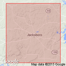
Specimens collected from several localities in Jack, Stephens, and Young Cos., north-central TX.
Source: Publication.
For more information, please contact Nancy Stamm, Geologic Names Committee Secretary.
Asterisk (*) indicates published by U.S. Geological Survey authors.
"No current usage" (†) implies that a name has been abandoned or has fallen into disuse. Former usage and, if known, replacement name given in parentheses ( ).
Slash (/) indicates name conflicts with nomenclatural guidelines (CSN, 1933; ACSN, 1961, 1970; NACSN, 1983, 2005, 2021). May be explained within brackets ([ ]).