

- Usage in publication:
-
- Phayles Reef member
- Modifications:
-
- Original reference
- AAPG geologic province:
-
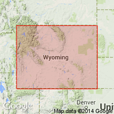
- Wind River basin
Summary:
Pg. 141. Phayles Reef member of Mesaverde formation. Name applied to lowermost regressive sequence of Mesaverde formation in southeast Wind River basin, central Wyoming. Author assigns regressive marine sequences to the Mesaverde formation and transgressive marine sequences to the Cody shale. Underlies Wallace Creek tongue (new) of Cody shale. Overlies and intertongues with Cody shale. Age is Late Cretaceous. Report includes cross sections.
Phayles Reef and Wallace Creek named on diagrammatic cross section of Mesaverde formation.
Source: US geologic names lexicon (USGS Bull. 1350, p. 573); supplemental information from GNU records (USGS DDS-6; Denver GNULEX).
- Usage in publication:
-
- Phayles member
- Modifications:
-
- Overview
- Dominant lithology:
-
- Sandstone
- Shale
- Siltstone
- Claystone
- AAPG geologic province:
-
- Wind River basin
Summary:
Name changed from Phayles Reef member to Phayles member. Is the basal member of the Upper Cretaceous Mesaverde formation. Type section is on northeast flank of Rattlesnake Hills in SW sec 4, T33N, R87W, Natrona Co, WY in the Wind River basin. Forms a ridge locally known as Phayles Reef. Is 240 ft thick at type. Merges to west with the overlying unnamed middle member of Mesaverde. Divisible west of type into: 1) basal, gray, fine- to medium-grained sandstone 40 to 50 ft thick (littoral and nearshore marine); 2) middle, dark-brown to purple black, partly lignitic, carbonaceous shale 20 to 40 ft thick (coastal swamp); 3) upper heterogeneous sequence of tan to buff, brown-weathering, fine-grained sandstone, siltstone, claystone, shale, carbonaceous shale, and coquina 145 ft thick at the type [thickness not stated] (brackish-water lagoonal). Shale in the upper part is olive-gray to tan, silty, and sandy. These three lithologies grade east into very fine to medium grained sandstone and gray sandy to silty shale. Deposited during eastward regression of the Late Cretaceous sea and subsequent still-stand. Was terminated by the re-advance of the sea that deposited the overlying Wallace Creek tongue of the Cody. Marine invertebrate fossils. Claggett age suggested. Cross section.
Source: GNU records (USGS DDS-6; Denver GNULEX).

- Usage in publication:
-
- Fales Sandstone Member*
- Modifications:
-
- Revised
- AAPG geologic province:
-
- Wind River basin
Summary:
Spelling of geographic name changed from Phayles to Fales. Spelling "Phayles" first used by Barwin (1959, 1961). Correct spelling on Garfield Peak 7 1/2 min quad is Fales. The Barwin spelling has not been well-established through published reports. Present authors adopt spelling Fales Sandstone Member, a term assigned to Mesaverde Formation in the southeastern Wind River basin. Assigned as a basal member of Mesaverde Formation. Overlies an unnamed shale of the Cody Shale. Underlies Wallace Creek Tongue of Cody. Correlation chart. Of Late Cretaceous, late Campanian age.
Source: GNU records (USGS DDS-6; Denver GNULEX).
For more information, please contact Nancy Stamm, Geologic Names Committee Secretary.
Asterisk (*) indicates published by U.S. Geological Survey authors.
"No current usage" (†) implies that a name has been abandoned or has fallen into disuse. Former usage and, if known, replacement name given in parentheses ( ).
Slash (/) indicates name conflicts with nomenclatural guidelines (CSN, 1933; ACSN, 1961, 1970; NACSN, 1983, 2005, 2021). May be explained within brackets ([ ]).