- Usage in publication:
-
- Eye of Needle Limestone
- Modifications:
-
- Named
- Dominant lithology:
-
- Limestone
- AAPG geologic province:
-
- Great Basin province
Summary:
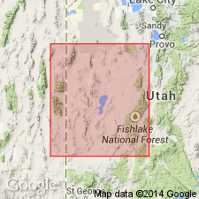
Named after feature (long thin slit or natural bridge) in sec 36, T26S, R16W on Wah Wah Summit 15' topographic map. Type section is designated in NW1/4 sec 25, T26S, R16W, Beaver Co, UT, Great Basin province. Exposed along west front of Wah Wah Mountains; correlation chart shows unit to also occur in Cricket Range, western UT. Forms light-gray cliffs. Consists almost entirely of light-gray, fine- to medium-grained massive limestone; middle 1/3 contains about 30 percent white calcite as fillings in small rods or tubes. Thickness is 62 m at type ranging up to 80 m thick just south of edge of quad. Conformably overlies Swasey Limestone; conformably underlies Pierson Cove Formation (new) with somewhat transitional contact. Correlates with Wheeler Shale in Fish Springs Range and northern and central House Range, western UT; also in western UT correlates in part with Abercrombie Formation, Deep Creek Range; upper part of Trailer Limestone, Dugway Range; and upper part of Teutonic Limestone, East Tintic Mountains. Correlates with upper part of Step Ridge Member of Highland Peak Formation, Pioche, NV. Assigned to lower part of trilobite BOLASPIDELLA Zone (Middle Cambrian) based on stratigraphic position.
Source: GNU records (USGS DDS-6; Denver GNULEX).
For more information, please contact Nancy Stamm, Geologic Names Committee Secretary.
Asterisk (*) indicates published by U.S. Geological Survey authors.
"No current usage" (†) implies that a name has been abandoned or has fallen into disuse. Former usage and, if known, replacement name given in parentheses ( ).
Slash (/) indicates name conflicts with nomenclatural guidelines (CSN, 1933; ACSN, 1961, 1970; NACSN, 1983, 2005, 2021). May be explained within brackets ([ ]).

