The National Geologic Map Database is migrating to a new infrastructure. We apologize for any service disruptions during this process.
|
|---|


- Usage in publication:
-
- Etchegoin beds
- Modifications:
-
- Named
- Dominant lithology:
-
- Sand
- Gravel
- Clay
- Conglomerate
- AAPG geologic province:
-
- San Joaquin basin
Summary:
Pg. 178-192. Etchegoin beds [broad sense]. Divided into Etchegoin sands, which compose lower two-thirds of formation, and San Joaquin clays, which compose upper one-third. The Etchegoin sands consist of unconsolidated sands and gravels. In many places characterized by blue or bluish gray color. They vary in thickness from 1,200 to 2,500 feet. Are commonly coarse in texture and often pebbly, forming beds of conglomerate. One fossil horizon occurs near bottom and another some distance above. [Fossils listed.] The San Joaquin clays are about 1,500 feet thick. At a distance they present a banded appearance, from the zones of color seen in the different strata, some of which have a width of 200 or 300 feet. The clays are conformably overlain by fresh-water Tulare formation. The Etchegoin beds overlie in turn all older formations of region, resting upon each respectively with a distinct nonconformity. The next older rocks are the Coalinga beds. Age is Pliocene.
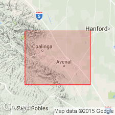
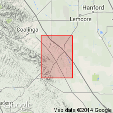
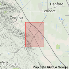
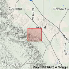
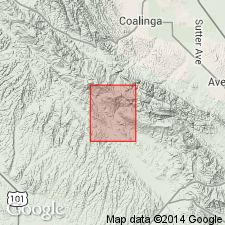
Named for exposures near Etchegoin Ranch, 20 mi northeast of Coalinga, [in NW/4 sec. 1, T. 19 S., R. 15 E.], Fresno Co., CA.
Source: US geologic names lexicon (USGS Bull. 896, p. 703); supplemental information from GNU records (USGS DDS-6; Menlo GNULEX).
- Usage in publication:
-
- Etchegoin formation
- Modifications:
-
- Revised
- AAPG geologic province:
-
- San Joaquin basin
Summary:
Pg. 46-55. Etchegoin formation [broad sense]. In accordance with Mr. [F.M.] Anderson's statements and on basis of reasons stated below the Etchegoin formation is mapped and described in present paper as the succession of slightly consolidated beds of sand, gravel, and clay, interbedded with occasional indurated beds, occurring on summit and flanks of Anticline Ridge and on southeast end of Joaquin Ridge north of Coalinga, above base of the hill-forming sandstone beds (referred to for convenience as GLYCYMERIS zone), and below the beds described as Paso Robles formation. Strata in other parts of Coalinga district are referred to Etchegoin formation on basis of paleontologic correlation with the beds on Anitcline Ridge. The GLYCYMERIS zone is underlain by clay that is classed in Jacalitos formation, and is overlain by a thick succession of bluish gray sand beds interbedded with dark-gray sand. An unconformity occurs below the GLYCYMERIS zone in the synclinal basin north of White Creek. Although in most places the Etchegoin appears to rest conformably on Jacalitos formation, in other places it overlaps the Jacalitos. It is overlain by Tulare formation, with possible unconformity. Thickness over 3,600 feet in southern part of district, 1,700 feet in oil field north of Coalinga, 1,100 feet in White Creek basin. Age is Pliocene. [Fossils listed. The formation includes marine, brackish, and fresh-water deposits.]
Source: US geologic names lexicon (USGS Bull. 896, p. 703).
- Usage in publication:
-
- Etchegoin sand
- Modifications:
-
- Revised
- AAPG geologic province:
-
- San Joaquin basin
Summary:
Pg. 477 (table 1), 482-483. Formation restricted to exclude San Joaquin clay. Highest member of Etchegoin sand has been described as "upper MULINIA" zone, and top of upper zone is chosen as base of San Joaquin clay as this zone marks important lithologic and faunal change. Etchegoin sand rests with marked unconformity on Reef Ridge shale on Reef Ridge, southwest of Kettleman Hills [southern California]. Age is Pliocene.
Source: US geologic names lexicon (USGS Bull. 1200, p. 1290-1292).
- Usage in publication:
-
- Etchegoin sandstone*
- Modifications:
-
- Revised
- AAPG geologic province:
-
- San Joaquin basin
Summary:
Restricted Etchegoin, under the name Etchegoin sandstone, to lower two-thirds of Etchegoin formation as originally defined [Anderson, 1905] and used in previous publications, and adopted San Joaquin formation for upper part, previously called San Joaquin clays [Anderson, 1905]. Age is Pliocene.
Source: US geologic names lexicon (USGS Bull. 896, p. 703)

- Usage in publication:
-
- Etchegoin formation† [broad sense]
- Etchegoin formation* [narrow sense]
- Modifications:
-
- Abandoned
- Overview
- AAPG geologic province:
-
- San Joaquin basin
Summary:
The broad usage of Etchegoin [= Etchegoin beds of Anderson, 1905] has been discontinued by the USGS and Etchegoin formation has been adopted for the beds called Etchegoin sands, and San Joaquin formation has been adopted for the beds called San Joaquin clays in original definition [Anderson, 1905] of Etchegoin formation.
Source: US geologic names lexicon (USGS Bull. 896, p. 703)
- Usage in publication:
-
- Etchegoin formation*
- Modifications:
-
- Revised
- Overview
- AAPG geologic province:
-
- San Joaquin basin
Summary:
Pg. 26-27, 55-75, pl. 3. Etchegoin formation. There is no general agreement in classification and nomenclature of Pliocene strata underlying Tulare Formation. Anderson (1905) originally divided them into two units, San Joaquin clays and Etchegoin sands, but he also used name Etchegoin in a group sense (Etchegoin beds) for both. Arnold and Anderson (1910, USGS Bull. 398) divided this part of section into two formations, Etchegoin and Jacalitos formations, the latter embracing original part of Coalinga beds of Anderson (1905). Mapping in Kettleman Hills has shown desirability of recognizing as a separate unit the upper part of Etchegoin formation of Arnold and Anderson (1910). Because this unit corresponds to F.M Anderson's (1905; 1908, California Acad. Sci. Proc., 4th ser., v. 3) San Joaquin clay, that name has been recently revived (Barbat and Galloway, 1934). Nomland (1917, California Univ. Pub. Geol. Sci. Bull., v. 10, no. 14), Gester and Galloway (1933, AAPG Bull., v. 17, no. 10), and Barbat and Galloway (1934) extended name to embrace Jacalitos formation; that is, they adopted Anderson's (1908) revised nomenclature with the exception that Etchegoin was not used in group sense. Reed (1933, Geology of California: Tulsa, OK, AAPG) raised Etchegoin to group rank and extended name Jacalitos to include Arnold and Anderson's (1910) Etchegoin minus the San Joaquin. In view of conflicting opinions and undesirable features of other schemes, a compromise involving restriction of name of Etchegoin to Arnold and Anderson's solution was reached independently by Goudkoff (1934, AAPG Bull., v. 18, no. 4). Exposed part of formation has thickness of about 700 feet in North Dome and estimated exposed thickness of about 600 feet in Middle Dome. With exception of fresh-water beds near top of formation in North Dome, formation consists of marine deposits, principally sandstone and conglomerate, and silt. Faunal zones mapped. Age is Pliocene.
Source: US geologic names lexicon (USGS Bull. 1200, p. 1290-1292); supplemental information from GNU records (USGS DDS-6; Menlo GNULEX).
- Usage in publication:
-
- Etchegoin group
- Modifications:
-
- Revised
- AAPG geologic province:
-
- San Joaquin basin
Summary:
Pg. 225 (fig. 4), 240-246. Etchegoin group. Discussion of geology of San Benito quadrangle. Term Etchegoin is herein used as group as Nomland (1917, California Univ. Pub. Geol. Sci. Bull., v. 10, no. 14) used it to include the Jacalitos, Etchegoin, and possibly San Joaquin formations of Coalinga district, which cannot be distinguished lithologically in field in this region. One cartographic division is separated, a series of red beds 400 to 600 feet thick on nonmarine origin at base, which is quite different character from rest of group. Group lies chiefly in narrow belt, 2 miles wide, between San Andreas and San Benito fault zones. Here it reaches maximum thickness of 3,500 feet. In Sulphur Creek area, the Etchegoin extends 2 miles farther east, overlapping sediments of Butts Ranch syncline, but with reduced thickness of only 750 feet. Main belt, along San Benito River, continues northwest of quadrangle beneath San Benito gravels and reappears in Lomerias Muertos, northwest of Hollister. To the southeast, belt extends through Priest Valley and Waltham Canyon (where it has thickness of 8,000 feet) into Coalinga district. Basal red beds of main Etchegoin belt rest disconformably upon Santa Margarita formation southwest of San Benito River. Eastern belt rests with as much as 90 degree angular discordance upon Upper Cretaceous, middle Eocene, and middle Miocene sediments of Butts Ranch syncline. In some areas, in fault contact with Franciscan group.
Source: US geologic names lexicon (USGS Bull. 1200, p. 1290-1292).
- Usage in publication:
-
- Etchegoin formation
- Modifications:
-
- Revised
- AAPG geologic province:
-
- San Joaquin basin
Summary:
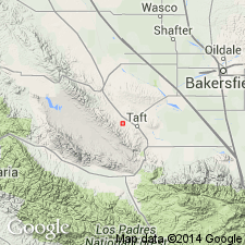
Pg. 523, 524, (fig. 224). Unconformably overlies Belridge dolomite in Midway-Sunset area.
Source: US geologic names lexicon (USGS Bull. 1200, p. 1290-1292).
- Usage in publication:
-
- Etchegoin megafaunal "stage"
- Modifications:
-
- Biostratigraphic dating
- AAPG geologic province:
-
- San Joaquin basin
Summary:
Pg. 60 (fig. 2). Chart shows Etchegoin megafaunal "stage" equivalent to Venturian microfaunal stage.
Source: US geologic names lexicon (USGS Bull. 1200, p. 1290-1292).
- Usage in publication:
-
- Etchegoin Formation
- Modifications:
-
- Revised
- AAPG geologic province:
-
- San Joaquin basin
Summary:
Pg. 28-34. Recognized only a two-fold division of Pliocene sequence in southeastern part of Diablo Range and Kettleman Hills. Assigned the predominantly sandy Iower two-thirds to the Etchegoin Formation [= Etchegoin sands of Anderson (1905); Jacalitos formation of Reed (1933); Etchegoin sand of Barbat and Galloway (1934); Jacalitos and Etchegoin of Goudkoff (1934); Jacalitos and Etchegoin formations of Woodring and others (1940) and Stewart (1946, USGS Prof. Paper 205-C, p. 81-115)] and the largely clayey upper one-third to the San Joaquin Formation [= San Joaquin clays of Anderson (1905); San Joaquin clay of Reed (1933), Goudkoff (1934), and Barbat and Galloway (1934); San Joaquin formation of Woodring and others (1940) and Stewart (1946)].
Source: Dibblee, T.W., Jr., 1973, USGS Professional Paper 764, p. 34, 35 (fig. 13), 36.
- Usage in publication:
-
- Etchegoin Formation*
- Modifications:
-
- Age modified
- AAPG geologic province:
-
- San Joaquin basin
Summary:
Pg. E16-E20. Etchegoin Formation. Follows Arnold and Anderson's (USGS Bull. 398, 1910) definition of Etchegoin Formation: "the succession of beds of sand, gravel, and clay, in part indurated, occurring in oilfield northeast of Coalinga above base of hill-forming sandstone beds referred to for convenience as GLYCYMERIS zone, and in Kettleman Hills below fresh-water beds described as base of Tulare Formation." In this area, the GLYCYMERIS fossil zone lies above the lowest blue sandstone. Etchegoin described as unconsolidated to semiconsolidated continental and marine deposits of sandstone, sandy silt, gravel and clay; locally contains beds of conglomerate and calcareous gypsite. Thickness ranges from 500 to 2,000 feet. Is exposed discontinuously in foothills from southern end of San Joaquin Valley to a point 2 miles north of Panoche Creek. Upper part possibly equivalent to San Joaquin Formation of Kettleman Hills. Unconformably overlies Jacalitos Formation. Unconformably underlies Tulare Formation. Age is middle Pliocene. Report includes geologic map, measured sections.
Source: Modified from GNU records (USGS DDS-6; Menlo GNULEX).
- Usage in publication:
-
- Etchegoin Formation*
- Modifications:
-
- Revised
- Overview
- AAPG geologic province:
-
- San Joaquin basin
Summary:
Etchegoin Formation revised in subsurface of Elk Hills, Kern County, California; remains unchanged elsewhere. Divided into two members (ascending): Tupman Shale Member and Carman Sandstone Member (both new). The names are applied to two distinct lithologic units of nearly equal thickness in well 324-19R at Elk Hills. Overall thickness in subsurface is 2,622 feet. Overlies Reef Ridge Shale. Underlies San Joaquin Formation. Age is Pliocene. Report includes electric log, detailed lithologic description of core, charts showing distribution of fossils. History of literature given.
Source: GNU records (USGS DDS-6; Menlo GNULEX); Changes in stratigraphic nomenclature, 1973 (USGS Bull. 1395-A, p. A14-A15).
- Usage in publication:
-
- Etchegoin Formation*
- Modifications:
-
- Revised
- Overview
- Reference
- AAPG geologic province:
-
- San Joaquin basin
Summary:
Etchegoin Formation. Classification proposed by Adegoke (1969) of dividing upper Tertiary sedimentary sequence into Etchegoin and San Joaquin Formations is adopted by the USGS. Geographically restricted to area east of San Andreas fault. Stratigraphically extended in Diablo Range area to include underlying †Jacalitos Formation (now abandoned) and overlying San Joaquin Formation (now geographically restricted). Composed of a series of semi-friable sandstone and interbedded siltstone, claystone, and minor pebble conglomerate, all deposited under shallow-water marine conditions. Thickness 5,200 feet at reference section. Overlies Reef Ridge or Monterey Shale and underlies Tulare or San Joaquin (in Kettleman Hills area) Formation. Age changed from middle Pliocene --to-- early and late Pliocene. Early and late Pliocene molluscan fossils collected in Reef Ridge area. History of literature given.
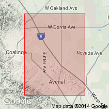
Reference section: exposures north of Reef Ridge, between Big Tar and Garza Creeks, Garza Peak quadrangle, 3 to 5 mi southeast of Avenal, southern CA.
Source: Modified from GNU records (USGS DDS-6; Menlo GNULEX); Changes in stratigraphic nomenclature, 1973 (USGS Bull. 1395-A, p. A14-A15).
- Usage in publication:
-
- Etchegoin Formation*
- Modifications:
-
- Age modified
- Biostratigraphic dating
- AAPG geologic province:
-
- San Joaquin basin
Summary:
Age of Etchegoin Formation is late Miocene (International Epoch assignment) based on vertebrate evidence of otarioid fauna, PLIOPEDIA PACIFICA and Arctocephaline aff. CALLORHINUS, collected in Kettleman Hills, California. Estimated age is 7 to 4 Ma. [Mammalian Provincial] Stage - Age association is Hemphillian and "Etchegoin."
Source: Modified from GNU records (USGS DDS-6; Menlo GNULEX).
- Usage in publication:
-
- Etchegoin Formation*
- Modifications:
-
- Geochronologic dating
- AAPG geologic province:
-
- San Joaquin basin
Summary:
Zircon fission-track age of 7.0 +/-1.2 Ma obtained on part of Etchegoin Formation in Kettleman Hills, San Joaquin basin, California. Assigned Etchegoin Stage [late Miocene].
Source: GNU records (USGS DDS-6; Menlo GNULEX).
- Usage in publication:
-
- Etchegoin Formation*
- Modifications:
-
- Age modified
- Geochronologic dating
- AAPG geologic province:
-
- San Joaquin basin
Summary:
A light-gray, water deposited, water transported(?), fine-grained vitric tuff near uppermost part of Etchegoin Formation in Kettleman Hills of western San Joaquin Valley is correlated with Lawlor Tuff. It is possible to temporally correlate uppermost part of marine Etchegoin Formation of western San Joaquin Valley with formations in central Coast Ranges. Age of tuff is 4.0 +/-0.5 Ma. Age of upper part of Etchegoin Formation is Pliocene. [Overall age of formation is now late Miocene and Pliocene.]
Source: GNU records (USGS DDS-6; Menlo GNULEX).
- Usage in publication:
-
- Etchegoin Formation*
- Modifications:
-
- Mapped
- AAPG geologic province:
-
- San Joaquin basin
Summary:
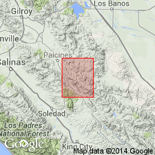
Etchegoin Formation mapped in sec. 4, T. 24 S., R. 15 E., east of San Andreas Fault, Cholome Valley quadrangle, Monterey County, California. Age is late Miocene and Pliocene.
Source: Modified from GNU records (USGS DDS-6; Menlo GNULEX).
- Usage in publication:
-
- Etchegoin Formation*
- Modifications:
-
- Areal extent
- AAPG geologic province:
-
- San Joaquin basin
Summary:
Etchegoin Formation geographically extended into report area (Parkfield 7.5-min quadrangle, Monterey and Fresno Counties, California). Age is late Miocene and Pliocene.
Source: Modified from GNU records (USGS DDS-6; Menlo GNULEX).
For more information, please contact Nancy Stamm, Geologic Names Committee Secretary.
Asterisk (*) indicates published by U.S. Geological Survey authors.
"No current usage" (†) implies that a name has been abandoned or has fallen into disuse. Former usage and, if known, replacement name given in parentheses ( ).
Slash (/) indicates name conflicts with nomenclatural guidelines (CSN, 1933; ACSN, 1961, 1970; NACSN, 1983, 2005, 2021). May be explained within brackets ([ ]).