The National Geologic Map Database is migrating to a new infrastructure. We apologize for any service disruptions during this process.
|
|---|


- Usage in publication:
-
- Empire shales*
- Modifications:
-
- Original reference
- Dominant lithology:
-
- Shale
- AAPG geologic province:
-
- Northern Rocky Mountain region
Summary:
Pg. 199-215. Empire shales. Greenish-gray, massively bedded banded siliceous shales, 600 feet thick. Underlie Helena limestone and overlie Spokane shales. Age is pre-Cambrian (Belt).
Type localities are on ridge north of Empire [2 miles west of Marysville] and in canyon walls just below Marysville, [Lewis and Clark Co.], west-central Montana.
Source: US geologic names lexicon (USGS Bull. 896, p. 686).

- Usage in publication:
-
- Empire member
- Modifications:
-
- Revised
- AAPG geologic province:
-
- Northern Rocky Mountain region
Summary:
Pg. 1898. Empire member of Spokane formation. Member of Spokane formation which is included in Meagher facies (new) of Belt series. Member consists of argillites, thickly bedded, siliceous, greenish-gray, with some sandstone and limestones. Thickness about 600 feet. Overlies Prickly Pear member (new) of Spokane. Age is Precambrian (Belt).
Source: US geologic names lexicon (USGS Bull. 1200, p. 1261-1262).
- Usage in publication:
-
- Empire formation
- Modifications:
-
- Redescribed
- Dominant lithology:
-
- Argillite
- Quartzite
- AAPG geologic province:
-
- Northern Rocky Mountain region
Summary:
Pg. 835-837. Empire formation. Marysville stock is surrounded by Precambrian rocks of Belt series (ascending): Empire formation, Helena limestone (renamed dolomite), Marsh formation, and Greenhorn Mountain quartzite (new). Area contains type section of Empire "shale." Empire formation, or "shale" as Walcott (1899) called it, was named for exposure west of Empire Mine, at head of Lost Horse Gulch in western part of Marysville district. Lowermost beds exposed here are intruded by granodiorite of Marysville stock. All rocks in type section are hornfelsed, dark weathering, and are crackle breccias ramified with tremolite veinlets and quartz veins. They are well within contact-metamorphic aureole of Marysville stock and are overlain conformably by white diopsidic hornfels of Helena dolomite. Walcott mentioned occurrence of Empire shale on Drumlummon Hill, in eastern part of district, but rock there is a superb scapolite-diopside hornfels. Barrell (1907, USGS Prof. Paper 57) in his account of Marysville district, ignored type section of Empire and described formation as exposed on Long Creek in north-central part of Marysville area, outside of contact aureole, where it consists of finely laminated, soft limy shale, grayish-green or buff-colored with a few reddish bands. As observed in present study, the Empire there consists of pale-green hard argillite alternating with mud-cracked rose or lavender argillites. Top of Empire is light colored and weathers pale buff and yellowish. Section at this locality is bottomed by fault; Barrell measured 520 feet of Empire and accepted Walcott's figure of 600 feet at total thickness. However, base of Walcott's section is an intrusive contact. In present work formation was found to be best exposed in section that extends east-west through USGS benchmark 4450 in Scratchgravel Hills, northwest of Helena where it consists of pale-green argillite, deep-red argillites, and fine-grained light-green and white quartzite. Thickness about 1,000 feet. Conformable contacts with Spokane shale below, where first appearance of quartzite in section is taken to mark base of Empire. Transition to overlying Helena is abrupt, taking place within stratigraphic thickness of 20 feet. Age is Precambrian (Belt).
Source: US geologic names lexicon (USGS Bull. 1200, p. 1261-1262).
- Usage in publication:
-
- Empire formation*
- Modifications:
-
- Revised
- AAPG geologic province:
-
- Northern Rocky Mountain region
Summary:
Empire formation. Provisionally included in Piegan group. Age is Precambrian (Belt).
Source: US geologic names lexicon (USGS Bull. 1200, p. 1261-1262).
- Usage in publication:
-
- Empire shale*
- Modifications:
-
- Areal extent
- AAPG geologic province:
-
- Northern Rocky Mountain region
Summary:
Pg. 6, pls. 1, 2. Empire shale intertongues with and grades downward into Spokane shale and underlies Flathead quartzite in southern Elkhorn Mountains, Jefferson and Broadwater Counties, northwestern Montana. Thickness about 600 feet. Age is Precambrian (Belt).
Source: US geologic names lexicon (USGS Bull. 1200, p. 1261-1262).

- Usage in publication:
-
- Empire formation*
- Modifications:
-
- Overview
- AAPG geologic province:
-
- Northern Rocky Mountain region
Summary:
Empire formation of Missoula group. The USGS currently [ca. 1960] classifies the Empire as a formation in the Missoula group on the basis of a study now in progress.
Source: US geologic names lexicon (USGS Bull. 1200, p. 1261-1262).

- Usage in publication:
-
- Empire Formation*
- Modifications:
-
- Overview
- AAPG geologic province:
-
- Northern Rocky Mountain region
Summary:
Used in the Northern Rocky Mountain region. Stratigraphic position and correlation with other Precambrian formations of the Belt Supergroup of the U.S., Northern Cascade Range-Okanagan province, Eastern Columbia basin, Idaho Mountains province, and the Snake River basin, and of the Purcell Supergroup in Alberta and British Columbia, Canada shown on figures 4, 5, 7, and 8.
Source: GNU records (USGS DDS-6; Denver GNULEX).

- Usage in publication:
-
- Empire Formation*
- Modifications:
-
- Revised
- AAPG geologic province:
-
- Northern Rocky Mountain region
Summary:
Empire Formation of Ravalli Group of Belt Supergroup. No longer included in Missoula Group. Age is Precambrian Y.
Source: Changes in stratigraphic nomenclature, 1972 (USGS Bull. 1394-A, p. A14-A15).
- Usage in publication:
-
- Empire Formation*
- Modifications:
-
- Mapped
- AAPG geologic province:
-
- Northern Rocky Mountain region
Summary:
Empire Formation of Belt Supergroup. Interlayered gray-green argillite and siltite with calcareous dolomitic layers. Argillite constitutes about 70 percent of the unit; it is gray green and light green and occurs in irregular, uneven beds; thin bedded to laminated, in beds generally less than 6 inches thick; mud cracks, scour, small-scale crossbedding, and mud-chip conglomerates are common. Thickness about 1,000 feet. Overlies St. Regis Formation and underlies Helena Formation, both of Belt Supergroup. Age is Precambrian Y.
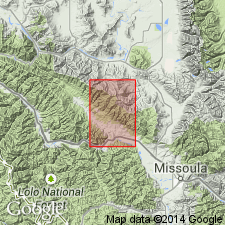
Mapped along eastern edge of quadrangle, in Sanders and Missoula Counties, central western Montana.
Source: Publication.

- Usage in publication:
-
- Empire Formation*
- Modifications:
-
- Geochronologic dating
- AAPG geologic province:
-
- Northern Rocky Mountain region
Summary:
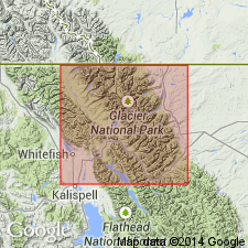
Pg. 20, geologic time scale (inside front cover). Empire Formation [Middle Proterozoic] of Belt Supergroup. Sample from a biotitic diabase sill that intrudes formation, in SW/4 sec. 1, T. 10 N., R. 1 E., Hellgate Gulch quadrangle, Broadwater County, Montana, yielded a K-Ar age of 744 +/-37 Ma (pyroxene with minor biotite) [Precambrian Z]. Sill belongs to a widespread group of mafic dikes and sills which give early Proterozoic Z to late Proterozoic Y ages. Age calculated using decay constants of Steiger and Jager, 1977 (Earth Planet. Sci. Letters, v. 36, p. 359-362).
Source: Publication.
- Usage in publication:
-
- Empire Formation*
- Modifications:
-
- Mapped
- AAPG geologic province:
-
- Northern Rocky Mountain region
Summary:
Empire Formation of Belt Supergroup. Primarily argillite, siltite, and lesser amounts of arenite and dolomite. Thickness 122 to 158 m. Overlies Grinnell Formation and underlies Helena Formation, both of Belt Supergroup. Age is Middle Proterozoic.
Source: Publication.
- Usage in publication:
-
- Empire Formation*
- Modifications:
-
- Mapped 1:500k
- Dominant lithology:
-
- Argillite
- Siltite
- AAPG geologic province:
-
- Northern Rocky Mountain region
Summary:
Pg. 18-19. Empire Formation of Ravalli Group of Belt Supergroup. Grayish green and pale olive gray argillite and siltite with subordinate thin beds of quartzite and sandy limestone. Thickness as much as 610 m. Age is Proterozoic.
Source: Publication.
For more information, please contact Nancy Stamm, Geologic Names Committee Secretary.
Asterisk (*) indicates published by U.S. Geological Survey authors.
"No current usage" (†) implies that a name has been abandoned or has fallen into disuse. Former usage and, if known, replacement name given in parentheses ( ).
Slash (/) indicates name conflicts with nomenclatural guidelines (CSN, 1933; ACSN, 1961, 1970; NACSN, 1983, 2005, 2021). May be explained within brackets ([ ]).