

- Usage in publication:
-
- Ellis formation*
- Modifications:
-
- Mapped
- AAPG geologic province:
-
- Montana folded belt
Summary:
Map (pl. 1). Ellis formation. [This map (of "vicinity of Three Forks, Montana") shows Ellis formation as overlying Quadrant formation and underlying Cretaceous (the basal formation of which is designated Dakota formation), but does not describe the deposits. Age is Juratrias.]
Source: US geologic names lexicon (USGS Bull. 896, p. 676); supplemental information from GNU records (USGS DDS-6; Denver GNULEX).
- Usage in publication:
-
- Ellis limestone*
- Modifications:
-
- Mapped
- Dominant lithology:
-
- Limestone
- Sandstone
- AAPG geologic province:
-
- Montana folded belt
Summary:
Ellis limestone. Sandy limestone underlain by MYACITES beds, the latter consisting of impure fossiliferous limestones or soft earthy calcareous rocks of dark-gray color, with sandstones at base. Thickness 400 feet. At Cinnabar Mountain the MYACITES beds rest upon a massive cross-bedded, ripple-marked sandstone, underlain by a bright-red sandstone which may be = the Red bed sandstones of more southern localities. Underlies Dakota formation and overlies Quadrant quartzite. Age is Juratrias.
Source: US geologic names lexicon (USGS Bull. 896, p. 676).
- Usage in publication:
-
- Ellis formation*
- Modifications:
-
- Mapped
- AAPG geologic province:
-
- Montana folded belt
Summary:
Ellis formation (Juratrias). As here mapped the basal part consists of 40 to 60 feet of nonfossiliferous quartzitic sandstone, which probably belongs to the Juratrias but which may possibly be Carboniferous. Above this basal quartzite the formation consists largely of argillaceous limestone, many of the beds crowded with Jurassic fossils. The middle and upper parts of formation are more arenaceous and devoid of fossils. Total thickness 300 to 500 feet. Overlies Quadrant formation and underlies Dakota formation.
Source: US geologic names lexicon (USGS Bull. 896, p. 676).

- Usage in publication:
-
- Ellis formation*
- Modifications:
-
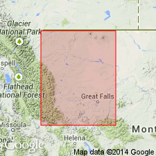
- Overview
- Dominant lithology:
-
- Sandstone
- Limestone
- AAPG geologic province:
-
- Montana folded belt
Summary:
Ellis formation. The commonly accepted definition of Ellis formation applies to Upper Jurassic marine strata and excludes any older beds that may inadvertently have been included in the earlier mapping. Recognized in Montana (widespread) and northwestern Wyoming.
Named from Fort Ellis, an old military post in Livingston quadrangle, to east of Bozeman, MT, near which the formation is mapped in Livingston folio, USGS Geol. Atlas Folio GF-1.
Source: US geologic names lexicon (USGS Bull. 896, p. 676).
- Usage in publication:
-
- Ellis group
- Modifications:
-
- Revised
- AAPG geologic province:
-
- Montana folded belt
- Sweetgrass arch
Summary:
Ellis group. Rank raised to group and subdivided into (ascending) Sawtooth, Rierdon, and Swift formations (all new). Name is restricted to marine Jurassic beds. In Sweetgrass arch area, north-central Montana, unconformably overlies marine Mississippian beds and underlies Upper Jurassic continental deposits (Morrison) or Lower Cretaceous continental deposits (Kootenai). Locally, includes informal Strode sand at or near base. Fossils. Age is Middle to Late Jurassic (Bathonian to Argovian).
Source: US geologic names lexicon (USGS Bull. 1200, p. 1241-1242); supplemental information from GNU records (USGS DDS-6; Denver GNULEX).
- Usage in publication:
-
- Ellis formation*
- Modifications:
-
- Principal reference
- Dominant lithology:
-
- Sandstone
- Limestone
- Shale
- AAPG geologic province:
-
- Montana folded belt
Summary:
Ellis formation. Thickness 297 feet at type section herein designated. Underlies Morrison formation; overlies Tensleep(?). Fossils (mollusks). Probably belongs to the Upper Jurassic Callovian, Divesian, and Argovian stages.
Type section: on north side of U.S. Highway 10, north side of Rocky Creek Canyon, about 3.7 mi southeast of site of Fort Ellis or 7 mi southeast of Bozeman Court House, in sec. 19, T. 2 S., R. 7 E., Gallatin Co., MT.
Source: US geologic names lexicon (USGS Bull. 1200, p. 1241-1242); supplemental information from GNU records (USGS DDS-6; Denver GNULEX).
- Usage in publication:
-
- Ellis group*
- Modifications:
-
- Revised
- AAPG geologic province:
-
- Central Montana uplift
- Montana folded belt
- Sweetgrass arch
Summary:
Ellis group. In south-central Montana comprises (ascending) Piper (new), Rierdon, and Swift formations. In north-central Montana comprises (ascending) Sawtooth, Rierdon, and Swift formations. Age is Middle and Late Jurassic.
Source: US geologic names lexicon (USGS Bull. 1200, p. 1241-1242); supplemental information from GNU records (USGS DDS-6; Denver GNULEX).
- Usage in publication:
-
- Ellis group*
- Modifications:
-
- Areal extent
Summary:
Ellis group. Three-fold division of Ellis group into Swift, Rierdon, and Sawtooth formations recognizable and applicable in Alberta. Known only in subsurface in southern Alberta Plains [area of this report]. Age is Middle and Late Jurassic.
Source: US geologic names lexicon (USGS Bull. 1200, p. 1241-1242).
- Usage in publication:
-
- Ellis group*
- Modifications:
-
- Mapped
- AAPG geologic province:
-
- Central Montana uplift
- Sweetgrass arch
Summary:
Ellis group. In Hobson area, Judith Basin and Fergus Counties, central Montana, consists of (ascending) Piper, Rierdon, and Swift formations. Entire group less than 100 feet thick, and commonly only Swift formation represented. Overlies Amsden formation; underlies Morrison formation. Age is Middle to Late Jurassic.
Source: Publication; US geologic names lexicon (USGS Bull. 1200, p. 1241-1242).
- Usage in publication:
-
- Ellis formation
- Modifications:
-
- Areal extent
- AAPG geologic province:
-
- Sweetgrass arch
Summary:
Pg. 8 (fig. 5). Ellis formation. Stratigraphic section of northern end of Teton Range, Wyoming, shows that Ellis formation, 400 feet thick, comprises (ascending) Nugget sandstone, Twin Creek limestone, and (?)Stump sandstone members. Overlies Chugwater formation; underlies Lower Creteceous sandstones, shales, and siltstones.
Source: US geologic names lexicon (USGS Bull. 1200, p. 1241-1242).
- Usage in publication:
-
- Ellis group*
- Modifications:
-
- Areal extent
- AAPG geologic province:
-
- Montana folded belt
Summary:
Pg. 1802-1810. Ellis group. Marine Jurassic rocks of southwestern Montana have heretofore been mapped as Ellis formation, but study of these beds indicates that subdivisions recognized by Cobban (1945) in Sweetgrass arch region are present in area considered in this report. Proposed that Ellis of this region be raised to group rank and that formation names of Sweetgrass arch region be used in southwestern Montana. Thickness 236 feet, Little Water Creek section, Beaverhead County. Overlies Triassic Thaynes formation.
Source: US geologic names lexicon (USGS Bull. 1200, p. 1241-1242).
- Usage in publication:
-
- Ellis group*
- Modifications:
-
- Areal extent
Summary:
Pg. 25-30. Ellis group. In Gravelly Range, is thin, 13 to 41 feet, and is not differentiated into formations. Underlies Morrison formation; overlies Thaynes(?).
Source: US geologic names lexicon (USGS Bull. 1200, p. 1241-1242).
- Usage in publication:
-
- Ellis formation*
- Modifications:
-
- Areal extent
- AAPG geologic province:
-
- Montana folded belt
Summary:
Ellis formation. Overlies Phosphoria formation (Permian); underlies Morrison formation (Upper Jurassic). Contains fossil pelecypod fragments. Age is Middle and Late Jurassic. Report includes measured sections.
Source: Publication; GNU records (USGS DDS-6; Denver GNULEX).
For more information, please contact Nancy Stamm, Geologic Names Committee Secretary.
Asterisk (*) indicates published by U.S. Geological Survey authors.
"No current usage" (†) implies that a name has been abandoned or has fallen into disuse. Former usage and, if known, replacement name given in parentheses ( ).
Slash (/) indicates name conflicts with nomenclatural guidelines (CSN, 1933; ACSN, 1961, 1970; NACSN, 1983, 2005, 2021). May be explained within brackets ([ ]).