

- Usage in publication:
-
- Ellenburger limestone*
- Modifications:
-
- Named
- Dominant lithology:
-
- Limestone
- Dolomite
- AAPG geologic province:
-
- Llano uplift
Summary:
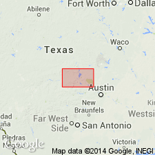
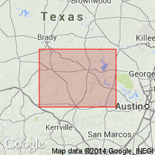
Named for the Ellenburger Hills, Burnet quad., Burnet Co., TX. Llano uplift. No type locality designated. Conformably overlies Wilberns formation (new). Unconformably underlies Marble Falls formation of Pennsylvanian age. Columnar section. Measured section. Mapped (geologic map at northwest part of Burnet quad west across north part of Llano quad, across San Saba Co. Also mapped in south part of quad across Llano Co. into Mason Co. Is probably 1,000 ft thick. Consists of white to gray limestone and dolomite with much white and yellow chert. The bedding is poor. The limestone has coarse and fine phases. Has a rough upper surface. Locally some of the chert has been dissolved and replaced by crystalline quartz. Thought to be Late Cambrian age in lower part. Upper part is Early Ordovician Fossiliferous.
Source: GNU records (USGS DDS-6; Denver GNULEX).
- Usage in publication:
-
- Ellenburger group*
- Modifications:
-
- Contact revised
- AAPG geologic province:
-
- Llano uplift
Summary:
Upper contact revised in several areas in central TX on Llano uplift in that Ellenburger underlies two newly recognized units. Near Pillar Bluff on the Pillar Bluff Creek, northern Burnet Co., a limestone of Helderberg (Early Devonian) age is named Pillar Bluff limestone. This limestone recognized at 3+ localities, can be mapped as a single line; exposures are 100+ ft long. Pillar Bluff was included in the Mississippian Chappel formation in earlier reports. A second limestone in eastern Blanco Co., younger than Pillar Bluff, named Stribling formation (late Early or early Middle Devonian) overlies Ellenburger Stribling, also of very limited occurrences, mapped at 3 localities. Two geologic maps. Graphic section of Stribling.
Source: GNU records (USGS DDS-6; Denver GNULEX).
- Usage in publication:
-
- Ellenburger group*
- Modifications:
-
- Revised
- AAPG geologic province:
-
- Llano uplift
Summary:
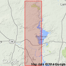
Raised to group rank; divided into the newly named Tanyard formation, at base, Gorman formation, in the middle, and Honeycut formation, at top. The 3 new formations are equivalent to the Gasconade, Roubidoux, and Jefferson City formations respectively of MO. Tanyard divided into Threadgill member (formerly Threadgill limestone) and Staendebach member (new). The group has a maximum known thickness of 1820 ft near Johnson City, Blanco Co., TX on the Llano uplift. Geologic maps cover parts of San Saba, Burnet, Llano, and Blanco Cos., TX. Cross section. Is restricted to rocks of Early Ordovician age. All 3 formations are fossiliferous. The limestones of the Ellenburger are wary, brown, gray, sublithographic, stromatolitic; they are ripple marked, have desiccation polygons, are thin-bedded, all indicative of shallow-water origin. The dolomites of the group are micro-granular to coarse-grained, weather rough to pitted. Chert abundant.
Source: GNU records (USGS DDS-6; Denver GNULEX).
- Usage in publication:
-
- Ellenburger group*
- Modifications:
-
- Principal reference
- AAPG geologic province:
-
- Llano uplift
Summary:
Pg. 473, plates. Type section, standard section, and local stratigraphy, including underlying Cambrian formations, described in detail.
Type section: composite Tanyard-Gorman section adjoining the Ellenburger Hills. Section is relatively inaccesible. Combined Moore Hollow and Warren Springs sections south of Llano, Llano Co., [TX], are designated as standard section.
Source: US geologic names lexicon (USGS Bull. 1200, p. 1238-1239).
For more information, please contact Nancy Stamm, Geologic Names Committee Secretary.
Asterisk (*) indicates published by U.S. Geological Survey authors.
"No current usage" (†) implies that a name has been abandoned or has fallen into disuse. Former usage and, if known, replacement name given in parentheses ( ).
Slash (/) indicates name conflicts with nomenclatural guidelines (CSN, 1933; ACSN, 1961, 1970; NACSN, 1983, 2005, 2021). May be explained within brackets ([ ]).