


- Usage in publication:
-
- East Mountain shale member
- Modifications:
-
- Original reference
- Dominant lithology:
-
- Shale
- Limestone
- Sandstone
- AAPG geologic province:
-
- Bend arch
Summary:
Pg. 25, 31; Univ. Texas Bull., no. 2132, p. 77 and charts. East Mountain shale member of Mineral Wells formation, uppermost formation of Strawn group (revised) in Brazos River Valley area, north-central Texas. [Not recognized in Colorado River Valley.] Chiefly dark bluish gray shale, about 300 feet thick. Contains near top a lentil of fossiliferous limestone and near base a bed of massive sandstone. The shale carries a prolific fauna which is very similar to that of the Wewoka fauna of southern Oklahoma and apparently quite dissimilar to that in the Millsap formation, underlying the Mineral Wells. Most of the fossil collections made in the vicinity of Mineral Wells are from this member. Underlies Lake Pinto sandstone member and overlies Brazos River sandstone; all included in Mineral Wells formation. Age is Pennsylvanian. Report includes measured section, correlation chart, fossil lists.
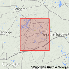
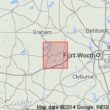
Named from exposures in high escarpment east of town of Mineral Wells, Palo Pinto Co., north-central TX.
Source: US geologic names lexicon (USGS Bull. 896, p. 655); supplemental information from GNU records (USGS DDS-6; Denver GNULEX).
- Usage in publication:
-
- East Mountain shale member
- Modifications:
-
- Revised
- AAPG geologic province:
-
- Bend arch
Summary:
F.B. Plummer, 1929, and R.W. Cumley, 1930 (Univ. Texas Econ. Geol. geol. map of Palo Pinto Co.). Applied this name to a small part of East Mountain shale as originally defined. Age is Pennsylvanian.
Source: US geologic names lexicon (USGS Bull. 896, p. 655).

- Usage in publication:
-
- East Mountain shale member
- Modifications:
-
- Overview
- AAPG geologic province:
-
- Bend arch
Summary:
Pg. 108. East Mountain shale member of Mineral Wells formation. Is 300+/- feet thick, includes a thin limestone near top, and is in places highly fossiliferous. Age is Pennsylvanian.
Source: US geologic names lexicon (USGS Bull. 896, p. 655).
- Usage in publication:
-
- East Mountain shale member
- Modifications:
-
- Principal reference
- Revised
- AAPG geologic province:
-
- Bend arch
Summary:
Pg. 31, 35. East Mountain shale member, basal member of Mineral Wells formation. Consists of gray and black calcareous and siliceous shale containing in upper part the Village Bend limestone and near base the Hog Mountain sandstone lentil. It underlies Lake Pinto sandstone and unconformably overlies Brazos River sandstone member of Garner formation. Age is Pennsylvanian.
Type locality: the extensive exposure on south end of East Mountain in Mineral Wells.
Source: US geologic names lexicon (USGS Bull. 896, p. 655).

- Usage in publication:
-
- East Mountain formation
- Modifications:
-
- Revised
- AAPG geologic province:
-
- Bend arch
Summary:
Pg. 66 (fig. 1), 87, 88, 92. East Mountain formation of Lone Camp group (new). Rank raised. Includes (ascending) Hog Mountain sandstone, Capps limestone (upper part), and Village Bend limestone members. Overlies Garner formation; underlies Salesville formation of Whitt group (new). Name Mineral Wells dropped in this report. Age is Middle Pennsylvanian. Report includes stratigraphic chart.
Source: US geologic names lexicon (USGS Bull. 1200, p. 1206).
- Usage in publication:
-
- East Mountain formation
- Modifications:
-
- Revised
- AAPG geologic province:
-
- Bend arch
Summary:
Fig. 2 [stratigraphic chart by R.J. Cordell and others]. East Mountain formation. Formation revised to include (ascending) Brazos River sandstone (in part) and conglomerate, Hog Mountain sandstone, conglomerate sandstone in East Mountain shale, Capps limestone, and Village Bend limestone. Revision based on faunal break in Brazos River sandstone. Age is Middle Pennsylvanian.
Source: US geologic names lexicon (USGS Bull. 1200, p. 1206).

- Usage in publication:
-
- East Mountain formation
- Modifications:
-
- Overview
- AAPG geologic province:
-
- Fort Worth syncline
Summary:
Pg. 22-23, fig. 3, pl. 1. East Mountain formation. In Parker County, north-central Texas, consists of shale, one sandstone body (Hog Mountain sandstone bed), and one conglomeratic sandstone. Thickness 330 feet in traverse located east of Lake Mineral Wells. Upper 35 to 40 feet exposed in scarp that crosses Wolters Military Base; beds are poorly laminated clay-shale; interval includes stratigraphic position of Village Bend limestone mapped in Palo Pinto County by Plummer and Hornberger [Univ. Texas Bull., no. 3534, 1936], but limestone cannot be traced into Parker County. Underlies Salesville formation; overlies Garner formation. Age is Middle Pennsylvanian. Group terminology not used in this report.
Source: US geologic names lexicon (USGS Bull. 1200, p. 1206).
For more information, please contact Nancy Stamm, Geologic Names Committee Secretary.
Asterisk (*) indicates published by U.S. Geological Survey authors.
"No current usage" (†) implies that a name has been abandoned or has fallen into disuse. Former usage and, if known, replacement name given in parentheses ( ).
Slash (/) indicates name conflicts with nomenclatural guidelines (CSN, 1933; ACSN, 1961, 1970; NACSN, 1983, 2005, 2021). May be explained within brackets ([ ]).