

- Usage in publication:
-
- Eagle formation*
- Modifications:
-
- Original reference
- Dominant lithology:
-
- Sandstone
- AAPG geologic province:
-
- Sweetgrass arch
Summary:
Eagle formation. Basal part consists of thinly laminated sandstones stained light brown by lignitic material and containing concretions and nodular masses of iron ore. These grade up into very pure white sandstone, which forms bluffs 75 to 100 feet high along Missouri River. Upper part of formation consists of less shaly sandstones with interbedded lignite seams. Total thickness 200 to 235 feet. Overlain by 2,000 feet of marine beds, designated as Montana formation. Underlain by Colorado formation, 1,850 feet thick. [Age is Late Cretaceous.]
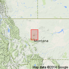
Named from type exposures along the Missouri River about mouth of Eagle Creek [40 mi below Fort Benton], Choteau Co., MT.
Source: US geologic names lexicon (USGS Bull. 896, p. 648).
- Usage in publication:
-
- Eagle formation*
- Modifications:
-
- Revised
- AAPG geologic province:
-
- Central Montana uplift
Summary:
Pg. 211-212. Eagle sandstone. Coarse, light-colored sandstone with clay shale and lignite, 250 to 300 feet thick, contains Fox Hills fauna. Beds of Montana age overlying Eagle sandstone divided into (ascending): Claggett formation, 400 feet; Judith River beds, 500 to 600 feet; Bearpaw shale, 600 feet. The Eagle sandstone as now defined underlies Claggett formation and in most areas overlies Colorado shale.
[GNC remark (ca. 1938, US geologic names lexicon, USGS Bull. 896, p. 648): In Yellowstone-Bighorn Counties region of Montana, however, the 350+/- feet of transition beds underlying Virgelle sandstone (basal member of Eagle sandstone) and containing a fauna of predominantly Montana types, are now known as Telegraph Creek formation. In that area the Telegraph Creek formation separates the Eagle from deposits of unquestioned Colorado age, containing Niobrara fossils and designated as Niobrara shale.]
Source: US geologic names lexicon (USGS Bull. 896, p. 648); supplemental information from GNU records (USGS DDS-6; Denver GNULEX).
- Usage in publication:
-
- Eagle sandstone*
- Modifications:
-
- Mapped
- AAPG geologic province:
-
- Sweetgrass arch
Summary:
Eagle sandstone of Montana group. Exposed along Missouri River and along several faults in Eagleton quadrangle, Chouteau County, north-central Montana. Includes Virgelle sandstone member in lower 80 to 100 feet. Middle and upper members consist of 125 to 150 feet of alternating beds of gray to buff medium-grained sandstone, containing sandy limonitic concretions. Conformably underlies Claggett shale of Montana group; overlies Colorado shale with contact transitional through series of alternating beds of sandstone and shale. Age is Late Cretaceous.
Source: US geologic names lexicon (USGS Bull. 1200, p. 1192).
- Usage in publication:
-
- Eagle sandstone*
- Modifications:
-
- Areal extent
- AAPG geologic province:
-
- Sweetgrass arch
Summary:
Pg. 108 (fig. 1), 114-115. Eagle sandstone. On east side of Sweetgrass arch, northwestern Montana, the Eagle sandstone includes all strata between Telegraph Creek formation and Claggett shale. Divided into lower Virgelle sandstone member and upper unnamed member of mudstone, shale, siltstone, and sandstone. Age is Late Cretaceous.
Source: US geologic names lexicon (USGS Bull. 1200, p. 1192).
- Usage in publication:
-
- Eagle sandstone
- Modifications:
-
- Not used
- AAPG geologic province:
-
- Powder River basin
Summary:
Pg. 15, 16. Eagle sandstone. Discussion of marine Cretaceous formations of Hardin district, Montana and Wyoming. Local nomenclature revised. Names Frontier formation and Eagle sandstone which appear on maps published by Thom and others (1935, USGS Bull. 856), Richards and Rogers (1951, USGS Oil and Gas Inv. Prelim. Map OM-111), and Knechtel and Patterson (1952, USGS Circ. 150) have been dropped from nomenclature adopted for this report. Rocks formerly called Eagle sandstone are assigned to unnamed sandy shale member in upper part of Cody shale of Montana group; they represent a shaly facies of strata that elsewhere in central Montana includes thick massive sandstone beds that are typical of Eagle sandstone.
Source: US geologic names lexicon (USGS Bull. 1200, p. 1192).
- Usage in publication:
-
- Eagle Sandstone*
- Modifications:
-
- Areal extent
- AAPG geologic province:
-
- Montana folded belt
Summary:
Pg. 28-31, 104-107. Eagle Sandstone. Includes (ascending): (1) Virgelle Sandstone Member, gray, fine- to medium-grained sandstone, has a salt-and-pepper appearance, commonly stained by limonite, thickness 163 feet; and (2) coal member, interbedded sandstone, shale, carbonaceous shale, and coal, thickness 614 feet, occurs 180 feet above Virgelle. Total thickness 777 feet. Homotaxial with the Eagle of Livingston area, 40 miles north. Overlies Telegraph Creek Formation with gradational contact; underlies Everts Formation (new), contact placed at top of sandstone just above last coal. Fossils (pelecypods, plant debris, pollen and spores). Age is considered early Late Cretaceous.
Measured section (Mount Everts 4) about 0.6 mi south of mapped area, 1.3 mi north-northeast of Mammoth, WY, on west face of Mount Everts, Yellowstone National Park, Lat. 44 deg. 59 min. 30 sec. N., Long. 110 deg. 41 deg. 00 min. W., Mammoth 15-min quadrangle, Park Co., northwestern WY.
Source: Publication.
- Usage in publication:
-
- Eagle Sandstone*
- Modifications:
-
- Reference
- Dominant lithology:
-
- Sandstone
- Siltstone
- Coal
- AAPG geologic province:
-
- Montana folded belt
- Central Montana uplift
- Powder River basin
Summary:
Eagle Sandstone. A series of lagoonal, estuarine, deltaic, swamp, and beach deposits that interfinger with marine near-shore and offshore deposits (east) and continental deposits (west). Thickness ranges from 515 to 860 feet. Includes (ascending) Virgelle Sandstone Member and an unnamed upper part. Virgelle Sandstone Member, gray, coarse- to fine-grained, noncalcareous, thin- to medium-bedded to massive, cliff-forming sandstone, 110 feet thick; in places is an olive-gray, poorly sorted, indurated to platy, arkosic, thin-bedded siltstone. Unamed upper part, 645 feet thick, consists of: (1) sandstone; (2) light-gray to olive-gray siltstone and gray-brown, very fine-grained, tuffaceous, carbonaceous, thin- to thick-bedded coal; and (3) dark-gray, very fine-grained, microlitic, andesitic, calcareous, medium-bedded tuff. Gradationally overlies Telegraph Creek Formation; gradationally underlies Cokedale Formation of Livingston Group, a conspicuous deposit containing andesitic detritus. Age is Late Cretaceous (Campanian). Report includes geologic map, correlation chart, petrographic descriptions.
Reference section: a few miles west of Livingston on north side of Miner Creek, [between confluence of Eldridge and Miner Creeks and town of Cokedale (abandoned)], in NW/4 sec. 26, T. 2 S., R. 8 E., [in vicinity of Lat. 45 deg. 38 min. 20 sec. N., Long. 110 deg. 42 min. 29 sec. W., Hoppers 7.5-min quadrangle], Park Co., MT.
Composite measured section: in NE/4 sec. 27, T. 2 S., R. 9 E. (outcrop) and in SW/4 sec. 11, T. 2 S., R. 9 E.
Source: Modified from GNU records (USGS DDS-6; Denver GNULEX).
- Usage in publication:
-
- Eagle Sandstone*
- Modifications:
-
- Areal extent
- AAPG geologic province:
-
- Montana folded belt
Summary:
Pg. B3-B4, B6 (fig. 3). Eagle Sandstone. In Elkhorn Mountains area, Jefferson and Broadwater Counties, southwestern Montana, the uppermost strata in lower part of Slim Sam Formation of Klepper and others (1957) are assigned to Eagle Sandstone. Consists of (ascending): feldspar-chert-quartz-sandstone; silty sandstone; medium-grained magnetite-bearing sandstone that intertongues and underlies planar-bedded fine-grained sandstone. Correlated with Eagle Sandstone of Livingston area. Conformably overlies Telegraph Creek Formation and unconformably underlies Slim Sam Formaton (restricted). Contains fossil plants. Age is Late Cretaceous (Santonian).
Source: Publication.
For more information, please contact Nancy Stamm, Geologic Names Committee Secretary.
Asterisk (*) indicates published by U.S. Geological Survey authors.
"No current usage" (†) implies that a name has been abandoned or has fallen into disuse. Former usage and, if known, replacement name given in parentheses ( ).
Slash (/) indicates name conflicts with nomenclatural guidelines (CSN, 1933; ACSN, 1961, 1970; NACSN, 1983, 2005, 2021). May be explained within brackets ([ ]).