- Usage in publication:
-
- Duskin Creek formation
- Modifications:
-
- Original reference
- Dominant lithology:
-
- Sandstone
- Shale
- AAPG geologic province:
-
- Appalachian basin
Summary:
Duskin Creek formation of Lee group. [Duskin formation used on p. 30, 39, 63, and in headings on p. 68, 170, 179; Duskin Creek formation used in heading on p. 53, where occurs first description.] Top formation of Lee group in Southern Tennessee coal field. Its top member is a heavy, thick-bedded, very hard, yellowish sandstone, of which 75 feet remains uneroded. Underlying part of formation consists of about 150 feet of shale with a few thin-bedded, shaly, impure sandstones. The shale is usually of dark-blue or gray color and contains several coal beds. In some places the shale is iron-stained and weathers into long, thin slivers. The formation varies in thickness from 0 to 125 feet. It rests on Rockcastle sandstone. [Age is Early Pennsylvanian (early Pottsville).]
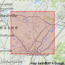
Well exposed on Duskin Creek, a tributary of Piney Creek, which flows by Spring City, Rhea Co., southeastern TN.
Source: US geologic names lexicon (USGS Bull. 896, p. 646).

- Usage in publication:
-
- Duskin Creek formation
- Modifications:
-
- Revised
- AAPG geologic province:
-
- Appalachian basin
Summary:
Duskin Creek formation of Lee group. Extended to include strata between Rockcastle and Corbin sandstones in northern Tennessee and southern Kentuclcy. Includes Crossville sandstone member (new). [Age is Pennsylvanian.]
Source: US geologic names lexicon (USGS Bull. 1200, p. 1187).

- Usage in publication:
-
- Duskin Creek formation[†]
- Modifications:
-
- [Abandoned]
- AAPG geologic province:
-
- Appalachian basin
Summary:
Pg. 4-5. Duskin Creek formation was used for beds presumably overlying Rockcastle, and including Dorton shale (new) of this report. Type section of Duskin Creek, which is along this tributary of Piney River, however, consists of beds of Vandever formation that actually underlie the Rockcastle. This error is believed to have been due to failure to identify the Rockcastle because of its local shaly character. For this reason, the name Duskin Creek is no longer used.
[Abandoned. See Rockcastle.]
Source: US geologic names lexicon (USGS Bull. 1200, p. 1187).

- Usage in publication:
-
- Duskin Creek Formation†
- Modifications:
-
- Abandoned
- AAPG geologic province:
-
- Appalachian basin
Summary:
Duskin Creek Formation of TN abandoned herein. Was defined as strata exposed in Walden Ridge syncline, overlying Rockcastle Sandstone. Unit probably represents a sequence of shale and siltstone within Rockcastle Sandstone.
Source: GNU records (USGS DDS-6; Reston GNULEX).
For more information, please contact Nancy Stamm, Geologic Names Committee Secretary.
Asterisk (*) indicates published by U.S. Geological Survey authors.
"No current usage" (†) implies that a name has been abandoned or has fallen into disuse. Former usage and, if known, replacement name given in parentheses ( ).
Slash (/) indicates name conflicts with nomenclatural guidelines (CSN, 1933; ACSN, 1961, 1970; NACSN, 1983, 2005, 2021). May be explained within brackets ([ ]).

