

- Usage in publication:
-
- Drury shale and sandstone member
- Modifications:
-
- Original reference
- Dominant lithology:
-
- Shale
- Sandstone
- AAPG geologic province:
-
- Illinois basin
Summary:
Pg. 23, 91-95, and map. The Drury shale and sandstone member of Pottsville formation is composed of shale, sandy shale, shaly sandstone and sandstone, with the first three predominant. Most characteristic lithologic features are the sandy shales and shaly sandstones which weather to a plastic buff, cream or gray, sandy clay. Another typical feature is the fine- and very fine-grained, thin, irregularly bedded sandstone which weathers white with pink blotches commonly mottling the white surface. Clay inclusions, irregular current ripple marks, and mica are common. The sandstone is locally quartzitic and not micaceous. Carbonaceous material occurs throughout as thin partings or laminae. Small lenses of coal are present in western part of quadrangle. Thickness 50 to 120 feet. Lies conformably on Lick Creek sandstone member of Pottsville and is conformably overlain by Makanda sandstone member. Age is Pennsylvanian.
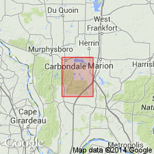
Named from excellent exposures along Drury Creek, particularly in bluffs south of Makanda, Carbondale quadrangle, Jackson Co., southwestern IL.
Source: US geologic names lexicon (USGS Bull. 896, p. 634).
- Usage in publication:
-
- Drury shale member
- Modifications:
-
- Revised
- AAPG geologic province:
-
- Illinois basin
Summary:
Pg. 37, 38. Drury shale member of Battery Rock formation. Reallocated to member status in Battery Rock formation. Present in southwestern Illinois. Principally sandy shale and shaly sandstone 50 to 100 feet thick. Upper part of formation; overlies Battery Rock sandstone in lower part of formation. Age is Pennsylvanian.
Source: US geologic names lexicon (USGS Bull. 1200, p. 1161).

- Usage in publication:
-
- Drury shale member
- Modifications:
-
- Revised
- AAPG geologic province:
-
- Illinois basin
Summary:
Pg. 29-30, 44 (table 1), 61, pl. 1. Drury shale member of Caseyville formation of McCormick group (new). Reallocated to member status in Caseyville formation. Includes all strata between Battery Rock sandstone member below and Pounds sandstone member. Dominantly shale, but includes some sandstone and two or more discontinuous coals. Thickness at type section of Caseyville, 98 feet. Name Drury not used in southeastern Illinois where Gentry coal and Sellers limestone are differentiated in this interval. Age is Pennsylvanian. Presentation of new rock-stratigraphic classification of Pennsylvanian strata in Illinois.
Source: US geologic names lexicon (USGS Bull. 1200, p. 1161).

- Usage in publication:
-
- Drury Member
- Modifications:
-
- Revised
- AAPG geologic province:
-
- Illinois basin
Summary:
Pg. 13 (fig. 6), 19 (fig.9), 20-21. Drury Member of Caseyville Formation. Changed name to Drury Member because in many places half or more of the interval consists of sandstone. Consists principally of variable proportions of light- to dark-gray clay-shale and silty shale, light-gray, thinly laminated siltstone, and light-gray, very fine-grained, thin- to medium-bedded, shaly sandstone. Locally contains lenses of cross-bedded sandstone up to about 15 feet thick. Includes Gentry Coal Bed (rank reduced). Overlies Battery Rock Sandstone Member and underlies Pounds Sandstone Member. Fossiliferous (goniatites, nautiloids, bivalves, gastropods, brachiopods, conodonts, and palynomorphs, J.A. Devera and others, 1987, GSA Abs. with Programs, p. 220). Age is Early Pennsylvanian (Morrowan, Westphalian A).
Mapped in Creal Springs quadrangle (http://ngmdb.usgs.gov/Prodesc/proddesc_10331.htm), Eddyville quadrangle (http://ngmdb.usgs.gov/Prodesc/proddesc_10314.htm), and Stonefort quadrangle (http://ngmdb.usgs.gov/Prodesc/proddesc_10341.htm).
Source: Publication.
- Usage in publication:
-
- Drury Member
- Modifications:
-
- Revised
- AAPG geologic province:
-
- Illinois basin
Summary:
Detailed geologic mapping has indicated that strata referred to as Drury Member of Caseyville Formation may actually lie entirely above what is mapped in the Goreville quad as the Pounds Sandstone Member, rather than below it. If this is true, author feels the Drury needs a major redefinition. Drury, as used in this report, follows the usage established by Nelson and others (1990). Unit crops out from the south-central portion to the west-southwest part of the Goreville quad. Commonly erodes to form a topographic bench between the Battery Rock and the Pounds. Most complete exposure is near-center NE, sec. 36, T11S, R2E, near and along a county road (measured section 3, appendix A). Thickness ranges from 50 to 70 ft in the Goreville quad. Unit is predominantly shale and siltstone, but the sandstones, are best exposed. One of these sandstones, the Dutchman Creek sandstone lentil, is relatively continuous and was mapped on the quad. It is an orthoquartzite, light to yellow tan that locally weathers to orange-yellow and commonly has orange-red Liesegang banding. The lentil is medium to thick bedded and typically trough cross-bedded. Occurs near the middle part of the Drury and forms ledges from 10 to 30 ft thick. Coal occurs near the base of the Drury Member in a roadcut along Interstate 24 in an adjacent quad. Drury shown as Middle Pennsylvanian (Morrowan). [Morrowan here considered to extend into the Middle Pennsylvanian.]
Source: GNU records (USGS DDS-6; Reston GNULEX).
- Usage in publication:
-
- "Drury" Member
- Modifications:
-
- Overview
- AAPG geologic province:
-
- Illinois basin
Summary:
Because most Pennsylvanian outcrops in the Waltersburg quad consist of sandstone, only "Wayside" sandstone lentils, the Battery Rock Sandstone Member, and the Pounds Sandstone Member were mapped. The "Wayside" and "Drury" Members are poorly defined and described in both their respective type areas and in the Waltersburg quad. Both are poorly exposed and their contacts generally concealed. The two cannot be differentiated from each other where the intervening Battery Rock is absent. These members are referred to as "Wayside" and "Drury" because of their questionable status as valid lithostratigraphic units in the Waltersburg quad.
Source: GNU records (USGS DDS-6; Reston GNULEX).
For more information, please contact Nancy Stamm, Geologic Names Committee Secretary.
Asterisk (*) indicates published by U.S. Geological Survey authors.
"No current usage" (†) implies that a name has been abandoned or has fallen into disuse. Former usage and, if known, replacement name given in parentheses ( ).
Slash (/) indicates name conflicts with nomenclatural guidelines (CSN, 1933; ACSN, 1961, 1970; NACSN, 1983, 2005, 2021). May be explained within brackets ([ ]).