- Usage in publication:
-
- Dover limestone
- Modifications:
-
- Original reference
- Dominant lithology:
-
- Limestone
- AAPG geologic province:
-
- Forest City basin
Summary:
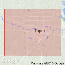
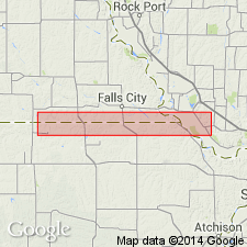
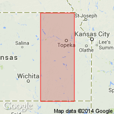
Pg. 31. Dover limestone. Limestone, 4 feet or less thick, in Upper Coal Measures of Shawnee County, northeastern Kansas. Age is Pennsylvanian. [From statement on p. 28 appears to underlie Rossville shales and sandstone and to overlie Dover shale and sandstone.]
Source: US geologic names lexicon (USGS Bull. 896, p. 628).
- Usage in publication:
-
- Dover limestone bed
- Modifications:
-
- Revised
- AAPG geologic province:
-
- Forest City basin
Summary:
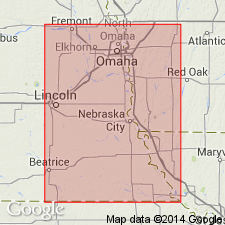
Pg. 72, 73, 74, 75, 80, 90, 116, 222. Dover limestone bed of McKissick Grove shale member of Wabaunsee formation. Beede's Dover shale and sandstone, Dover limestone, and Rossville shale and sandstone occupy practically all of interval represented by Admire shale member, but only one of these is acceptably defined; it is Dover limestone, which extends northward to Nebraska and Iowa. It is composed of one impure massive gray limestone or of 2 limestones separated by a thin shale. It underlies Pony Creek shale and overlies Table Creek shale, all included in McKissick Grove shale. Thickness 2 to 4 feet. Age is Late Pennsylvanian (Missouri age). Report includes cross sections, measured sections, geologic maps, stratigraphic tables.
Named from exposures near Dover [Shawnee Co.], northeastern KS.
Source: US geologic names lexicon (USGS Bull. 896, p. 628); GNC KS-NE Pennsylvanian Corr. Chart, sheet 1, Oct. 1936; supplemental information from GNU records (USGS DDS-6; Denver GNULEX).
- Usage in publication:
-
- Dover limestone member
- Modifications:
-
- Revised
Summary:
Pg. 94, 96. Dover limestone member of McKissick Grove formation of Wabaunsee group. Between Maple Hill limestone member of McKissick Grove formation and overlying Brownville limestone are two, instead of one, persistent limestones. The upper one is distinguished by occurrence of coal a few inches to 2 or 3 feet beneath the limestone. The lower limestone is characterized by abundance of large TRITICITES and Cryptozoon, and, except for generally lighter color, very closely resembles Tarkio limestone. Both of these limestones between the Maple Hill and Brownville have been identified at various places in Kansas and Nebraska as Dover limestone. Study of Beede's original description of the Dover and examination in field near Dover convince writer that lower of the 2 limestones is true Dover, and name Jim Creek, from a locality in central Pottawatomie County, Kansas, where entire section is well exposed, is selected for the upper limestone just above the coal. Condra's name Table Creek shale (which includes Nyman coal) is restricted to shale between the Jim Creek and the Dover, and the new name Frenck shale [French Creek] (from a creek northwest of Onaga, Kansas) is adopted for the shale between the Dover and Maple Hill limestone. Age is Late Pennsylvanian (Virgil).
Source: US geologic names lexicon (USGS Bull. 896, p. 628); GNC KS-NE Pennsylvanian Corr. Chart, sheet 2, Oct. 1936.
- Usage in publication:
-
- Dover limestone
- Modifications:
-
- Errata
Summary:
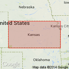
Transposed the names Frenck [French] shale and Table Creek shale restricted, by applying former name to shale overlying Dover limestone and latter name to shale underlying Dover limestone.
Source: US geologic names lexicon (USGS Bull. 896, p. 628); GNC KS-NE Pennsylvanian Corr. Chart, sheet 2, Oct. 1936.
- Usage in publication:
-
- Dover limestone formation
- Modifications:
-
- Revised
- AAPG geologic province:
-
- Forest City basin
- Nemaha anticline
Summary:
Pg. 10. Dover limestone formation of Wabaunsee group. Dark gray, nodular to blocky, 1 bed or 2 beds separated by shale, quite fossiliferous (fusulinids). Thickness 1.5 to 4 feet. Underlies [/]Friedrich-Dry shale member of Pony Creek shale formation. Rests on Table Creek shale, top member of McKissick shale formation. Age is Late Pennsylvanian (Virgil). [See also under Jim Creek.]
[The use of a hyphen between undifferentiated [members] is not considered proper notation (CSN, 1933).]
Source: Publication; US geologic names lexicon (USGS Bull. 896, p. 628, Jim Creek entry p. 1046); GNC KS-NE Pennsylvanian Corr. Chart, sheet 2, Oct. 1936.

- Usage in publication:
-
- Dover limestone
- Modifications:
-
- Revised
Summary:
Dover limestone of Wabaunsee group. The shale overlying Dover limestone and underlying Grandhaven limestone in Kansas is here named Dry shale. Age is Late Pennsylvanian (Virgil).
[Moore abandoned McKissick Grove shale and treated its subdivisions as formations in Wabaunsee group. See "Modern classifications of the Pennsylvanian rocks of eastern Kansas and southeastern Nebraska," compiled by M.G. Wilmarth, Secretary of Committee on Geologic Names, USGS unpub. corr. chart, Oct. 1936, sheet 2.]
Source: US geologic names lexicon (USGS Bull. 896, p. 628); GNC KS-NE Pennsylvanian Corr. Chart, sheet 2, Oct. 1936.
- Usage in publication:
-
- Dover limestone
- Modifications:
-
- Overview
Summary:
Pg. 15. Dover limestone of Wabaunsee group. Consists of thin fossiliferous limestone and some shale. Thickness 2 to 4 feet in Nebraska, southeastern Iowa, and northwestern Missouri; thicker in southern Kansas. Underlies Dry formation; overlies Langdon formation. Age is Late Pennsylvanian (Virgilian).
Source: US geologic names lexicon (USGS Bull. 1200, p. 1151).
- Usage in publication:
-
- Dover limestone member*
- Modifications:
-
- Revised
Summary:
Pg. 2274 (fig. 1), 2275. Dover limestone member of Stotler limestone. Rank reduced to member status in Stotler limestone (new). Underlies Dry shale member; overlies Pillsbury shale (new). Age is Late Pennsylvanian (Virgilian).
Source: US geologic names lexicon (USGS Bull. 1200, p. 1151).
- Usage in publication:
-
- Dover limestone
- Modifications:
-
- Areal extent
Summary:
Pg. 12, fig. 5. Dover limestone of Wabaunsee group. Consists of two limestone beds separated by thin bed of gray shale. Upper limestone is dense, gray, unfossiliferous, and weathers buff; lower limestone is dark gray to black, weathering to nodular form with many white fragments of DERBYIA, CHONETES, and CRURITHYRIS. Thickness about 3 feet. Underlies Dry shale; overlies Table Creek shale. Age is Late Pennsylvanian (Virgilian).
Source: US geologic names lexicon (USGS Bull. 1200, p. 1151).
- Usage in publication:
-
- Dover limestone member*
- Modifications:
-
- Revised
- AAPG geologic province:
-
- Cherokee basin
- Forest City basin
Summary:
Pg. 6-7, pl. 1. Dover limestone member of Stotler limestone of Wabaunsee group. Moore's (1949) Dover restricted to upper limestone bed (containing algal deposits); middle and lower limestone beds included in Maple Hill limestone and Wamego shale members of Zeandale limestone, respectively. Overlies Pillsbury shale and underlies Dry shale member of Stotler. Distribution of fossils collected from the Dover is given in table 1 (sheet 1). Fossils include: fusulinids, coelentrates, crinoids, bryozoans, brachiopods, pelecypods, gastropods, algae. Age is Late Pennsylvanian (Virgilian). Report includes measured sections, correlation diagrams, fossil distribution charts. [Report submitted for publication before release of 1961 ACSN code, recommending capitalization of formal names.]
Source: Publication.
For more information, please contact Nancy Stamm, Geologic Names Committee Secretary.
Asterisk (*) indicates published by U.S. Geological Survey authors.
"No current usage" (†) implies that a name has been abandoned or has fallen into disuse. Former usage and, if known, replacement name given in parentheses ( ).
Slash (/) indicates name conflicts with nomenclatural guidelines (CSN, 1933; ACSN, 1961, 1970; NACSN, 1983, 2005, 2021). May be explained within brackets ([ ]).

