

- Usage in publication:
-
- Dog Bend limestone
- Modifications:
-
- Original reference
- Dominant lithology:
-
- Limestone
- AAPG geologic province:
-
- Bend arch
Summary:
(Attributed to F.B. Plummer, 1929.) Dog Bend limestone lies in interval between Turkey Creek sandstone and Lake Pinto sandstone in Mineral Wells formation. Age is Pennsylvanian. [This interval is that occupied by Salesville shale as defined by Moore and Plummer, 1922.]
Source: US geologic names lexicon (USGS Bull. 896, p. 617).

- Usage in publication:
-
- Dog Bend limestone
- Modifications:
-
- Not used
- AAPG geologic province:
-
- Bend arch
Summary:
Defined Salesville shale as underlying Turkey Creek sandstone and overlying Lake Pinto sandstone.
Source: US geologic names lexicon (USGS Bull. 896, p. 617).
- Usage in publication:
-
- Dog Bend limestone
- Modifications:
-
- Not used
- AAPG geologic province:
-
- Bend arch
Summary:
Defined Salesville shale as consisting of gray calcareous, sandy shale containing several lentils of sandstone and near its base a thin stratum of impure sandy limestone, and as overlain by Turkey Creek sandstone, and underlain by Lake Pinto sandstone. They did not mention Dog Bend limestone. But columnar section on geologic map (of Palo Pinto County, north-central Texas) accompanying Bull. 3534 shows in lower part of Salesville shale, 3 limestones separated by shale beds, and the name Dog Bend limestone appears opposite the upper of these 3 limestones. The map itself shows a sandstone mapped around Dog Bend of Brazos River, between towns of Palo Pinto and Mineral Wells.
Source: US geologic names lexicon (USGS Bull. 896, p. 617).

- Usage in publication:
-
- Dog Bend limestone member
- Modifications:
-
- Revised
- AAPG geologic province:
-
- Bend arch
Summary:
Pg. 66 (fig. 1). Dog Bend limestone member of Salesville formation. Salesville is raised to formation rank and expanded below to base of Lake Pinto sandstone. Chart shows Dog Bend limestone member above Lake Pinto member; underlies unnamed sandstones and limestone below Turkey Creek sandstone member of Keechi Creek formation. Age is Pennsylvanian (Canyon).
Source: US geologic names lexicon (USGS Bull. 1200, p. 1130).
- Usage in publication:
-
- Dog Bend limestone bed
- Modifications:
-
- Revised
- AAPG geologic province:
-
- Fort Worth syncline
Summary:
Pg. 24, pl. 1. Referred to as Dog Bend limestone bed in Salesville formation. As used in this report [Parker County, north-central Texas], it is lower part of unnamed shale member that overlies Lake Pinto sandstone member. Bed is continuous with bed mapped and named Dog Bend in Palo Pinto County. Age is Pennsylvanian (Canyon).
Source: US geologic names lexicon (USGS Bull. 1200, p. 1130).

- Usage in publication:
-
- Dog Bend Limestone [unranked]
- Modifications:
-
- Mapped 1:250k
- Dominant lithology:
-
- Limestone
- AAPG geologic province:
-
- Bend arch
Summary:
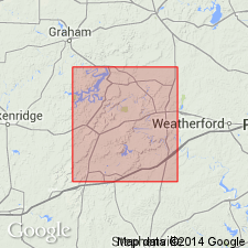
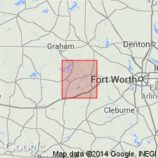
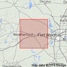
Dog Bend Limestone [unranked] in Mineral Wells Formation of Strawn Group. One to four discontinuous limestone units separated by shale; limestone, fine-grained, slightly argillaceous, light gray, individual units 1 to 3 feet thick, locally grades to sandstone in southern area. Lies above Lake Pinto Sandstone and below Turkey Creek Sandstone, [both unranked] in Mineral Wells Formation. Age is Middle Pennsylvanian (Desmoinesian).
[Age is considered early Late Pennsylvanian (early Missourian). Early-Middle Pennsylvanian boundary tentatively placed between Village Bend and Lake Pinto (see Geol. Atlas Texas, Dallas sheet 1987 entry under Mineral Wells). Boardman and others, 1994, Kansas Geol. Survey Bull., no. 232, p. 8, 14 (fig. 8) state boundary is 15 to 25 feet above Village Bend, based on fusulinids, conodonts, and ammonoids.]
Mapped in Palo Pinto and Parker Cos., central northern TX.
Source: Publication.
For more information, please contact Nancy Stamm, Geologic Names Committee Secretary.
Asterisk (*) indicates published by U.S. Geological Survey authors.
"No current usage" (†) implies that a name has been abandoned or has fallen into disuse. Former usage and, if known, replacement name given in parentheses ( ).
Slash (/) indicates name conflicts with nomenclatural guidelines (CSN, 1933; ACSN, 1961, 1970; NACSN, 1983, 2005, 2021). May be explained within brackets ([ ]).