

- Usage in publication:
-
- Diamond Creek sandstone*
- Modifications:
-
- Named
- Dominant lithology:
-
- Sandstone
- AAPG geologic province:
-
- Wasatch uplift
Summary:
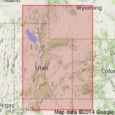
Named for outcrops near the head of Little Diamond Creek, a tributary of Diamond Fork in sec 22, T8S, R4E, Utah Co, UT on the Wasatch uplift. No type locality designated. Consists of gray or buff to red, fine- to coarse-grained, cross-bedded sandstone that is usually lime-cemented and friable, but locally has siliceous cement. Is 600 to 1,000+ ft thick. Conformably overlies Kirkman limestone (new). Conformably underlies Park City formation. Thought to be equivalent in accordance to its lithology and stratigraphic position to the Kaibab limestone. Cross section. Permian age.
Source: GNU records (USGS DDS-6; Denver GNULEX).

- Usage in publication:
-
- Diamond Creek? sandstone*
- Modifications:
-
- Areal extent
- Overview
- AAPG geologic province:
-
- Great Basin province
Summary:
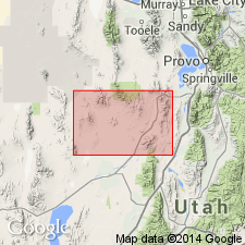
Provisionally extended. Crops out in southern part of East Tintic Mountains where it is provisionally correlated with Diamond Creek sandstone of Wasatch Range and with Coconino sandstone of San Rafael Swell. Section 685 ft thick measured in southern part of T13S, R2W, Juab Co, UT in Great Basin province where it overlies Oquirrh formation and underlies Park City and Phosphoria formations. No fossils found. Permian age assignment base correlation with Diamond Creek sandstone of Wasatch Mountains, UT, Wasatch uplift and Coconino sandstone of San Rafael Swell.
Source: GNU records (USGS DDS-6; Denver GNULEX).
- Usage in publication:
-
- Diamond Creek Sandstone*
- Modifications:
-
- Revised
- AAPG geologic province:
-
- Great Basin province
Summary:
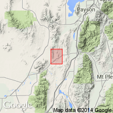
Is a unit, probably of Leonardian, or Early Permian age, that disconformably overlies the newly named Furner Valley Limestone, upper formation of Oquirrh Group in Juab Co, UT in Great Basin province. Is 685 to 875 ft thick on Jericho Ridge and 822 ft thick on Furner Ridge.
Source: GNU records (USGS DDS-6; Denver GNULEX).
- Usage in publication:
-
- Diamond Creek Sandstone*
- Modifications:
-
- Age modified
- AAPG geologic province:
-
- Wasatch uplift
Summary:
Age is Early Permian.
Source: GNU records (USGS DDS-6; Menlo GNULEX).
For more information, please contact Nancy Stamm, Geologic Names Committee Secretary.
Asterisk (*) indicates published by U.S. Geological Survey authors.
"No current usage" (†) implies that a name has been abandoned or has fallen into disuse. Former usage and, if known, replacement name given in parentheses ( ).
Slash (/) indicates name conflicts with nomenclatural guidelines (CSN, 1933; ACSN, 1961, 1970; NACSN, 1983, 2005, 2021). May be explained within brackets ([ ]).