

- Usage in publication:
-
- Denton marl
- Modifications:
-
- Original reference
- Dominant lithology:
-
- Marl
- AAPG geologic province:
-
- Fort Worth syncline
Summary:
Pg. 272. Denton marl. Chiefly friable blue marl, characterized by GRYPHAEA PITCHERI, with, at top, 5 feet of conglomerate containing GRYPHAEA PITCHERI, and lower down a thin bed of sand and one of sandstone. Thickness 40 feet. Upper part of Fort Worth limestone. Underlies Denison marl. [Age is Early Cretaceous (Comanche).]
[Named from Denton Creek, Denton Co., northeastern TX.]
Source: US geologic names lexicon (USGS Bull. 896, p. 598).
- Usage in publication:
-
- Denton terrane
- Modifications:
-
- Revised
- AAPG geologic province:
-
- Anadarko basin
Cragin, F.W., 1895, A study of the Belvidere beds: American Geologist, v. 16, p. 357-385.
Summary:
Pg. 384-385. Denton terrane underlies North Denison terrane (basal terrane of Denison division) and overlies Fort Worth terrane. [Age is Early Cretaceous (Comanche).]
Source: US geologic names lexicon (USGS Bull. 896, p. 598).
- Usage in publication:
-
- Denton subgroup
- Modifications:
-
- Revised
- AAPG geologic province:
-
- Fort Worth syncline
- Ouachita folded belt
- South Oklahoma folded belt
- Strawn basin
Summary:
Pls. 18, 19, p. 114-115, 121-124, 266-276. Denton subgroup. Consists of (descending): (1) breccia of OSTREA CARINATA and G. WASHITAENSIS, 2 feet; (2) brown clay marls, less calcareous than No. 3, 18 feet; (3) GERVILLIOPSIS beds (marls and fissile indurated layers), 8 feet. Underlies Weno formation and overlies Fort Worth formation. Is basal division of Denison beds. [Age is Early Cretaceous (Comanche).]
Source: US geologic names lexicon (USGS Bull. 896, p. 598).
- Usage in publication:
-
- Denton clay member*
- Modifications:
-
- Revised
Summary:
Pg. 140-141. Denton clay member of Denison formation. Consists of (ascending): (1) 5 feet of strongly calcareous clay of a decided marly character; (2) 35 feet of shaly, less calcareous clay; (3) 3 to 5 feet of highly fossiliferous impure limestone composed largely of shells of GRYPHAEA WASHITAENSIS, a few echinoid spines and other fossils, including a large number of OSTREA CARINATA, which led to its being called "Ostrea carinata bed." [Age is Early Cretaceous (Comanche).]
Source: US geologic names lexicon (USGS Bull. 896, p. 598).

- Usage in publication:
-
- Denton Clay
- Modifications:
-
- Areal extent
- AAPG geologic province:
-
- Fort Worth syncline
- Ouachita folded belt
- Strawn basin
Summary:
Denton Clay. Alternating clay, marl, and limestone. Thickness 6 to 25 feet, thins southward. Lies above Fort Worth Limestone and below Weno Limestone. Fossiliferous. Age is Early Cretaceous.
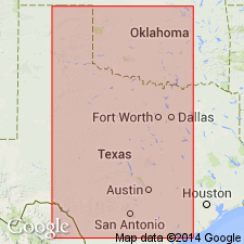
Not separately mapped. Mapped with Pawpaw Formation, Weno Limestone, Fort Worth Limestone, and Duck Creek Formation [in greater Fort Worth area, in Bosque, Denton, Erath, Hill, Hood, Johnson, Parker, Somervell, and Tarrant Cos., eastern TX].
Source: Publication.

- Usage in publication:
-
- Denton Clay
- Denton Clay Member
- Modifications:
-
- Mapped 1:250k
- Dominant lithology:
-
- Clay
- Limestone
- AAPG geologic province:
-
- Fort Worth syncline
- South Oklahoma folded belt
Summary:
Pamphlet [p. 5]. Denton Clay (Texas); Denton Clay Member of Bokchito Formation (Oklahoma).
In Texas, mostly clay, brownish-gray, calcareous, shaly; basal 5 feet marly, upper 3 to 5 feet composed of impure limestone with abundant GRYPHAEA. Thickness approximately 45 feet. Age is Early Cretaceous.
In Oklahoma, bluish-gray shale with thin interbeds of siltstone in middle part and marly limestone near top. Thickness 150 to 200 feet. Age is Early Cretaceous.
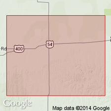
[Mapped in Red River area and southward to Lake Ray Roberts (btw. Sanger and Pilot Point); in Cooke, Denton, and Grayson Cos., central northern TX, and Love Co., southeastern OK; in central part of sheet. Pawpaw, Weno, and Denton mapped undifferentiated from Lake Ray Roberts area to southern edge of map sheet.]
Source: Publication.
For more information, please contact Nancy Stamm, Geologic Names Committee Secretary.
Asterisk (*) indicates published by U.S. Geological Survey authors.
"No current usage" (†) implies that a name has been abandoned or has fallen into disuse. Former usage and, if known, replacement name given in parentheses ( ).
Slash (/) indicates name conflicts with nomenclatural guidelines (CSN, 1933; ACSN, 1961, 1970; NACSN, 1983, 2005, 2021). May be explained within brackets ([ ]).