The National Geologic Map Database is migrating to a new infrastructure. We apologize for any service disruptions during this process.
|
|---|


- Usage in publication:
-
- Deer Creek system
- Modifications:
-
- Original reference
- Dominant lithology:
-
- Limestone
- Shale
- AAPG geologic province:
-
- Forest City basin
Summary:
Pg. 117. Deer Creek system. Three limestones separated by shales; aggregate thickness 26.5 feet. Separated from overlying Topeka limestone by 60 feet of shale [Calhoun shale member] and from underlying Lecompton limestone by about 100 feet of shale with some thin limestones [Tecumseh shale member]. Age is Pennsylvanian.
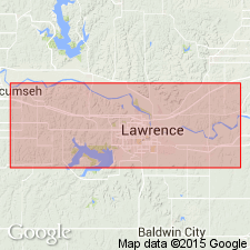
Named from exposures on Deer Creek, east of Topeka, Shawnee Co., KS.
Source: US geologic names lexicon (USGS Bull. 896, p. 587-588).

- Usage in publication:
-
- Deer Creek limestone member
- Modifications:
-
- Revised
- AAPG geologic province:
-
- Forest City basin
Summary:
Pg. 48. Deer Creek limestone member of Shawnee formation. As originally defined by Bennett included 3 limestones and 2 shales. The following names are proposed for the subdvisions (descending): Ervine Creek limestone, Mission Creek shale, Haynies limestone, Larsh shale, and Rock Bluff limestone. All of these units extend through outcrops in Nebraska, Iowa, Missouri, and Kansas. Thickness 29.5 feet. Overlies Tecumseh shale member and underlies Calhoun shale member, both of Shawnee formation. Age is Late Pennsylvanian (Missouri age). Report includes cross sections, measured sections, geologic maps, stratigraphic tables.
Source: US geologic names lexicon (USGS Bull. 896, p. 587-588); GNC KS-NE Pennsylvanian Corr. Chart, sheet 1, Oct. 1936; supplemental information from GNU records (USGS DDS-6; Denver GNULEX).

- Usage in publication:
-
- Deer Creek limestone member
- Modifications:
-
- Revised
Summary:
Deer Creek limestone of Shawnee group. Transferred from Calhoun shale to top of Deer Creek limestone the beds previously named Jones Point shale and Sheldon limestone, and restricted Calhoun shale to the beds previously named Iowa Point shale. As redefined, includes the following members (descending): Sheldon limestone, Jones Point shale, Ervine Creek limestone, Mission Creek shale, Haynies limestone, Larsh shale [true], Rock Bluff limestone [true], Larsh shale (of Kansas), and Rock Bluff limestone (of Kansas). Age is Late Pennsylvanian (Virgil).
Source: US geologic names lexicon (USGS Bull. 896, p. 587-588); GNC KS-NE Pennsylvanian Corr. Chart, sheet 2, Oct. 1936.

- Usage in publication:
-
- Deer Creek limestone formation
- Modifications:
-
- Revised
- AAPG geologic province:
-
- Forest City basin
- Nemaha anticline
Summary:
Pg. 11. Deer Creek limestone formation of Shawnee group. Divided Calhoun shale into (descending) Iowa Point shale, Sheldon limestone, and Jones Point shale; restricted Deer Creek limestone to the beds between base of Jones Point shale and top of Tecumseh shale; and divided Deer Creek limestone in section from Forest City, Missouri, to Du Bois, Nebraska, into following members (descending): Ervine Creek limestone, Larsh shale, Rock Bluff limestone, Oskaloosa shale, and Ozawkie limestone. Age is Late Pennsylvanian (Virgil).
Source: US geologic names lexicon (USGS Bull. 896, p. 587-588); GNC KS-NE Pennsylvanian Corr. Chart, sheet 2, Oct. 1936.

- Usage in publication:
-
- Deer Creek limestone
- Modifications:
-
- Revised
Summary:
Deer Creek limestone of Shawnee group. Divided Deer Creek limestone of Kansas into (descending): Ervine Creek limestone, [/]Larsh-Mission Creek shale, Rock Bluff limestone, Oskaloosa shale (formerly erroneously indentified as Rock Bluff limestone). He stated that his Ozawkie and Oskaloosa members are absent in Nebraska. Age is Late Pennsylvanian (Missouri age).
On p. 182 states type section on Deer Creek, in northeastern Shawnee Co., east of Topeka [Kansas]. Typically exposed in roadcut in SE/4 sec. 36, T. 11 S., R. 17 E.
[GNC remark (ca. 1936, US geologic names lexicon, USGS Bull. 896, p. 588): In Kansas the Shawnee is treated as a group and the Deer Creek as a formation. In northern Oklahoma the Deer Creek limestone is treated as a member of Pawhuska limestone.
See "Modern classifications of the Pennsylvanian rocks of eastern Kansas and southeastern Nebraska," compiled by M.G. Wilmarth, Secretary of Committee on Geologic Names, USGS unpub. corr. chart, Oct. 1936, sheet 2.]
[The use of a hyphen between undifferentiated [members] is not considered proper notation (CSN, 1933).]
Source: US geologic names lexicon (USGS Bull. 896, p. 587-588); GNC KS-NE Pennsylvanian Corr. Chart, sheet 2, Oct. 1936; supplemental information from Gentile and Thompson (2004).

- Usage in publication:
-
- Deer Creek limestone
- Modifications:
-
- Overview
Summary:
Pg. 17-18. Deer Creek limestone. In Missouri, the interval between the Rock Bluff limestone member and the uppermost limestone of the Deer Creek is occupied by shale; this shale has been treated by Missouri Geological Survey as occupying the Rock Bluff-Ervine Creek interval, with implication that intervening Haynies limestone is absent in Missouri. Missouri follows Kansas practice, and the shale is called [/]Larsh-Burroak; the Missouri Survey recognizes the possibility that Burroak shale member may be absent in Missouri and that the uppermost limestone of the Deer Creek may include the Haynies and Ervine Creek limestone members. Age is Late Pennsylvanian (Virgil).
[The use of a hyphen between undifferentiated [members] is not considered proper notation (CSN, 1933).]
Source: US geologic names lexicon (USGS Bull. 896, p. 1069-1070).

- Usage in publication:
-
- Deer Creek formation
- Modifications:
-
- Overview
Summary:
Pg. 126 (fig. 22), 142 (fig. 29), 156. Deer Creek formation, in Shawnee group, underlies Calhoun formation and overlies Tecumseh formation; includes (ascending) Ozawkie limestone, Oskaloosa shale. Rock Bluff limestone, Larsh shale, Haynies limestone, Burroak shale, and Ervine Creek limestone members. This is classification agreed upon by State Geological Surveys of Iowa, Kansas, Missouri, Nebraska, and Oklahoma. In Kansas, the shale between the Rock Bluff and Ervine Creek limestones is called the [/]Larsh-Burroak because it seems to be exactly equivalent to the Larsh shale, Haynies limestone, and Burroak shale as described in Nebraska. The Deer Creek is a member of the Pawhuska formation as defined in Oklahoma. Age is Late Pennsylvanian (Virgil).
[The use of a hyphen between undifferentiated [members] is not considered proper notation (CSN, 1933).]
Source: US geologic names lexicon (USGS Bull. 896, p. 1069-1070).

- Usage in publication:
-
- Deer Creek limestone*
- Modifications:
-
- Areal extent
Summary:
Pg. 17-18, fig. 5. Deer Creek limestone of Shawnee group. Comprises (ascending) Ozawkie limestone, Oskaloosa shale, Rock Bluff limestone, Larsh shale, Haynies limestone, Burroak shale, and Ervine Creek limestone members. Lower two members not differentiated everywhere. Underlies Calhoun shale; overlies Tecumseh shale. Age is Late Pennsylvanian (Virgil).
Source: US geologic names lexicon (USGS Bull. 896, p. 1069-1070).
- Usage in publication:
-
- Deer Creek formation
- Modifications:
-
- Reference
- AAPG geologic province:
-
- Forest City basin
Summary:
Pg. D586-D599. Deer Creek Formation of Shawnee Group. In Missouri, includes (ascending) Ozawkie Limestone, Oskaloosa Shale, Rock Bluff Limestone, [/]Larsh-Burroak Shale, Ervine Creek Limestone Members. Age is Late Pennsylvanian (Virgilian).
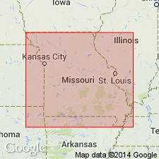
Reference section: in roadcuts on both sides of I-29, 0.5 mi northwest of junction of I-29 and Andrew Co. Route CC and K (exit 60), center NE/4 NW/4 sec. 23, T. 59 N., R. 36 W., Amazonia 7.5-min quadrangle Andrew Co., northwestern MO.
[The use of a hyphen between undifferentiated [members] is not considered proper notation (CSN, 1933).]
Source: Publication.
For more information, please contact Nancy Stamm, Geologic Names Committee Secretary.
Asterisk (*) indicates published by U.S. Geological Survey authors.
"No current usage" (†) implies that a name has been abandoned or has fallen into disuse. Former usage and, if known, replacement name given in parentheses ( ).
Slash (/) indicates name conflicts with nomenclatural guidelines (CSN, 1933; ACSN, 1961, 1970; NACSN, 1983, 2005, 2021). May be explained within brackets ([ ]).