

- Usage in publication:
-
- Dorwin sandstone member*
- Modifications:
-
- Named
- Dominant lithology:
-
- Sandstone
- AAPG geologic province:
-
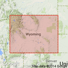
- Green River basin
- Wind River basin
- Bighorn basin
Summary:
The lower massive resistant sandstone of the Amsden formation named for Dorwin Peak in the Gros Ventre Range, WY, Sublette Co, Greater Green River basin and Teton Co in Yellowstone province. The Peak is capped by this sandstone. No type locality designated. Averages 60 ft thick in Gros Ventre Range. Thins southeast to 15 ft thick near Lander, Fremont Co, WY in the Wind River basin. Has been traced west to Teton Pass and Yellowstone Park, WY in the Yellowstone province and northeast to the southern Bighorn Mountains, Bighorn basin. Has not been distinguished in ID. Caps mountains and ledges of Madison limestone where upper part stripped off. Disconformably overlies Madison limestone. Underlies upper part of Amsden that includes, in contrast, less resistant shale, sandstone, and dolomite. Early Pennsylvanian or late Mississippian age indicated by stratigraphic position.
Source: GNU records (USGS DDS-6; Denver GNULEX).
- Usage in publication:
-
- Darwin sandstone member
- Modifications:
-
- Revised
Summary:
Revised in that rocks between top of Madison group and base of Darwin sandstone member of Amsden (revised) are assigned to Sacajawea formation (revised) rather than only the basal part of this interval as originally defined by Branson (1937). [Areal extent not specific enough to assign basins.] Assigned Early Pennsylvanian age and marks base of Pennsylvanian.
Source: GNU records (USGS DDS-6; Denver GNULEX).

- Usage in publication:
-
- Darwin Sandstone Member*
- Modifications:
-
- Revised
- Reference
- Dominant lithology:
-
- Sandstone
- AAPG geologic province:
-
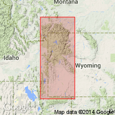
- Bighorn basin
- Wind River basin
- Green River basin
Summary:
Darwin Sandstone Member, basal member of Amsden Formation is a gray, white or cream to salmon sandstone, locally is brick red or has brick red blotches or specks. Is cross-bedded, well-sorted, fine to medium quartz sand with silica (or locally calcite) cement. Is up to 145 ft thick, varying in thickness abruptly. Unconformably overlies Madison Limestone and underlies Horseshoe Shale Member (new name) of Amsden. Reference section designated in Tensleep Canyon on west flank, Bighorn Mountains (sta. 190) T47N, R88W, Washakie Co. Is 132 ft thick at reference section where it is composed solely of sandstone. Known in Bighorn basin, Wind River basin, and Greater Green River basin, Late Mississippian. Unfossiliferous. Assigned a Chester age. Was a beach (sand dune) and bar deposit. Columnar sections. Areal extent maps. Correlation diagrams.
Source: GNU records (USGS DDS-6; Denver GNULEX).
- Usage in publication:
-
- Darwin Sandstone Member*
- Modifications:
-
- Areal extent
- Overview
- AAPG geologic province:
-
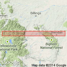
- Wind River basin
- Powder River basin
- Bighorn basin
- Yellowstone province
- Green River basin
Summary:
As basal member of Amsden Formation, Darwin Sandstone Member of late Meramecian to late Chesterian age is present in central WY from Rawlins north to MT border, and from central Natrona to Sheridan Cos west to Teton Co, in the Wind River basin, Powder River basin, Bighorn basin, Yellowstone province, and Greater Green River basin. Probably extends north into MT, ND, and NE. Isopach map; cross sections; measured sections. Section measured on north slope of Darwin Peak (S1/2 sec 28, T40N, R112W) Teton Co by J. D. Love. Darwin is a white, buff, massive to thin-bedded sandstone; one sandstone is cross-bedded; and a poorly exposed buff shale and limestone is 78.8 ft. Is about 200 ft thick at northeast edge of Owl Creek Mountains. Authors identified Darwin in SW1/4 sec 34, T57N, R87W near Mallory's (1967) type Amsden; Darwin was not identified by Mallory in nearby sec 33. Deposited on beaches and offshore bars adjacent to an eastward transgressing shoreline. Principal source areas were Precambrian and Paleozoic rocks of Canadian Shield and Transcontinental arch.
Source: GNU records (USGS DDS-6; Denver GNULEX).
- Usage in publication:
-
- Darwin Sandstone Member*
- Modifications:
-
- Overview
- Areal extent
- AAPG geologic province:
-
- Bighorn basin
- Wind River basin
- Yellowstone province
- Montana folded belt
- Snake River basin
Summary:
Darwin as lower of two members of Amsden Formation in Wind River Canyon, Hot Springs Co, WY, Bighorn basin, correlates with sandstones within Kibbey Member of Big Snowy Formation in Targhee Pass area, Beaverhead Co, MT, Montana folded belt province and Fremont Co, ID, Snake River basin (as shown on fig. 12), suggesting Chesterian (Mississippian) rather than Pennsylvanian age. Unconformably overlies Madison Group; unconformably underlies Horseshoe Shale Member of Amsden. Fig. 12 shows Darwin to be present also in Fremont Co, WY, Wind River basin and Teton Co, WY, Yellowstone province.
Source: GNU records (USGS DDS-6; Denver GNULEX).
- Usage in publication:
-
- Darwin Sandstone Member*
- Modifications:
-
- Revised
- Overview
- AAPG geologic province:
-
- Denver basin
- Powder River basin
- Wind River basin
Summary:
Assigned in WY as the basal member to Amsden Formation at Blue Creek, Washakie Co in the Bighorn basin; assigned to Casper Formation from north of Fremont Canyon, Natrona Co in the Wind River basin east to Banner Mountain and Box Elder Canyon, Laramie Range, Converse Co in the Powder River basin; assigned to Hartville Formation in Hartville area, Platte Co in the Denver basin. Overlies Madison Limestone unconformably. Ranges from 6 ft (1.8 m) at Casper Mountain to 60 ft (18.3 m) at Box Elder Canyon. Thickens east and west of Casper Mountain. Crinoids and gastropods found at Casper Mountain. Is a beach and offshore bar deposit adjacent to an eastward transgressing shoreline. Is a time transgressive unit that ranges in age from Mississippian (Meramecian to Chesterian) in western and central WY to Pennsylvanian (possibly Morrowan to Desmoinesian) in eastern WY.
Source: GNU records (USGS DDS-6; Denver GNULEX).
- Usage in publication:
-
- Darwin Sandstone Member*
- Modifications:
-
- Age modified
- AAPG geologic province:
-
- Yellowstone province
- Montana folded belt
- Bighorn basin
- Powder River basin
Summary:
Is basal member of Amsden Formation. Assigned to author's stratigraphic sequence 5. Darwin is considered Meramecian and Chesterian age because of correlation (1) northward into Kibbey Sandstone (Meramecian and Chesterian) in eastern MT and westward where interfingering of Darwin and Kibbey can be observed at Miller Butte in Jackson Hole, Teton Co, WY, Yellowstone province and in adjacent areas of southwest MT, Montana folded belt province); (2) southward into Humbug Formation (Meramecian) in northern UT; and (3) westward into rocks below Monroe Canyon Limestone (Meramecian and Chesterian) in southeastern ID and into Little Flat Formation (middle Meramecian) farther west in eastern ID. Darwin is present in study area primarily as isolated outcrops along flanks of Bighorn Mountains, Bighorn and Powder River basins and is generally missing east of Bighorn Mountains due to erosion or nondeposition. Conformably overlies Madison Limestone; unconformably underlies Horseshoe Shale Member of Amsden. Regional unconformity at top of Darwin precludes correlation of Darwin as a time transgressive equivalent of Pennsylvanian rocks in central WY as has been previously suggested by several workers.
Source: GNU records (USGS DDS-6; Denver GNULEX).
For more information, please contact Nancy Stamm, Geologic Names Committee Secretary.
Asterisk (*) indicates published by U.S. Geological Survey authors.
"No current usage" (†) implies that a name has been abandoned or has fallen into disuse. Former usage and, if known, replacement name given in parentheses ( ).
Slash (/) indicates name conflicts with nomenclatural guidelines (CSN, 1933; ACSN, 1961, 1970; NACSN, 1983, 2005, 2021). May be explained within brackets ([ ]).