The National Geologic Map Database is migrating to a new infrastructure. We apologize for any service disruptions during this process.
|
|---|


- Usage in publication:
-
- Cypress sandstone
- Modifications:
-
- Named
- Dominant lithology:
-
- Sandstone
- AAPG geologic province:
-
- Illinois basin
Summary:
Named Cypress sandstone. Consists of quartzose sandstone with some shaly beds, about 150 ft thick. Overlies siliceous limestones and shales, in places arenaceous; underlies 150 ft of siliceous limestones and shales. Whole sequence forms a prominent part of the lower Carboniferous of southern IL.
Source: GNU records (USGS DDS-6; Reston GNULEX).
- Usage in publication:
-
- Cypress sandstone*
- Modifications:
-
- Overview
- AAPG geologic province:
-
- Illinois basin
Summary:
Chesterian Cypress sandstone consists of massive fine- to medium-grained, ferruginous, light-brown, quartzose sandstone. In places is soft and friable, usually grains are well cemented. Divided into three members (ascending): Lower member is a massive sandstone about 50 ft thick; middle member is a fossiliferous, cherty, blue, fine-grained limestone, 4 to 5 ft thick; upper member is a massive, slightly argillaceous sandstone, part is thin-bedded and flaggy with cross-bedding, member is 60 to 80 ft thick. Fossil PENTRAMITES is abundant and is restricted to the middle limestone member. Overlies Ste. Genevieve limestone; underlies Tribune limestone.
Source: GNU records (USGS DDS-6; Reston GNULEX).
- Usage in publication:
-
- Cypress sandstone*
- Modifications:
-
- Areal extent
- AAPG geologic province:
-
- Cincinnati arch
Summary:
In north-central TN, the Chesterian Cypress sandstone is a grayish, medium- to coarse-grained, well-cemented, flaggy to thick-bedded sandstone. Cross-bedding and ripple marks are common features in some areas. Varies from 1 to 70 ft, but averages 40 ft in thickness. Has been quarried for paving and chimney stones. Overlies Gasper oolite (gray limestone) with sharp contact; underlies Golconda shale.
Source: GNU records (USGS DDS-6; Reston GNULEX).
- Usage in publication:
-
- Cypress sandstone*
- Modifications:
-
- Areal extent
- AAPG geologic province:
-
- Black Warrior basin
Summary:
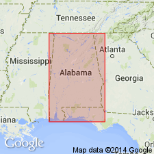
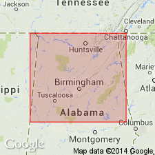
Extended to Colbert Co., northwestern AL on basis of its stratigraphic position and correlation with the Cypress sandstone in the type area of IL and in KY and TN. Thickness varies from 10 to 40 ft; the sandstone pinches out in the eastern part of the county. Overlies Gasper formation; underlies Golconda formation.
Source: GNU records (USGS DDS-6; Reston GNULEX).
- Usage in publication:
-
- Cypress sandstone*
- Modifications:
-
- Revised
- Areal extent
- AAPG geologic province:
-
- Black Warrior basin
Summary:
Geographically restricted from Colbert Co., northwestern AL. Rocks assigned to Mynot sandstone member, here named (next member below the top of seven members, five here named, two revised) of the Pride Mountain formation, here named. Correlation chart shows relations with Butts (1926).
Source: GNU records (USGS DDS-6; Reston GNULEX).

- Usage in publication:
-
- Cypress formation
- Modifications:
-
- Overview
- Areal extent
- AAPG geologic province:
-
- Illinois basin
Summary:
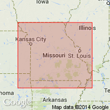
Chesterian Cypress formation extended into MO. Composed of gray shale and mudstone, contains some red shale layers and a few thin limestone stringers, becomes sandy eastward into IL. Thickness is not over 30 ft. Limited exposures in east-central Perry Co. are poor. Contacts with underlying Paint Creek formation and overlying Golconda formation are concealed.
Source: GNU records (USGS DDS-6; Reston GNULEX).
- Usage in publication:
-
- Cypress Sandstone
- Modifications:
-
- Overview
- AAPG geologic province:
-
- Illinois basin
Summary:
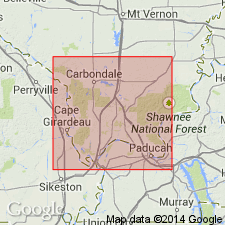
Chesterian Cypress Sandstone is well developed near the center of the Illinois basin. Includes massive sandstone bodies commonly over 100 ft thick. Thins and becomes mostly shale at the eastern and western margins of the basin. Marine fossils and thin limestone units are at widely scattered localities. Thin coal beds and underclays are in the upper third of the formation. Is the most prolific oil-bearing formation in the basin and is known by many different informal oil-field terms. Overlies Ridenhower Formation; underlies Beech Creek Limestone. Exposures in bluffs of Cypress Creek in the southwestern part of T12S and northern part of T13S R1E, Dongola quad, Union Co., IL are generally accepted as the type locality.
Source: GNU records (USGS DDS-6; Reston GNULEX).
- Usage in publication:
-
- Cypress Formation*
- Modifications:
-
- Revised
- AAPG geologic province:
-
- Illinois basin
Summary:
Because of its lithology in this and adjoining quadrangles, the unit is called Cypress Formation (Chesterian) instead of Cypress Sandstone. Shale, dark green with red interbeds, sandy and calcareous at base, 3 to 40 ft thick. Overlies Paint Creek Formation; underlies Beech Creek Limestone Member of Golconda Formation.
Source: GNU records (USGS DDS-6; Reston GNULEX).
- Usage in publication:
-
- Cypress Sandstone*
- Modifications:
-
- Overview
- AAPG geologic province:
-
- Illinois basin
Summary:
Chesterian Cypress Sandstone is divided into two parts, ascending: Lower part is sandstone, light gray, fine- to medium-grained, quartzose, contains interbedded shale, 30 to 60 ft thick; upper part is sandstone and shale, shale is papery, medium dark gray, contains elongate sand bodies and 1-inch beds of coaly material, sandstone is light brownish gray to white, cross-bedded, 50 to 60 ft thick. Overlies Paint Creek Shale, underlies Golconda Formation.
Source: GNU records (USGS DDS-6; Reston GNULEX).
- Usage in publication:
-
- Cypress Sandstone
- Modifications:
-
- Not used
- AAPG geologic province:
-
- Black Warrior basin
Summary:
The Upper Mississippian sequence (ascending) of Ste. Genevieve Limestone, Bethel Sandstone, Gasper Formation, Cypress Sandstone, and Golconda Formation is not used. Instead, the name Pride Mountain Formation is used for rocks between the underlying Tuscumbia Limestone and the overlying Hartselle Sandstone (both Upper Mississippian) in northwestern AL.
Source: GNU records (USGS DDS-6; Reston GNULEX).

- Usage in publication:
-
- Cypress Sandstone
- Modifications:
-
- Overview
- AAPG geologic province:
-
- Illinois basin
Summary:
Current (1975) usage of the Illinois State Geological Survey is Chesterian Cypress Sandstone at the top of the West Baden Group in southern Illinois. Consists of white to light-gray, fine- to medium-grained, friable, massive sandstone in the lower half of the formation; upper part is dark greenish-gray, or green, shale, or sandy shale. A persistent bed of red shale is near the top; coal beds a few inches thick are present in places near the top. Thickness varies from 100 to 200 ft. Plant fossils including LEPIDODENDRON trunks are present. Overlies Ridenhower Formation; underlies Beech Creek Limestone.
Source: GNU records (USGS DDS-6; Reston GNULEX).

- Usage in publication:
-
- Cypress Formation
- Modifications:
-
- Overview
- AAPG geologic province:
-
- Illinois basin
Summary:
Current (l986) usage of the Indiana Geological Survey is Chesterian Cypress Formation at the top of the West Baden Group. Recognized only in the subsurface. Consists of white, fine- to medium-grained sandstone and gray siltstone and shale. Maximum thickness is 125 ft. Is the most prolific oil-bearing unit in the Illinois basin. Overlies Reelsville Limestone; underlies Beech Creek Limestone. Is equivalent to the Elwren Formation of outcrop usage.
Source: GNU records (USGS DDS-6; Reston GNULEX).
- Usage in publication:
-
- Cypress Formation*
- Modifications:
-
- Overview
- Reference
- AAPG geologic province:
-
- Illinois basin
Summary:
Current (1986) usage of the Missouri Geological Survey is Chesterian Cypress Formation. Excellent overview and history of the nomenclature; quotes from other references. Overlies Paint Creek Formation; underlies Golconda Formation. Reference section in Missouri: Red and green shale exposures, about 20 ft thick, in the second small valley south of Red Rock Landing, SE1/4NE1/4 sec. 13, T35N R12E, Crosstown 7.5-min quad, northern Perry Co.
Source: GNU records (USGS DDS-6; Reston GNULEX).
For more information, please contact Nancy Stamm, Geologic Names Committee Secretary.
Asterisk (*) indicates published by U.S. Geological Survey authors.
"No current usage" (†) implies that a name has been abandoned or has fallen into disuse. Former usage and, if known, replacement name given in parentheses ( ).
Slash (/) indicates name conflicts with nomenclatural guidelines (CSN, 1933; ACSN, 1961, 1970; NACSN, 1983, 2005, 2021). May be explained within brackets ([ ]).