

- Usage in publication:
-
- Cutler formation*
- Modifications:
-
- Original reference
- Dominant lithology:
-
- Grit
- Conglomerate
- Sandstone
- Shale
- Limestone
- AAPG geologic province:
-
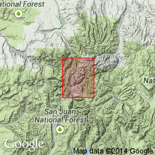
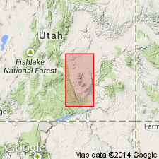
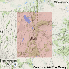
- San Juan Mountains province
Summary:
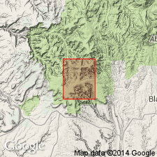
Cutler formation. Beds here named Cutler formation compose greater part of "Red Beds" of region. They were hitherto provisionally included in Dolores formation. Field work of 1904 in Ouray quadrangle revealed notable angular unconformity immediately below the most commonly fossiliferous beds of Dolores formation. Through this unconformity the Dolores [restricted] can be seen to transgress more than 1,000 feet of old "Red Beds" and several hundred feet of Rico and Hermosa. In view of these facts the name Dolores is here restricted to the Triassic strata, embracing the fossiliferous conglomerate and overlying beds up to La Plata sandstone, of Jurassic age, and the non-fossiliferous strata between Rico formation below and base of Triassic are named Cutler formation, for exposures on Cutler Creek, which enters Uncompahgre River about 4 miles north of Ouray, [Ouray County], Colorado. The Cutler is a complex of bright-red sandstones and lighter-red or pinkish grits and conglomerates alternating with sandy shales and earthy or sandy limestones of varying shades of red. It rests conformably on Rico formation and is unconformably overlain by Telluride conglomerate (Tertiary), the Triassic Dolores formation restricted being absent in this (Silverton) quadrangle. Thickness of Cutler 1,000+ feet. Age is Permian(?). Report includes geologic map, columnar section.
Source: US geologic names lexicon (USGS Bull. 896, p. 560-561); supplemental information from GNU records (USGS DDS-6; Denver GNULEX).
- Usage in publication:
-
- Cutler formation*
- Modifications:
-
- Revised
- AAPG geologic province:
-
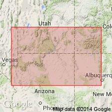
- Paradox basin
- Black Mesa basin
Summary:
Pg. 1423, 1425, 1436, 1444, 1445, 1446. Cutler formation. Includes (ascending) Halgaito tongue, Cedar Mesa sandstone tongue (new), Organ Rock tongue (new), White Rim sandstone member (new), De Chelly sandstone member, and Hoskinnini tongue (new). Age is Permian.
Source: US geologic names lexicon (USGS Bull. 1200, p. 1018-1019).

- Usage in publication:
-
- Cutler formation*
- Modifications:
-
- Overview
Summary:
The present [ca. 1938] definition of Cutler formation in its type region (southwestern Colorado) conforms to above original definition [Cross and Howe, 1905], namely, it rests conformably on Rico formation and is unconformably overlain by Dolores formation. (Upper Triassic and Jurassic?), where that formation is present. In southeastern Utah, northeastern Arizona, and northwestern New Mexico the Cutler is overlain by Moenkopi formation (Lower Triassic) and underlain by Rico formation. (See A.A. Baker and J.B. Reeside, Jr., AAPG Bull., v. 13, no. 11, 1929, p. 1413-1448.) In a part of southeastern Utah (Salt Valley anticline and northwest flank of Uncompahgre Plateau, Grand County) where the limestones of Rico formation are absent, the red beds corresponding to Rico formation of southwestern Colorado are now included in Cutler formation. (See USGS Bull. 863, 1935, by C.H. Dane.)
Source: US geologic names lexicon (USGS Bull. 896, p. 560-561).
- Usage in publication:
-
- Cutler formation*
- Modifications:
-
- Areal extent
- Mapped
- AAPG geologic province:
-
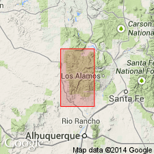
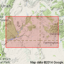
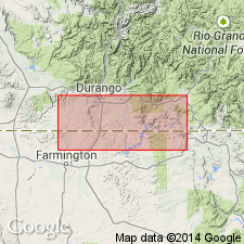
- San Juan basin
Summary:
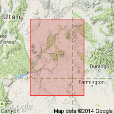
Cutler formation. Extended into Sandoval and Rio Arriba Counties, New Mexico. Considered = Permian(?) Abo formation and lower part of Permian Yeso formation. On west side of San Pedro Mountain, rests on Precambrian rocks; on east side, rests on Madera limestone with gradational contact. Fossiliferous. Age is Permian. Report includes geologic map, cross sections, fossil list.
Source: Modified from GNU records (USGS DDS-6; Denver GNULEX).
- Usage in publication:
-
- Cutler formation*
- Modifications:
-
- Age modified
- Biostratigraphic dating
- AAPG geologic province:
-
- San Juan Mountains province
Summary:
Pg. 1330. Cutler formation. On basis of fossil evidence, at least part of redbeds of Cutler at type locality are believed to be of Pennsylvanian age.
Source: US geologic names lexicon (USGS Bull. 1200, p. 1018-1019).
- Usage in publication:
-
- Cutler formation*
- Modifications:
-
- Revised
- AAPG geologic province:
-
- Paradox basin
- Black Mesa basin
Summary:
Pg. 39-45, pls. 1, 15. Cutler formation. Formation includes all Permian rocks exposed in canyons east of Henry Mountains. Divided into three members (ascending): Cedar Mesa sandstone, Organ Rock tongue, and White River sandstone. In Monument Valley, southeastern Utah and northeastern Arizona, comprises (ascending) Halgaito tongue, Cedar Mesa sandstone member, Organ Rock tongue, De Chelly sandstone member, and Hoskinnini tongue.
Source: US geologic names lexicon (USGS Bull. 1200, p. 1018-1019).
- Usage in publication:
-
- Cutler formation
- Modifications:
-
- Revised
- AAPG geologic province:
-
- Paradox basin
- Black Mesa basin
Summary:
Pg. 2174. Cutler formation. Includes Rico basal member. Overlies Hermosa formation. [See Hermosa formation for explanation of "R" datum.]
Source: US geologic names lexicon (USGS Bull. 1200, p. 1018-1019).
- Usage in publication:
-
- Cutler formation
- Modifications:
-
- Revised
- AAPG geologic province:
-
- Paradox basin
- Black Mesa basin
Summary:
Pg. 81. Cutler formation. Rico should not be considered basal unit of Cutler.
Source: US geologic names lexicon (USGS Bull. 1200, p. 1018-1019).
- Usage in publication:
-
- Cutler group
- Modifications:
-
- Revised
- AAPG geologic province:
-
- Paradox basin
- Black Mesa basin
Summary:
Pg. 2054, 2055 (fig. 3). Cutler group. Rank raised to group. Recognized in Four Corners region in southwest Colorado, southeast Utah, and northeast Arizona. Includes (ascending) Rico transition facies, Halgaito formation, and Cedar Mesa formation. Overlies Hermosa group. Age is Late Pennsylvanian (Missourian and Virgilian) and Early Permian (Wolfcampian). Report includes cross sections, columnar sections, isopach maps, correlation chart.
Source: US geologic names lexicon (USGS Bull. 1200, p. 1018-1019); supplemental information from GNU records (USGS DDS-6; Denver GNULEX).
- Usage in publication:
-
- Cutler formation
- Modifications:
-
- Mapped
- AAPG geologic province:
-
- Paradox basin
Summary:
Cutler formation. Mapped in Elk Ridge 3 NE quadrangle, San Juan County, Utah. Includes Cedar Mesa sandstone member, Organ Rock tongue, and Hoskinnini tongue. Overlies Rico formation; underlies Moenkopi formation. [Age is Permian.]
Source: US geologic names lexicon (USGS Bull. 1200, p. 1018-1019).
- Usage in publication:
-
- Cutler formation*
- Modifications:
-
- Areal extent
- AAPG geologic province:
-
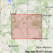
- Piceance basin
- Uinta basin
Summary:
In salt anticline region [Mesa County, Colorado, and Grand County, Utah], underlies Tenderfoot member (new) of Moenkopi formation. [Age is Permian.]
Source: Modified from GNU records (USGS DDS-6; Denver GNULEX).
- Usage in publication:
-
- Cutler formation*
- Modifications:
-
- Revised
- AAPG geologic province:
-
- Black Mesa basin
- Paradox basin
Summary:
Pg. 1854-1856, 1857 (fig. 3). Cutler formation. In most of southeastern Utah and southwestern Colorado, Cutler formation of Permian age overlies Rico formation of Pennsylvanian and Permian(?) age and underlies Moenkopi formation of Triassic(?) and Early and Middle(?) Triassic age. In salt anticline region, the Cutler is absent over crests of some anticlines and pinches out northeast along southwestern edge of Uncompahgre Plateau. In southwestern Utah, consists of reddish-brown horizontally bedded siltstone and sandstone redbed tongues with light-colored very fine- to fine-grained cross-stratified sandstone members. In Monument Valley, members, as recognized in this report, are (ascending) Halgaito tongue, about 400 feet thick; Cedar Mesa sandstone member, about 800 feet; Organ Rock tongue, about 500 feet; and De Chelly sandstone member, about 300 feet. Formation is stratigraphically restricted above to exclude Hoskinnini member which is reallocated to Moenkopi formation. Thickness about 2,000 feet in southern part of southeastern Utah; thins irregularly northward to about 700 feet in some parts of east-central Utah; zero to several thousand feet in salt anticline region; maximum thickness not known.
Source: US geologic names lexicon (USGS Bull. 1200, p. 1018-1019).
- Usage in publication:
-
- Cutler Formation
- Cutler Group
- Modifications:
-
- Overview
Summary:
Cannot be differentiated near the Uncompahgre uplift; formation rank used in that area. Variable in lithology and thickness. The undifferentiated Cutler has fine to coarse, poorly sorted, arkosic and conglomeratic sandstone, red to brown siltstone and shale, and thin, gray to red, sublithographic nonfossiliferous limestone. Ranges from 1,500 to 8,000 ft thick. Measured section. Nomenclature chart. Undifferentiated Cutler may be as old as Late Pennsylvanian to as young as middle Leonardian. Westward Cutler Group divided into a lower part that includes Halgaito Shale, Cedar Mesa Sandstone, and an upper part that includes Organ Rock Shale and De Chelly Sandstone. The newly named Elephant Canyon Formation is equivalent to the lower Cutler. The Hermit Shale and White Rim Sandstone are equivalents of the upper Cutler. Isopach maps of both parts of Cutler. Resume of each formation given. Recognized through a large part of the Paradox basin. Cutler Group is Wolfcampian to early Leonardian.
Source: GNU records (USGS DDS-6; Denver GNULEX).
- Usage in publication:
-
- Cutler Formation
- Modifications:
-
- Revised
- AAPG geologic province:
-
- Paradox basin
Summary:
Type section of Elephant Canyon Formation near confluence of Green and Colorado Rivers, San Juan Co, UT in the Paradox basin, restudied. Basal Elephant Canyon contact previously considered to be an angular unconformity that separated it from the underlying Honaker Trail Formation [,upper formation of Hermosa Group]. Authors of this report traced individual beds in both formations and collected fossils (fusulinids) from both. They conclude: 1) there is no major break--no angular unconformity--within the sequence; 2) scour-surfaces are present in both formations; 3) the lower 450 ft of the original Elephant Canyon is Virgilian, not Wolfcampian, and thus no great time gap present between the Honaker Trail Formation of Missourian age and Wolfcampian rocks of the original upper Elephant Canyon. Fossils listed. Columnar sections. Name Elephant Canyon abandoned. Upper contact for upper member of Honaker Trail raised to top of a limestone 25+ ft thick about 560 ft above former top of Honaker Trail. Upper 590+ ft of former Elephant Canyon is reassigned as the informal "lower Cutler beds," rather than Rico Formation, because of distance between type Elephant Canyon and Rico. Cedar Mesa Sandstone overlies the "lower Cutler beds."
Source: GNU records (USGS DDS-6; Denver GNULEX).
- Usage in publication:
-
- Cutler Group*
- Cutler Formation*
- Modifications:
-
- Mapped 100k
- Areal extent
- AAPG geologic province:
-
- Black Mesa basin
- Paradox basin
- San Juan basin
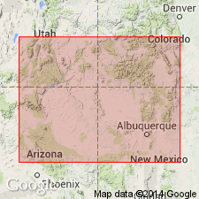
Summary:
Pg. A5 (fig. 3), A30, A32-A33, A34-A37 (figs. 17-20), pl. 1 (geol. map). Cutler Group; Cutler Formation (where group cannot be subdivided into distinct formations, pl. 1). Recognized in subsurface and surface of the Four Corners region of southwestern Colorado, northwestern New Mexico, northeastern Arizona, and southeastern Utah. Conformably overlies Rico Formation (Upper? Pennsylvanian to Lower Permian; Virgilian? to Wolfcampian). Unconformably underlies Triassic Dolores Formation; in places, the Cutler is truncated by a pre-Triassic unconformity. Partly correlative with Abo Formation. Age is Early Permian (Wolfcampian to Leonardian).
Cutler Group (text; figs. 17-20, isopach maps). Thickness on Reservation from 1,200 to 1,750 feet. Consists of (descending): (1) De Chelly Sandstone, tan, reddish-brown, and orangish-red, very fine- to medium-grained sandstone, 0 to 400+ feet; (2) Organ Rock Formation, interbedded reddish-brown to red siltstone, silty sandstone, and sandstone, 0 to 800+ feet; (3) Cedar Mesa Sandstone, 0 to 500 feet; and (4) Halgaito Formation, reddish-brown to dark-brown silty sandstone and siltstone, and minor gray limestone, 0 to 900+ feet.
Cutler Formation (pl. 1). Described as gray, red and brown sandstone, arkosic sandstone, and arkosic conglomerate and red to purple shale and siltstone. Thickness 0 to 850 feet.
Source: Publication.
For more information, please contact Nancy Stamm, Geologic Names Committee Secretary.
Asterisk (*) indicates published by U.S. Geological Survey authors.
"No current usage" (†) implies that a name has been abandoned or has fallen into disuse. Former usage and, if known, replacement name given in parentheses ( ).
Slash (/) indicates name conflicts with nomenclatural guidelines (CSN, 1933; ACSN, 1961, 1970; NACSN, 1983, 2005, 2021). May be explained within brackets ([ ]).