The National Geologic Map Database is migrating to a new infrastructure. We apologize for any service disruptions during this process.
|
|---|


- Usage in publication:
-
- Crestone conglomerate phase
- Modifications:
-
- Original reference
- Dominant lithology:
-
- Conglomerate
- AAPG geologic province:
-
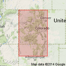
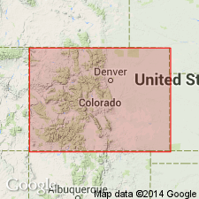
- San Luis basin
Summary:
Pg. 812. Crestone conglomerate phase. The largest boulders in Upper Sangre de Cristo conglomerate have diameter of 8+/- feet, but this extreme coarseness, even though it is very prominent feature near Crestone [Sangre de Cristo Range, southern central Colorado], is only of local development, and in both directions along the range the upper series becomes thinner and finer in grain. For this reason the coarse conglomeratic series has been named by the writer the Crestone conglomerate phase of the Upper Sangre de Cristo conglomerate. Near Crestone the coarse phase overlaps the Lower conglomerate and rests on pre-Cambrian granite. Though an angular unconformity was not seen between the two divisions of Sangre de Cristo conglomerate, it is believed that further search in this area may reveal such a break. Age is Permian.
Source: US geologic names lexicon (USGS Bull. 896, p. 542).
- Usage in publication:
-
- Crestone conglomerate member
- Modifications:
-
- Revised
- Dominant lithology:
-
- Conglomerate
- AAPG geologic province:
-
- Las Vegas-Raton basin
Summary:
Pg. 63. Crestone conglomerate member of Maroon formation. Proposed that name Sangre de Cristo be dropped and that prior name Maroon be applied to equivalent coarse redbeds, at least as far south as La Veta Pass [southern central Colorado]. Conglomeratic unit in upper part of formation is about 6,000 feet thick in vicinity of Crestone, where it has been called Crestone conglomerate "phase," more appropriately member, of Sangre de Cristo formation (now Maroon formation). Very local in occurrence, disappearing both southward and northward within a distance of about 10 miles. [Age is Pennsylvanian or Permian.]
Source: US geologic names lexicon (USGS Bull. 1200, p. 982).
- Usage in publication:
-
- Crestone conglomerate member
- Modifications:
-
- Revised
- AAPG geologic province:
-
- San Luis basin
Summary:
Pg. 1903 (fig. 5), 1923, 1924-1925, 1933 [see also D.W. Bolyard, 1956, Univ. Colorado unpub. MS thesis; D.W. Bolyard, 1956a, Permo-Pennsylvanian section at La Veta Pass, CO, Rocky Mtn. Geol. Raton Basin Gdbk.].
Crestone conglomerate member of Sangre de Cristo formation. Referred to as member of Sangre de Cristo. Overlies lower unnamed member. Best developed at Crestone Needle and Crestone Peak, Saguache County, central southern Colorado (type area). Consists of massive, boulder-and-cobble conglomerate with some thin interbeds of arkosic sandstone. Thickness 6,000 feet. Age is considered Late Pennsylvanian(?) and probably Permian (Wolfcamp).
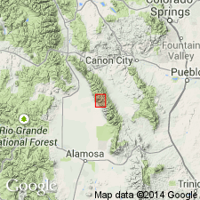
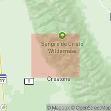
[Crestone Peak in sec. 18, T. 24 S., R. 73 W., Lat. 37 deg. 58 min. 01 sec. N., Long. 105 deg. 35 min. 07 sec. W., Crestone Peak 7.5-min quadrangle, Saguache Co., Rio Grande National Forest / Sangre de Cristo Wilderness Area. Crestone Needle is less than 1 mi to the east-southeast, in sec. 17, along Saguache-Custer Co. line (USGS historical topographic map collection TopoView and USGS GNIS database, accessed Mother's Day, 2018).]
Source: US geologic names lexicon (USGS Bull. 1200, p. 982); GNU records (USGS DDS-6; Denver GNULEX).
- Usage in publication:
-
- Crestone Conglomerate Member*
- Modifications:
-
- Principal reference
- Dominant lithology:
-
- Conglomerate
- Sandstone
- AAPG geologic province:
-
- San Luis basin
Summary:
Crestone Conglomerate Member of Sangre de Cristo Formation. Adopted by the USGS. Consists of coarse conglomerate, conglomeratic sandstone, sandstone, and minor siltstone and shale. Conglomerate beds, usually up to 55 m thick, are unsorted, chaotically packed, have angular to subround clasts up to boulder size. Clasts are mostly red syenite, pink to red porphyritic felsite, granite and gneiss, gray quartzite. Total thickness 1,132 [m] at principal reference section; top is eroded. Is upper member of Sangre de Cristo Formation; overlies unnamed lower member. Interpreted as a debris-flow and braided stream deposit. Age is considered Middle Pennsylvanian(?) to Early Permian(?); Desmoinesian(?) to Wolfcampian(?).
Principal reference section (=principal reference section of Sangre de Cristo Formation): northeast of Crestone in Groundhog Basin, [in NW/4 sec. 15, T. 44 N., R. 12 E., Lat. 38 deg. 03 min. 55 sec. N., Long. 105 deg. 39 min. 07 sec. W., Rito Alto Peak 7.5-min quadrangle], Saguache Co., southern central CO. See also Lindsey and others, 1985, USGS Misc. Field Stud. Map MF-1787.
[Additional locality information from USGS historical topographic map collection TopoView and USGS GNIS database, accessed Mother's Day 2018.]
Source: Modified from GNU records (USGS DDS-6; Denver GNULEX).
- Usage in publication:
-
- Crestone Conglomerate Member*
- Modifications:
-
- Mapped 1:24k
- Dominant lithology:
-
- Conglomerate
- Sandstone
- AAPG geologic province:
-
- Las Vegas-Raton basin
Summary:
Crestone Conglomerate Member of Sangre de Cristo Formation. Red conglomerate, conglomeratic sandstone, sandstone, and minor siltstone and shale. Subdivided into two lithofacies by presence of abundant clasts: (1) syenite clast facies, red syenite; and (2) quartz-monzonite clast facies, derived from rocks correlated with Early Proterozoic Boulder Creek Granodiorite. Coarse conglomerate composed of boulders, cobbles, and pebbles of igneous and metamorphic rocks in matrix of feldspathic sand and clay-size material deposited by debris flows, mudflows, and streams on alluvial fans. Sandstone, laminated and cross-bedded. Thickness about 1,100 m at principal reference section in Groundhog Basin; thickens up to 2,000 m on west side of Gibson Peak syncline. Conformably overlies, and to southeast interfingers with, unnamed lower member of Sangre de Cristo. Age is considered Pennsylvanian and Permian.
Source: Publication.
For more information, please contact Nancy Stamm, Geologic Names Committee Secretary.
Asterisk (*) indicates published by U.S. Geological Survey authors.
"No current usage" (†) implies that a name has been abandoned or has fallen into disuse. Former usage and, if known, replacement name given in parentheses ( ).
Slash (/) indicates name conflicts with nomenclatural guidelines (CSN, 1933; ACSN, 1961, 1970; NACSN, 1983, 2005, 2021). May be explained within brackets ([ ]).