

- Usage in publication:
-
- Cow Springs sandstone*
- Modifications:
-
- Named
- Dominant lithology:
-
- Sandstone
- AAPG geologic province:
-
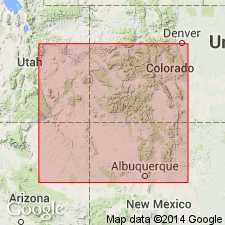
- Black Mesa basin
Summary:
Named for development near Cow Springs, Navajo Co, AZ, Black Mesa basin. Type locality is a cliff on north face of Black Mesa, 4 mi east of Cow Springs. Type section is 1 1/4 mi west of long 110 deg, 45 min and 6 mi south of lat 36 deg, 30 min where 342 ft were measured and where new formation overlies Entrada sandstone and unconformably underlies Dakota sandstone. Consists of greenish-gray to light yellowish-gray, fine-grained, well-sorted, cross-stratified, firmly cemented sandstone. Has subround quartz, magnetite, garnet, tourmaline, and staurolite grains. Thought to grade north into strata assigned to Summerville formation, Bluff sandstone, and Recapture shale members of Morrison formation. Thins south to 112 ft at Coal Canyon and to 240 ft toward Lupton, AZ in the Black Mesa basin. Is 420 ft thick near Steamboat, AZ. Thought to be an eolian deposit intercalated with shallow water deposits. Assigned a Jurassic age.
Source: GNU records (USGS DDS-6; Denver GNULEX).
- Usage in publication:
-
- Cow Springs sandstone*
- Modifications:
-
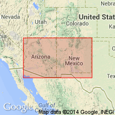
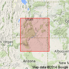
- Areal extent
- AAPG geologic province:
-
- Black Mesa basin
- Paradox basin
- Plateau sedimentary province
- San Juan basin
Summary:
Pg. 3 (fig. 2), 48-51, pls. 1, 3. Cow Springs sandstone. Because of its intertonguing relationships with Summerville formation and lower members of Morrison formation, Cow Springs cannot be considered either a formation in San Rafael group or a member of Morrison formation. Bluff sandstone is believed to be a tongue of Cow Springs, but, because of its homogeneous and mappable character and its areal extent, it is considered a separate formation and assigned to San Rafael group. Age is Late Jurassic.
Source: US geologic names lexicon (USGS Bull. 1200, p. 966-967).
- Usage in publication:
-
- Cow Springs Sandstone
- Modifications:
-
- Areal extent
- Overview
- AAPG geologic province:
-
- Plateau sedimentary province
Summary:
Thought to be equivalent to greenish-sandstone facies of Escalante Member of Entrada Sandstone, and to intertongue with Summerville Formation and with lower members of Morrison. Therefore, cannot be either a formation of the San Rafael Group or a member of Morrison Formation. Author considers use in UT to be a mistake; Name should not be used north of Rainbow Plateau, AZ, Plateau sedimentary province.
Source: GNU records (USGS DDS-6; Denver GNULEX).
- Usage in publication:
-
- Cow Springs Sandstone*
- Modifications:
-
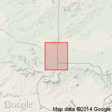
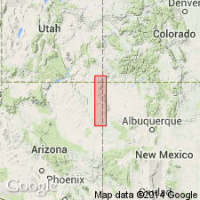
- Areal extent
- AAPG geologic province:
-
- Basin-and-Range province
Summary:
Name Zuni Sandstone used in preference to Cow Springs Sandstone in this part of the Basin-and-Range province.
Source: GNU records (USGS DDS-6; Denver GNULEX).
- Usage in publication:
-
- Cow Springs Sandstone*
- Modifications:
-
- Revised
- AAPG geologic province:
-
- San Juan basin
Summary:
Intertongues with Horse Mesa and Beclabito Members (both new) of Wanakah Formation in the Todilto Park area and to the south in McKinley Co, NM in San Juan basin. Is the same unit as Cow Springs Member of Entrada. Of Middle Jurassic age.
Source: GNU records (USGS DDS-6; Denver GNULEX).
- Usage in publication:
-
- Cow Springs Member*
- Modifications:
-
- Revised
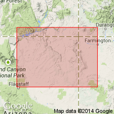
- Areal extent
- Overview
- AAPG geologic province:
-
- Plateau sedimentary province
- Black Mesa basin
- San Juan basin
Summary:
Assigned as upper member of Entrada Sandstone in Black Mesa basin of AZ. Composed of porous permeable, light-colored, cross-bedded sandstone that has been bleached. Bleached rocks occur beneath Tidwell Member (new) of Morrison Formation and beneath Dakota Formation or the J-3 unconformity. The color derived from bleaching cuts across bedding and is clearly post depositional. Contact with underlying lower sandy member of Entrada difficult to select because of bleaching. Is determined to be related to Entrada, to be a good stratigraphic marker, and is thus reduced in stratigraphic rank to upper member of Entrada, and made part of San Rafael Group. Does not interfinger with Morrison or Summerville as formerly thought. Is roughly equivalent, but may be slightly older than upper member of Entrada to east, but both members may have been part of a single sandstone body, later separated by upwarping and erosion. Not used north and northwest of White Mesa and Square Butte, Coconino Co, AZ, Plateau sedimentary province. Retains formation status on southwest side San Juan basin. Extends into Black Mesa basin. Cross-bedding dip vectors show Cow Springs dips to southeast, south, southwest and west, whereas sandstones of Morrison dip to northeast or east-northeast, and those of Romana Sandstone (new) dip N 87 deg E. Grades into Wanakah Formation in northeast AZ, southeast UT, and on west side San Juan basin.
Source: GNU records (USGS DDS-6; Denver GNULEX).
- Usage in publication:
-
- Cow Springs Sandstone*
- Modifications:
-
- Areal extent
- AAPG geologic province:
-
- San Juan basin
Summary:
In the Todilto Park area, Beclabito Member of Wanakah Formation and Cow Springs Sandstone intertongue. Chuska Mountains are used as an arbitrary dividing line between use of Beclabito to north in San Juan Co, NM, San Juan basin, Apache Co, AZ, Black Mesa basin, and San Juan Co, UT (as far north as Bluff), Paradox basin, and use of Cow Springs to south in McKinley Co, NM, San Juan basin.
Source: GNU records (USGS DDS-6; Denver GNULEX).
For more information, please contact Nancy Stamm, Geologic Names Committee Secretary.
Asterisk (*) indicates published by U.S. Geological Survey authors.
"No current usage" (†) implies that a name has been abandoned or has fallen into disuse. Former usage and, if known, replacement name given in parentheses ( ).
Slash (/) indicates name conflicts with nomenclatural guidelines (CSN, 1933; ACSN, 1961, 1970; NACSN, 1983, 2005, 2021). May be explained within brackets ([ ]).