The National Geologic Map Database is migrating to a new infrastructure. We apologize for any service disruptions during this process.
|
|---|


- Usage in publication:
-
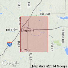
- Council Grove stage
- Modifications:
-
- Original reference
- Dominant lithology:
-
- Limestone
- Shale
- AAPG geologic province:
-
- Nemaha anticline
Summary:
Pg. 709. Council Grove stage. It is perhaps a more satisfactory classification to regard the base of the Permian as marked by the lower limit of Wreford limestone, and writer is inclined to accept this as the division line, as indicated by Dr. Frech. If this be done the writer would class the two formations succeeding Eskridge shales (Cottonwood limestone and Garrison) together to form a stage, for which he would propose the name Council Grove. The upper part of the stage is well shown in bluffs of Neosho River and its tributaries in vicinity of this city [Council Grove], while Cottonwood limestone and overlying Florena shales may be found in Neosho Valley about 6 miles below Council Grove. Underlies Chase stage and overlies Wabaunsee stage. Age is late Paleozoic [Pennsylvanian].
[Named from the town of Council Grove, Morris Co., eastern KS.]
[GNC remark (ca. 1925, US geologic names lexicon, USGS Bull. 896, p. 531): Above definition of Council Grove group was followed until 1922, when J.W. Beede (GSA Bull., v. 33, no. 4) extended base of the Council Grove down to base of Neva limestone. This change was not adopted by other geologists, however.]
Source: US geologic names lexicon (USGS Bull. 896, p. 531-532); GNC KS-NE Permian Corr. Chart, Oct. 1936.

- Usage in publication:
-
- Council Grove group
- Modifications:
-
- Revised
Summary:
Expanded Council Grove group by including in it Eskridge shale, Neva limestone, Elmdale shale, and Americus limestone, and Moore and G.E. Condra in their Oct. 1932 revised classification chart of Pennsylvanian rocks of Kansas and Nebraska followed this definition, as did G.E. Condra, 1935 (Nebraska Geol. Survey Paper, no. 8) and R.C. Moore, 1936 (Kansas Geol. Survey Bull., no. 22). Age is Permian. The USGS has not yet had occasion to consider, for its publication, this modified definition.
Source: US geologic names lexicon (USGS Bull. 896, p. 531-532); GNC KS-NE Pennsylvanian Corr. Chart, sheet 2, Oct. 1936; GNC KS-NE Permian Corr. Chart, Oct. 1936.

- Usage in publication:
-
- Council Grove group
- Modifications:
-
- Areal extent
- AAPG geologic province:
-
- Anadarko basin
Summary:
Extended as an undivided unit into the subsurface of Baca County, Colorado, in the Anadarko basin. Overlies Admire shale and underlies Chase group (undivided). Report includes correlation chart.
Source: Modified from GNU records (USGS DDS-6; Denver GNULEX).

- Usage in publication:
-
- Council Grove group
- Modifications:
-
- Overview
Summary:
Pg. 45-49. Council Grove group. As defined in Kansas, includes (ascending) Foraker limestone, Johnson shale, Red Eagle limestone, Roca shale, Grenola limestone, Eskridge shale, Beattie limestone, Stearns shale, Bader limestone, Easly Creek shale, Crouse limestone, Blue Rapids shale, Funston limestone, and Speiser shale. Thickness 310 to 330 feet. Overlies Admire group; underlies Chase group. Age is Permian.
Source: US geologic names lexicon (USGS Bull. 1200, p. 957-958).
- Usage in publication:
-
- Council Grove group
- Modifications:
-
- Mapped 1:500k
Summary:
Council Grove group. As mapped, includes only Cottonwood limestone, Neva limestone, and Red Eagle limestone. Age is Permian.
Source: US geologic names lexicon (USGS Bull. 1200, p. 957-958).
- Usage in publication:
-
- Council Grove group*
- Modifications:
-
- Areal extent
- AAPG geologic province:
-
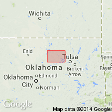
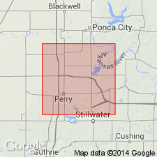
- Chautauqua platform
Summary:
Pg. 73 (table 3), 77-105. Council Grove group. As presently applied, group includes beds from base of Americus limestone upward to base of Wreford limestone. Lies with apparent conformity between underlying Admire group and overlying Chase group. Thickness increases from 321 feet in Kansas to about 480 feet in Pawnee County, Oklahoma. In southwest part of T. 22 N., R. 4 E., Wreford limestone, base of which defines upper limit of group, loses its identity; farther south, therefore Council Grove and overlying Chase groups cannot be differentiated. They grade laterally into Konawa-Asher sequence of central Oklahoma. Group subdivided into limestone and shale-sandstone units of equal rank. Where applicable, names from Kansas classification has been discarded. In Pawnee County, includes (ascending) Foraker limestone with Americus limestone, Hughes Creek shale, and Long Creek limestone members, Johnson shale, Red Eagle limestone, Roca shale, Neva limestone, Eskridge shale, Cottonwood limestone, and Garrison shale. Age is Early Permian (Wolfcampian).
Source: US geologic names lexicon (USGS Bull. 1200, p. 957-958).
- Usage in publication:
-
- Council Grove Group
- Modifications:
-
- Not used
- AAPG geologic province:
-
- Chautauqua platform
Summary:
Oscar Group is preferred name of the Oklahoma Geol. Survey rather than Kansas name Council Grove. [See entry under Oscar.]
Source: Publication.
For more information, please contact Nancy Stamm, Geologic Names Committee Secretary.
Asterisk (*) indicates published by U.S. Geological Survey authors.
"No current usage" (†) implies that a name has been abandoned or has fallen into disuse. Former usage and, if known, replacement name given in parentheses ( ).
Slash (/) indicates name conflicts with nomenclatural guidelines (CSN, 1933; ACSN, 1961, 1970; NACSN, 1983, 2005, 2021). May be explained within brackets ([ ]).