- Usage in publication:
-
- Copper Queen limestone
- Modifications:
-
- Named
- Biostratigraphic dating
- Dominant lithology:
-
- Limestone
- AAPG geologic province:
-
- Pedregosa basin
Summary:
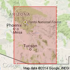
Named for Copper Queen mining area of Bisbee, Cochise Co, AZ in the Pedregosa basin. Section measured on Mount Martin [presumably intended as the type section]. Made up mostly of limestone with an 8 ft thick quartzite at top. About 82 ft thick. Practically unknown in Arizona outside Bisbee. Separated from Abrigo limestone of Ransome (1904). Overlies Abrigo formation (restricted). Overlain by Martin limestone (Devonian). Is of Late Cambrian age.
Source: GNU records (USGS DDS-6; Denver GNULEX).

- Usage in publication:
-
- Copper Queen Limestone Member*
- Modifications:
-
- Revised
- Overview
- AAPG geologic province:
-
- Pedregosa basin
Summary:
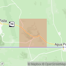
Copper Queen Limestone of Stoyanow (1936) revised to uppermost member of Abrigo Limestone in Mule Mountains, AZ in the Pedregosa basin, and upper contact lowered about 70 ft below that of Ransome (1904) for top of Abrigo to exclude beds of probable Devonian age. 94 ft thick in type section of Abrigo. Consists of thin-bedded laminated medium-gray to pinkish-gray limestone: basal 25 ft is medium- to coarse-crystalline with laminae of brown-weathering medium-gray siliceous limestone; next 15 ft forms prominent ledge of partially recrystallized detrital-micritic limestone with sandy laminae; next 30 ft forms upper part of a ledge and consists of stylolitic laminated detrital-micritic limestone whose detrital fragments are sparry calcite and micrite; and top 24 ft, poorly exposed, contains laminae of argillaceous limestone and a few thin chert beds. Overlies sandy member of Abrigo Limestone. Overlain disconformably by Martin Limestone (Upper Devonian). Represents slow deposition in quiet water of moderate depth. Fossil brachiopods and trilobites indicate Franconian (Late Cambrian) age. Is probably equivalent to lower part of Bliss Sandstone in southwestern NM.
Source: GNU records (USGS DDS-6; Denver GNULEX).

- Usage in publication:
-
- Copper Queen Member*
- Modifications:
-
- Revised
- Areal extent
- Redescribed
- AAPG geologic province:
-
- Pedregosa basin
Summary:
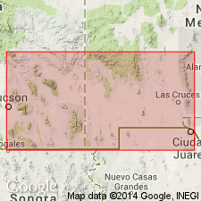
Name applied as the uppermost member of the Abrigo Formation to rocks assigned by Krieger (1968) to the upper part of the upper member of the Abrigo. Extended regionally in southern AZ in Pedregosa basin and Basin-and-Range province. Redescribed--name changed from Copper Queen Limestone Member to Copper Queen Member. Is mostly thin-bedded limestone interbedded with sandy limestone in the Mule Mountains. Is dominantly thin-bedded dolomite with sand layers in most other ranges. Missing in most western areas. Disconformably overlain by Upper Devonian rocks in some areas. Conformably overlain by Ordovician strata in Pedregosa and Swisshelm Mountains. Fossils [none described] indicate a Late Cambrian (Franconia and Trempealeau?) age.
Source: GNU records (USGS DDS-6; Denver GNULEX).

- Usage in publication:
-
- Copper Queen Member*
- Modifications:
-
- Areal extent
- Overview
- AAPG geologic province:
-
- Pedregosa basin
- Basin-and-Range province
Summary:
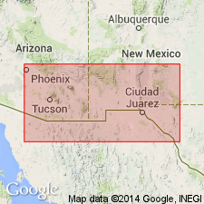
Extended as the upper member of the Abrigo Formation to Santa Catalina and Galiuro Mountains, AZ. Summary description over area of occurrence including fossil (trilobites, brachiopods) data. Is of Late Cambrian (Franconian and Trempealeauan?) age. Measured section at Brandenburg Mountain, N1/2 SW1/4 sec 7, T6S, R16E described. At that locality member is 25 ft thick; it overlies upper sandy member of Abrigo; it underlies Martin Formation.
Source: GNU records (USGS DDS-6; Denver GNULEX).
For more information, please contact Nancy Stamm, Geologic Names Committee Secretary.
Asterisk (*) indicates published by U.S. Geological Survey authors.
"No current usage" (†) implies that a name has been abandoned or has fallen into disuse. Former usage and, if known, replacement name given in parentheses ( ).
Slash (/) indicates name conflicts with nomenclatural guidelines (CSN, 1933; ACSN, 1961, 1970; NACSN, 1983, 2005, 2021). May be explained within brackets ([ ]).

