

- Usage in publication:
-
- Conejos formation
- Modifications:
-
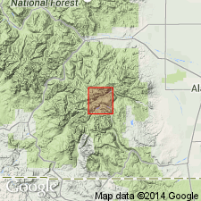
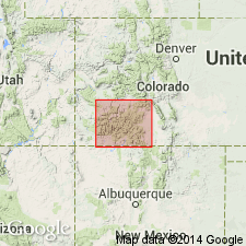
- Areal extent
- AAPG geologic province:
-
- San Juan basin
- San Juan Mountains province
- San Luis basin
Summary:
(E.S. Larsen's 1917 provisional and field names for Summitville quadrangle), p. 20, 38-39. Conejos formation of Potosi volcanic series. Dark-colored andesite of compact tecture and similar in appearance to Summitville andesite. Presumably an augite andesite. Basal formation of Potosi volcanic series in Platoro-Summitville quadrangle, southwestern Colorado. Underlies Treasure Mountain latite. In field we called this formation Palisade andesite. [Palisade is preoccupied.] [Age is Miocene.]
Source: US geologic names lexicon (USGS Bull. 896, p. 502-503).
- Usage in publication:
-
- Conejos andesite*
- Modifications:
-
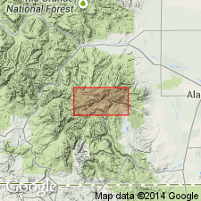
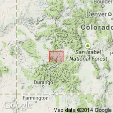
- Areal extent
- Dominant lithology:
-
- Andesite
- AAPG geologic province:
-
- Piceance basin
- San Juan Mountains province
- San Luis basin
Summary:
[Credited to Larsen.] Conejos andesite of Potosi volcanic series. In nearly all large exposures of this formation tuff breccia is in greater amount than massive rock. In central and thickest part of the Conejos volcanic pile, in Summitville, Conejos and Del Norte quadrangles, [southwestern Colorado], massive rock makes up considerable part of formation, but near borders, to west, in San Cristobal quadrangle, and to north, in northern part of Del Norte quadrangle and southern part of Cochetopa and Saguache quadrangles, massive rock is very subordinate and tuff breccia, much of it rather well bedded, makes up most of formation. To south, in Tusas quadrangle, New Mexico, beginning not far south of State line, the formation is made up mostly of several hundred feet of sands and gravels, composed chiefly of pre-Cambrian rocks. In southern slopes of the mountains a variable thickness of soft bedded sands and gravels made up of volcanic material underlies the normal Conejos andesite. It has been included in the Conejos although it may be older. It is commonly very poorly exposed. Is well developed in drainage of Chama River in southeastern part of Summitville quadrangle and north and east of Quien Sabe Mountain, in northwestern part of Summitville quadrangle and adjoining part of Pagosa Springs quadrangle, where it overlies Blanco Basin formation. The greater part of the rocks of Conejos formation are andesitic. [Age is Miocene.]
Source: US geologic names lexicon (USGS Bull. 896, p. 502-503).
- Usage in publication:
-
- Conejos formation*
- Modifications:
-
- Redescribed
- Dominant lithology:
-
- Rhyodacite
- AAPG geologic province:
-
- San Luis basin
Summary:
Formerly designated Conejos quartz latite. Redescribed as Conejos formation because of its heterogeneous character. Consists of a pile of dark flows about 2,800 ft thick on Alamosa Creek. Base not exposed near Summitville, Rio Grande and Conejos Cos, CO, San Luis basin, where pile is probably more than 3,000 ft thick. The flows near Summitville are cut by dioritic and quartz monzonitic intrusive bodies. The flows are rhyodacite near Summitville. The flows are gray to black porphyry with an aphanitic groundmass. Small plagioclase crystals generally an eighth of an inch long are the most abundant phenocrysts. Some flows are earthy-or granular-appearing and characterized by chlorite and carbonate minerals. Is the oldest part of Potosi volcanic series in report area. Geologic maps. Considered middle or late Tertiary age.
Source: GNU records (USGS DDS-6; Denver GNULEX).
- Usage in publication:
-
- Conejos Quartz Latite*
- Modifications:
-
- Age modified
- AAPG geologic province:
-
- San Juan basin
Summary:
Used near the Conejos River, Conejos Co, CO in San Juan basin. Age changed from middle or late Tertiary to Oligocene or older. Formed at same time as Lake Fork Formation and West Elk Breccia of Piceance basin, and before the explosive eruptions that began with Blue Mesa Tuff of Oligocene or older age.
Source: GNU records (USGS DDS-6; Denver GNULEX).
- Usage in publication:
-
- Conejos Formation
- Modifications:
-
- Revised
- AAPG geologic province:
-
- San Luis basin
Summary:
Revised in the San Luis Hills of Conejos and Costilla Cos, CO, San Luis basin, in that formation is divided into three newly named members (ascending): Wildhorse, La Sauses, and Manassa. The contact of each member is an unconformity. Overlain by Servilleta Formation. Geologic map. K-Ar dates of 27.4 +/-0.6 and 27.9 +/-0.6 m.y. were obtained from South Pinon Hills stock which intrudes flows of Manassa Member. Oligocene age assigned.
Source: GNU records (USGS DDS-6; Denver GNULEX).
- Usage in publication:
-
- Conejos Formation*
- Modifications:
-
- Mapped 1:50k (Conejos and Costilla Cos, CO)
- Dominant lithology:
-
- Dacite
- Andesite
- Volcaniclastics
- AAPG geologic province:
-
- San Luis basin
Summary:
Is an Oligocene formation mapped in eastern Conejos and western Costilla Cos, CO (San Luis basin). Divided into eleven separate map units. Outcrops over much of map area. Unit described as including mafic to intermediate-composition vent facies rocks, consisting of lava flows, flow breccias, explosion breccias, and volcaniclastic rocks, principally mudflow breccias. Conejos is divided into a lower sequence (consisting of seven units) and an upper sequence (consisting of four units); division based on observed stratigraphy and variations in flow morphology and mineralogy. Conejos is oldest unit in map area; older than Oligocene intrusive rocks. Correlates with Conejos in San Juan Mountains and Tusas Mountains to west and southwest, respectively, despite a 1 m.y. younger age for volcanic rocks in San Luis Hills area than reported for the 30 Ma uppermost Conejos in the other areas. Thickness is variable with maximum exposed thickness of 250 m on east side of Flat Top; base not exposed. K-Ar date on intrusive quartz monzonite provide a minimum age for overlying volcanic rocks of about 29 Ma.
Source: GNU records (USGS DDS-6; Denver GNULEX).
For more information, please contact Nancy Stamm, Geologic Names Committee Secretary.
Asterisk (*) indicates published by U.S. Geological Survey authors.
"No current usage" (†) implies that a name has been abandoned or has fallen into disuse. Former usage and, if known, replacement name given in parentheses ( ).
Slash (/) indicates name conflicts with nomenclatural guidelines (CSN, 1933; ACSN, 1961, 1970; NACSN, 1983, 2005, 2021). May be explained within brackets ([ ]).