

- Usage in publication:
-
- Concha limestone*
- Modifications:
-
- Original reference
- Dominant lithology:
-
- Limestone
- AAPG geologic province:
-
- Pedregosa basin
Summary:
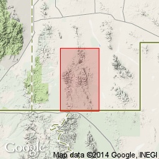
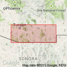
Pg. 1, 29-30, 42-43. Concha limestone of Naco group. Lower beds, for most part, are fine-grained calcareous sandstone which weathers gray; probably nowhere more than 50 feet thick. Above basal sandy beds, formation consists of gray medium-grained highly fossiliferous limestone which contains abundant irregular nodules of light-colored chert weathering pale brown. Thickness at type section 129.5 feet. Overlies Scherrer formation (new); unconformably underlies Glance conglomerate of Bisbee group. Age is Permian. Report includes stratigraphic sections, measured sections, fossil lists.
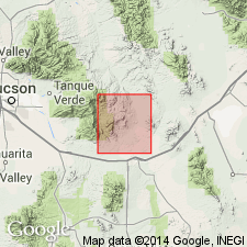
Type section: on east end of Concha Ridge, a conspicuous transverse spur of Scherrer Ridge in Gunnison Hills, in NW/4 sec. 28, T. 15 S., R. 23 E., central Cochise Co., southeastern AZ.
Source: US geologic names lexicon (USGS Bull. 1200, p. 907-908); supplemental information from GNU records (USGS DDS-6; Denver GNULEX).
- Usage in publication:
-
- Concha limestone
- Modifications:
-
- Areal extent
- AAPG geologic province:
-
- Pedregosa basin
Summary:
Pg. 498. Concha limestone of Naco group. Extended into Chiricahua Mountains, Cochise County, southeastern Arizona. Suggested that terms Chiricahua limestone and Snyder Hill formation be suppressed and term Concha limestone be used for the light-colored cherty limestones that contain Kaibab fauna and overlie Scherrer formation. Age is Permian (Leonard and Guadalupe?).
Measured sections: (1) in SW/4 sec. 14, T. 15 S., R. 30 E., 730 ft; (2) in NW/4 sec. 27, T. 15 S., R. 30 E., 245 ft; and (3) in SE/4 sec. 18, T. 16 S., R. 30 E., 150 ft.
Source: US geologic names lexicon (USGS Bull. 1200, p. 907-908); supplemental information from GNU records (USGS DDS-6; Denver GNULEX).
- Usage in publication:
-
- Concha Limestone*
- Modifications:
-
- Reference
- AAPG geologic province:
-
- Pedregosa basin
- Basin-and-Range province
Summary:
Is areally extended into southeastern AZ in the Basin-and-Range province and Pedregosa basin. A composite reference section is designated in Mustang Mountains in SW1/4 sec 14, and NE1/4 sec 15, T20S, R18E, Santa Cruz Co, AZ. Overlies Scherrer Formation and overlain by newly named Rainvalley Formation in reference section. Occurs widely in southern AZ from Kohl Kohl Hill (T12S, R7 and 8E) on west to Dunn Springs Mountain (T15S, R30E) on east. Specifically identified in Waterman, Tucson [Sierrita, Santa Rita], Empire, Mustang, and Chiricahua Mountains. Fossil Lophophyllid corals, Rhynchonellid brachiopods, and gastropods listed; bryozoa, sponges, horn corals, echinoid spines, crinoid stems, scaphopods, pelecypods, ammonoids, and fusulinids also noted. Fusulinids not studied in detail, but assemblage noted to be similar to that of Beta Member of Kaibab Limestone. Thus tentative age assignment of Leonard and Guadalupe? (Permian).
Source: GNU records (USGS DDS-6; Denver GNULEX).
- Usage in publication:
-
- Concha Limestone*
- Modifications:
-
- Areal extent
- AAPG geologic province:
-
- Pedregosa basin
Summary:
In map explanation, upper part of Concha said to be in Peloncillo Mountains, Pedregosa basin, NM as used by Gillerman (1958) [Actually, Gillerman (1958) used the name Chiricahua Limestone in preference to Concha]. Is of Permian age.
Source: GNU records (USGS DDS-6; Denver GNULEX).
- Usage in publication:
-
- Concha Limestone
- Modifications:
-
- Areal extent
- AAPG geologic province:
-
- Pedregosa basin
Summary:
Extended to Animas Mountains, Hidalgo Co, NM in Pedregosa basin. Is of Permian age.
Source: GNU records (USGS DDS-6; Denver GNULEX).

- Usage in publication:
-
- Concha limestone*
- Modifications:
-
- Overview
- AAPG geologic province:
-
- Pedregosa basin
Summary:
Base of Concha arbitrarily placed at top of highest rust-weathering sandstone bed of Scherrer formation. Most common fossil is a productid brachiopod, DICTYOCLOSTUS IVESI BASSI. Upper contact is a major unconformity with either Glance conglomerate or Walnut Gap volcanics. Section measured in NW1/4 sec 28, T15S, R23E is 129 1/2 ft thick. As upper formation of Naco group in this quad, is Early Permian age. Geologic map.
Source: GNU records (USGS DDS-6; Denver GNULEX).
- Usage in publication:
-
- Concha Limestone
- Modifications:
-
- Areal extent
- Overview
- AAPG geologic province:
-
- Pedregosa basin
Summary:
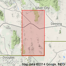
Extended without query as the upper formation of Naco Group in preference to Chiricahua Limestone to Big Hatchet Mountains, NM, Pedregosa basin. Underlies the newly named Hell-to-Finish Formation. Section 1,376 ft thick measured in secs 6 and 12, T32S, R14W. Correlation with San Andres Formation of central and southeast NM suggested. Brachiopods and fusulinids identified. Is of Permian (Leonard) age.
Source: GNU records (USGS DDS-6; Denver GNULEX).
- Usage in publication:
-
- Concha Limestone*
- Modifications:
-
- Areal extent
- Overview
- AAPG geologic province:
-
- Basin-and-Range province
- Pedregosa basin
Summary:
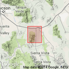
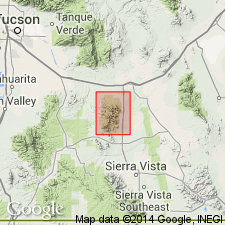
Extended to Whetstone Mountains, AZ, Pedregosa basin and Basin-and-Range province. Measured section Pima Co, AZ in SE1/4 sec 14 and N1/2 sec 23, T18S, R18E, 332 ft thick described. Overlies Scherrer Formation and overlain by Rainvalley Formation, both of Naco Group. Is of Early Permian age.
Source: GNU records (USGS DDS-6; Denver GNULEX).
- Usage in publication:
-
- Concha Limestone*
- Modifications:
-
- Areal extent
- AAPG geologic province:
-
- Pedregosa basin
- Basin-and-Range province
Summary:
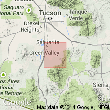
Accepted as a formation of Naco Group in Mustang Mountains, Santa Cruz Co, AZ in the Basin-and-Range province and extended to Huachuca Mountains, Cochise Co, AZ in the Pedregosa basin. Overlies Scherrer Formation. Overlain by Rainvalley Formation in Mustang Mountains. Is several hundred ft thick in Huachuca Mountains and as much as 570 ft thick in Mustang Mountains. Is of Early Permian age.
Source: GNU records (USGS DDS-6; Denver GNULEX).
- Usage in publication:
-
- Concha Limestone
- Modifications:
-
- Overview
- AAPG geologic province:
-
- Pedregosa basin
- Basin-and-Range province
Summary:
Deposited in sea below effective wave base in the Pedregosa basin and Basin-and-Range province. Is of Permian age.
Source: GNU records (USGS DDS-6; Denver GNULEX).
- Usage in publication:
-
- Concha Limestone*
- Modifications:
-
- Areal extent
- AAPG geologic province:
-
- Basin-and-Range province
Summary:
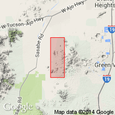
Extended to Santa Rita Mountains, Pima Co, AZ in Basin-and-Range province. Is of Early Permian age.
Source: GNU records (USGS DDS-6; Denver GNULEX).
- Usage in publication:
-
- Concha Limestone*
- Modifications:
-
- Areal extent
- AAPG geologic province:
-
- Basin-and-Range province
Summary:
Extended as a formation of Naco Group in the Sierrita Mountains, Pima Co, AZ in the Basin-and-Range province. Is of Early Permian age.
Source: GNU records (USGS DDS-6; Denver GNULEX).
- Usage in publication:
-
- Concha Limestone*
- Modifications:
-
- Areal extent
- AAPG geologic province:
-
- Basin-and-Range province
Summary:
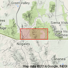
Extended as a formation of Naco Group to Patagonia Mountains, Santa Cruz Co, AZ in the Basin-and-Range province. Top formation of Naco Group. Unconformably overlain by Triassic or Jurassic volcanics; overlies Scherrer Formation. Is of Early Permian age.
Source: GNU records (USGS DDS-6; Denver GNULEX).
- Usage in publication:
-
- Concha Limestone*
- Modifications:
-
- Areal extent
- AAPG geologic province:
-
- Pedregosa basin
Summary:
Extended as a formation of Naco Group to Rincon Mountains, Cochise Co, AZ in the Pedregosa basin. Is of Early Permian age. Underlies Walnut Gap Formation (redefined).
Source: GNU records (USGS DDS-6; Denver GNULEX).
- Usage in publication:
-
- Concha Limestone*
- Modifications:
-
- Areal extent
- Overview
- AAPG geologic province:
-
- Pedregosa basin
Summary:
Mapped as top formation of Naco Group. Areally extended to Peloncillo Mountains, Hidalgo Co, NM in Pedregosa basin. Overlies Scherrer Formation of Naco Group. Unconformably overlain by McGhee Peak Formation (Lower Cretaceous) of Bisbee Group. Is locally coarse-grained white marble containing wollastonite in areas of outcrop adjacent to the granite of Granite Gap (Tertiary or Cretaceous). Is at least 75 m thick. Is of Early Permian age following Sabins (1975) and Sabins and Ross (1963).
Source: GNU records (USGS DDS-6; Denver GNULEX).
- Usage in publication:
-
- Concha Limestone*
- Modifications:
-
- Age modified
- AAPG geologic province:
-
- Pedregosa basin
- Basin-and-Range province
Summary:
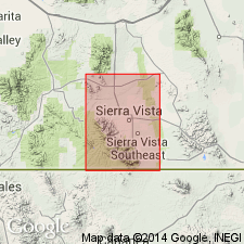
Age changed from Early Permian to Early and Late? Permian age in Whetstone Mountains, Cochise and Pima Cos, AZ in the Pedregosa basin and Basin-and-Range province. No evidence for age change given. [Late? Permian age is probably incorrect because of lack of evidence for late Guadalupian and Ochoan age rocks in AZ.]
Source: GNU records (USGS DDS-6; Denver GNULEX).

- Usage in publication:
-
- Concha Limestone*
- Modifications:
-
- Areal extent
- Mapped 1:24k
- Dominant lithology:
-
- Limestone
- AAPG geologic province:
-
- Pedregosa basin
Summary:
Concha Limestone. Geographically extended into Big Hatchet Mountains, Hidalgo County, southwestern New Mexico. Medium- and light-gray, cherty limestone. Chert dark- to pinkish-gray and makes up about half of some beds; chert-rich beds have abundant brachiopods. Thickness about 940 feet (240 m). Disconformably(?) overlies Scherrer Formation; conformably underlies Rainvalley Formation (provisionally correlated with Rainvalley of southeast Arizona). Age is Early Permian.
Source: Publication.
For more information, please contact Nancy Stamm, Geologic Names Committee Secretary.
Asterisk (*) indicates published by U.S. Geological Survey authors.
"No current usage" (†) implies that a name has been abandoned or has fallen into disuse. Former usage and, if known, replacement name given in parentheses ( ).
Slash (/) indicates name conflicts with nomenclatural guidelines (CSN, 1933; ACSN, 1961, 1970; NACSN, 1983, 2005, 2021). May be explained within brackets ([ ]).