- Usage in publication:
-
- Cloudburst formation
- Modifications:
-
- Named [?]
- Dominant lithology:
-
- Conglomerate
- Tuff
- AAPG geologic province:
-
- Basin-and-Range province
Pelletier, J.D., 1957, Geology of the San Manuel Mine: Mining Engineering, v. 9, no. 7, p. 760-762.
Summary:
Cloudburst formation. Occurs in area of San Manuel mine [Pinal County, Arizona]. Is informally divided into two members. Upper member is conglomerate made up mainly of quartz monzonite fragments but containing some fragments of older rocks in area. Matrix tends to be arkosic, but granitic sand and gravel not uncommon. Conglomerate poorly cemented but relatively well sorted, having beds of sand and gravel alternating with beds of larger boulders. Tuff beds in conglomerate and in the underlying member, which is composed of interbedded flows, flow breccias, and conglomerate. Unconformably [at least locally] underlies Gila(?) conglomerate. [Not clearly stated but apparently unit is younger than Late Cretaceous monzonite porphyry.] [Intruded by rhyolite dikes.] Age is Late Cretaceous(?) and Tertiary.
[Discrepancy concerning the original reference of the Cloudburst formation. US geologic names lexicon (USGS Bull. 1200, p. 844) and USGS DDS-6 (Menlo GNULEX) classified this publication as the original reference of the Cloudburst. USGS DDS-6 (Denver GNULEX) classified this publication as "First use" of the Cloudburst. First use denotes publications "in which intent to name is not stated." (Intent to name defined as "author(s) clearly state 'here' or 'in this report'"). This departure from classification in lexicon (USGS Bull. 1200) is not addressed in Denver GNULEX records. The US geologic names lexicon (USGS Bull. 1200) and USGS DDS-6 (Menlo GNULEX) classification is presented here.]
Source: US geologic names lexicon (USGS Bull. 1200, p. 844); GNU records (USGS DDS-6; Menlo GNULEX, supplemental information (in brackets) from Denver GNULEX).
- Usage in publication:
-
- Cloudburst
- Modifications:
-
- First used [?]
- Dominant lithology:
-
- Basalt
- Andesite
- Conglomerate
- Breccia
- AAPG geologic province:
-
- Basin-and-Range province
Summary:
First use of the term "Cloudburst". Used by San Manuel [mine] geologists in reference to a thick series of basaltic and andesitic flows, flow breccias, and agglomerates or conglomerates. Age is Late Cretaceous(?).
Source: GNU records (USGS DDS-6; Menlo GNULEX).
- Usage in publication:
-
- Cloudburst formation*
- Modifications:
-
- Age modified
- Overview
- AAPG geologic province:
-
- Basin-and-Range province
Summary:
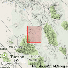
Mapped on west side of map, north of Santa Catalina Mountains, Pinal County, Arizona, in the Basin-and-Range province. Divisible locally into a fanglomerate unit estimated to be 5,000 feet thick; a volcanic unit 3,000 feet thick; and a conglomerate at Red Hill about 2,400 feet thick. Laid down in a continental environment of high relief. Age refined to Late Cretaceous(?) and middle Tertiary (from Cretaceous or Tertiary) on the basis of stratigraphic position, inclusion of quartz monzonite porphyry fragments of Cretaceous age, hiatus between the quartz monzonite porphyry and the Cloudburst formation, and correlation to unnamed volcanics and to Mineta formation. Report includes geologic map, cross sections.
Source: Modified from GNU records (USGS DDS-6; Denver GNULEX).
- Usage in publication:
-
- Cloudburst Formation*
- Modifications:
-
- Overview
- AAPG geologic province:
-
- Basin-and-Range province
Summary:
Name applied to exposures in Cloudburst Wash, secs. 28 through 30, T. 8 S., R. 16 E., Pinal County, Arizona, in the Basin-and-Range province. Mapped in west part of geologic map. Is about 6,000 feet thick. Divisible into 3 major facies. Fanglomerate facies is lenticular; has fragments of quartz monzonite, granodiorite, mafic volcanics, diabase, aplite, hornblende-biotite andesite, rhyolite, granodiorite porphyry, quartzite, limestone, and gabbro. Fragments range from 1/16 inch to 10 feet in size; sorting ranges from good to crude; were derived from Apache Group and Paleozoic rocks. Sedimentary breccia has fragments of granodiorite in a matrix of granitic material that is mostly angular; derived from the Precambrian. Volcanic facies includes latite flows, flow breccias, related dikes and intrusives. The facies lack persistent relationship to each other. Cloudburst overlies Precambrian granite. Unconformably underlies Gila Conglomerate. Age is probably Late Cretaceous or early Tertiary on the basis of stratigraphic position, and correlation to rocks in the Reed basin to the east. Report includes geologic map.
Source: Modified from GNU records (USGS DDS-6; Denver GNULEX).
- Usage in publication:
-
- Cloudburst Formation*
- Modifications:
-
- Age modified
- AAPG geologic province:
-
- Basin-and-Range province
Summary:
Age of Cloudburst Formation modified from Cretaceous or Tertiary, to Cretaceous(?) or Tertiary(?), on map.
Source: Modified from GNU records (USGS DDS-6; Menlo GNULEX).
- Usage in publication:
-
- Cloudburst Formation*
- Modifications:
-
- Age modified
- AAPG geologic province:
-
- Basin-and-Range province
Summary:
Is formation consisting of conglomerates and andesitic to latitic flows a few miles north of Santa Catalina Mountains, near Mammoth, Pinal County, Arizona, in Basin-and-Range province. Is possibly general equivalent of Salero Formation (Late Cretaceous) in Santa Rita and Empire Mountains. (See fig. 5 for regional correlations) Age is Late Cretaceous (Campanian); shown on correlation chart (fig. 5).
Source: Modified from GNU records (USGS DDS-6; Denver GNULEX).
- Usage in publication:
-
- Cloudburst Formation
- Modifications:
-
- Geochronologic dating
- Age modified
- AAPG geologic province:
-
- Basin-and-Range province
Summary:
K-Ar date of 24.0 +/-0.6 Ma on feldspar concentrate from trachyandesite of volcanic lower member of unit. Sample taken from bulldozer cut on southernmost peak of Owlhead Buttes, Tortolita Mountains quadrangle, Pinal County, Arizona, Basin-and-Range province. Cloudburst sedimentation spans Oligocene-Miocene boundary.
Source: GNU records (USGS DDS-6; Denver GNULEX).
For more information, please contact Nancy Stamm, Geologic Names Committee Secretary.
Asterisk (*) indicates published by U.S. Geological Survey authors.
"No current usage" (†) implies that a name has been abandoned or has fallen into disuse. Former usage and, if known, replacement name given in parentheses ( ).
Slash (/) indicates name conflicts with nomenclatural guidelines (CSN, 1933; ACSN, 1961, 1970; NACSN, 1983, 2005, 2021). May be explained within brackets ([ ]).

