- Usage in publication:
-
- Clinton group
- Modifications:
-
- Named
- Dominant lithology:
-
- Shale
- Sandstone
- AAPG geologic province:
-
- Appalachian basin
Summary:
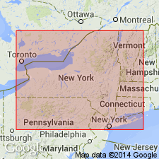
Clinton group of Third District of NY defined. Consists of green and black-blue shale, greenish and gray sandstone, red sandstone, often laminated, calcareous sandstone, encrinal sandstone, and red fossiliferous iron ore beds, of which the most prominent member is the shale, the next prominent member is the greenish sandstone, and the third most prominent, the iron ore beds. Characteristic masses of these rocks occur around Clinton, Oneida Co., NY. Underlies Niagara/Lockport group and overlies Oneida or Shawangunk group. Age is Silurian.
Source: GNU records (USGS DDS-6; Reston GNULEX).
- Usage in publication:
-
- Clinton Formation*
- Modifications:
-
- Age modified
- AAPG geologic province:
-
- Appalachian basin
Summary:
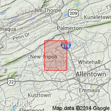
Early(?) to Middle Silurian age used for Clinton Formation in Slatedale quad., PA.
Source: GNU records (USGS DDS-6; Reston GNULEX).
- Usage in publication:
-
- Clinton Group
- Modifications:
-
- Revised
- AAPG geologic province:
-
- Appalachian basin
Summary:
Salmon Creek Bed, at the base of the Irondequoit Limestone, and Second Creek Bed, at the base of the Williamson Shale, are newly named phosphate quartz pebble beds in Wayne Co., western NY. The Second Creek is laterally equivalent eastward to the Westmoreland Iron Ore at the base of the Willowvale Shale. (Williamson and Willowvale are exact equivalents.) The Salmon Creek occurs at the base of the Rockway Member of the Irondequoit in Niagara Co. and at the base of the Dawes Formation in Clinton Co., eastern NY. Age of the Second Creek is late Llandoverian; age of the Salmon Creek is late Llandoverian to early Wenlockian.
Source: GNU records (USGS DDS-6; Reston GNULEX).
- Usage in publication:
-
- Clinton Group
- Modifications:
-
- Revised
- AAPG geologic province:
-
- Appalachian basin
Summary:
Clinton Group is actually an amalgam of parts of four distinct sequences (II-V). Authors, therefore, informally divided the Clinton into lower, middle, and upper Clinton units. As here defined the lower Clinton (Sequence II) constitutes a genetic unconformity-bounded sequence of strata ranging from the Densmore Creek Phosphate Bed at the base of the Maplewood/Neahga Shale (or equivalent Furnaceville Hematite) to the top of the Wolcott Limestone in western and central NY. The basal boundary of the lower Clinton is clearly marked by the Densmore Creek Phosphate Bed. Middle Clinton (Sequence III) is composed of the Sauquoit to Otsquago Formations in central New York State, a 40 m-thick sequence of greenish gray shales, with thin sandstone and conglomerate layers, which outcrops sporadically from near Cayuga to Madison Co. No strata belonging to this sequence occur in western NY or Ontario. The basal upper Clinton (Sequence IV) is the fourth major unconformity-bounded package. It comprises the Williamson-Willowvale and Dawes-upper Rose Hill-lower Irondequoit Formations (Rockway Member). Sequence contains deepest water deposits in the Silurian succession. The upper Clinton (sequence V) in the Niagara region includes the upper Irondequoit, Rochester Shale, DeCew Dolostone and Glenmark Shale. Package is bounded at base by the sharp lower contact of the Model City Member of the Irondequoit.
Source: GNU records (USGS DDS-6; Reston GNULEX).
- Usage in publication:
-
- Clinton Group
- Modifications:
-
- Revised
- AAPG geologic province:
-
- Appalachian basin
Summary:
The Clinton Group (Sequences II-V) does not form a natural, genetically related package. The lower beds in western NY are not even present at the type section. Base of Sequence II is marked by a lag bed only a few cm thick, called the Densmore Creek Phosphate Bed, eastward to Webster, NY, where the bed becomes hematitic and is called the Webster Conglomerate Bed. In the Niagara Gorge, the Densmore Creek is overlain by about 1 to 2 m of green Neahga Shale. Overlying the Neahga in this region is the true Reynales Limestone, the base of which is marked by the Budd Road Bed. Above the Budd Road is the Brewer Dock Member, which at Rochester is capped by the Seneca Park Hematite Bed. The Wallington Member of the Reynales is missing at Niagara Gorge. Near Syracuse, the top of Sequence II is marked by the Furnaceville Hematite Member of the Reynales Formation, while at Niagara Gorge, it is marked by the Hickory Corners Member according to fig. 8. Middle Clinton strata (Sequence III--Sauquoit Shale in central NY) is absent west of the Cayuga-Wayne Co. area in NY and is marked simply by the unconformity between the Williamson Shale or Merritton Dolostone and the lower Clinton Group. Upper Clinton strata are divided into Sequences IV and V. Sequence IV is a mixed carbonate and siliciclastic mudstone succession of latest Llandoverian to early Wenlockian age. The base is marked by the Second Creek Phosphate Bed of the Williamson Shale. Above the Williamson Shale is the Salmon Creek Bed, which marks the base of the Rockway Dolostone Member of the Irondequoit Formation. (The Rockway Member in CAN is commonly referred to as the upper beds of the "Reynales" limestone by Canadian geologists. However, the true Reynales Limestone is absent in CAN except along the Niagara River.) Sequence V of the upper Clinton includes (ascending) Model City Member of the Irondequoit, the Lewiston and Burleigh Hill Members of the Rochester Shale and the DeCew Dolostone.
Source: GNU records (USGS DDS-6; Reston GNULEX).
- Usage in publication:
-
- Clinton interval
- Modifications:
-
- Overview
- AAPG geologic province:
-
- Appalachian basin
Summary:
"The Clinton is not recognized as a formal stratigraphic unit of formational rank by the Ohio Geol. Survey, but use of the term is pervasive." In this report, strata between the Queenston Shale and the Packer Shell limestone is referred to as the Clinton interval. The Clinton here is divided into (ascending) Whirlpool unit, Cabot Head Shale, White sandstone, Red sandstone, Stray sandstone, and Neahga Shale, a mixture of New York nomenclature and informal terms used by drillers.
Source: GNU records (USGS DDS-6; Reston GNULEX).
- Usage in publication:
-
- Clinton Group
- Modifications:
-
- Revised
- AAPG geologic province:
-
- Appalachian basin
Summary:
Figure 25 illustrates one change in the Clinton Group. The basal Maplewood has been abandoned and replaced with the older name Neahga, which is extended through the outcrop belt.
Source: GNU records (USGS DDS-6; Reston GNULEX).
- Usage in publication:
-
- Clinton Group
- Modifications:
-
- Revised
- AAPG geologic province:
-
- Appalachian basin
Summary:
Interval from above the Kodak Sandstone (including the post-Kodak shales at Rochester) downward through the Cambria Shale and Thorold Sandstone is "herein" removed from the Clinton Group and assigned to the Medina Group. The base of the Clinton is drawn at the base of the Neahga and correlative Maplewood Shales, which include the distinctive phosphatic Densmore Creek Bed. [No reference is made to the report by Brett and others (in press), which also claims to make this revision.]
Source: GNU records (USGS DDS-6; Reston GNULEX).
- Usage in publication:
-
- Clinton Group*
- Modifications:
-
- Revised
- AAPG geologic province:
-
- Appalachian basin
Summary:
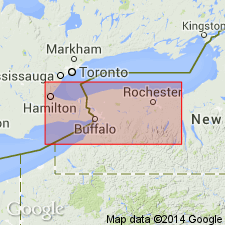
The Clinton Group in western NY is revised to include (ascending) the Neahga Shale, Reynales Limestone, Merritton Limestone, Williamson Shale, Rockway Dolomite, Irondequoit Limestone, Rochester Shale, and DeCew Dolomite. This revision removes the interval containing the Thorold Sandstone, Cambria Shale, and Kodak Sandstone and places them in the underlying Medina Group. The Clinton is 100 to 110 ft thick and consists of thin- to medium-bedded shale, limestone, and dolomite. The base of the group is placed at the base of the Neahga Shale (Densmore Creek Phosphate Bed) and marked by a regional unconformity. The upper contact of the Clinton is placed at the top of the DeCew Dolomite and is marked by a regional unconformity. Overlies the Kodak Sandstone of the Medina Group and underlies the Gasport Dolomite of the Lockport Group. The Clinton ranges in age from Llandoverian (Aeronian) to the middle Wenlockian, Early Silurian according to the usage in this report. [Report uses Early and Late Silurian time scale of Harland and others (1982).]
Source: GNU records (USGS DDS-6; Reston GNULEX).
For more information, please contact Nancy Stamm, Geologic Names Committee Secretary.
Asterisk (*) indicates published by U.S. Geological Survey authors.
"No current usage" (†) implies that a name has been abandoned or has fallen into disuse. Former usage and, if known, replacement name given in parentheses ( ).
Slash (/) indicates name conflicts with nomenclatural guidelines (CSN, 1933; ACSN, 1961, 1970; NACSN, 1983, 2005, 2021). May be explained within brackets ([ ]).

