

- Usage in publication:
-
- Clear Fork beds
- Modifications:
-
- Original reference
- Dominant lithology:
-
- Limestone
- Clay
- Sandstone
- AAPG geologic province:
-
- Bend arch
- Palo Duro basin
- Permian basin
Summary:
Pg. 188, and E.T. Dumble's pl. 3 [table of formations facing p. xxx] and p. lxix. Clear Fork beds. Fossiliferous magnesium and earthy limestones, calcareous clays and sandstones, with small quantities of gypsum and conglomerate. Limestones contain invertebrate fossils (see C.A. White, 1889, Amer. Naturalist, v. 23, no. 266, p. 109-128); become less fossiliferous towards top. Clays are red (predominantly) and blue. Red clays contain vertebrate fossils (see E.D. Cope's 5-part series, Proc. Amer. Phil. Soc., 1881-1885); blue clays contain copper. Overlie Wichita beds and conformably underlie Double Mountain beds. Age is Permian.
Origin of name not stated by author, but probably named from Clear Fork of Brazos River, Jones and Shackelford Cos., north-central TX.
Source: Publication; US geologic names lexicon (USGS Bull. 896, p; supplemental information from GNU records (USGS DDS-6; Denver GNULEX).
- Usage in publication:
-
- Clear Fork beds
- Modifications:
-
- Revised
- AAPG geologic province:
-
- Permian basin
Summary:
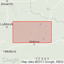
Clear Fork beds revised locally. Present in two measured sections: (1) along the Texas and Pacific RR, from Abilene, Taylor County to Sweetwater, Nolan County, Texas, where it includes (ascending) Tye formation, Bullwagon dolomite, and Merkel dolomite; and (2) 30 mi north of RR, along Double Mountain Fork of Brazos River, from Flat Top Mountain, Haskell County to top of Double Mountains, Stonewall County, Texas, where it includes only the Merkel. Overlies Wichita beds; underlies Blowout Mountain sandstone of Double Mountain beds. Age is Permian.
Source: Publication; US geologic names lexicon (USGS Bull. 896, Blowout Mountain p. 216, Buffalo Hill p. 288, Bullwagon p. 292, Merkel p. 1352, Tye p. 2205).
- Usage in publication:
-
- Clear Fork stage
- Modifications:
-
- Revised
- AAPG geologic province:
-
- Permian basin
Summary:
Pg. 46-50, pls. 1-3. Clear Fork stage. In bluffs of Colorado River, Runnels County, Texas, includes (ascending) Vale formation (replaces preempted Tye formation of Wrather, 1917) and Choza formation. Overlies Arroyo formation (replaces preoccupied Abilene formation of Wrather, 1917) of Wichita stage; underlies Double Mountain stage. Age is Permian.
Source: Publication.

- Usage in publication:
-
- Clear Fork group*
- Modifications:
-
- Overview
Summary:
Some geologists include Arroyo formation of Beede and Waite in Clear Fork group, but Beede, Waite, and Wrather include it in Wichita group. The USGS includes it in Clear Fork group.
Source: US geologic names lexicon (USGS Bull. 896, p. 460).

- Usage in publication:
-
- Clear Fork group*
- Modifications:
-
- Revised
- AAPG geologic province:
-
- Bend arch
Summary:
Pg. 66 (fig. 1), 97. Clear Fork group. Includes (ascending) Arroyo, Vale, and Choza formations. Overlies Lueders group; underlies El Reno (San Andres) group. Age is Early Permian (Leonard).
Source: US geologic names lexicon (USGS Bull. 1200, p. 832-833).
- Usage in publication:
-
- Clear Fork group
- Modifications:
-
- Revised
- AAPG geologic province:
-
- Permian basin
Summary:
Pg. 42. Clear Fork group. Term Wichita group (restricted) used for beds of Leonard age between base of Clear Fork group and top of Wolfcamp series. Cheney proposes to abandon term Wichita. Clear Fork group comprises (ascending) Arroyo formation about 250 feet; Vale formation, with Bullwagon dolomite at top and about 360 feet of red shale below; and Choza formation. Age is Early Permian (Leonard).
Source: US geologic names lexicon (USGS Bull. 1200, p. 832-833).
- Usage in publication:
-
- Clear Fork group*
- Modifications:
-
- Revised
- AAPG geologic province:
-
- Permian basin
Summary:
Pg. 57. Clear Fork group. Underlies San Andres group. Age is Early Permian (Leonard).
Source: US geologic names lexicon (USGS Bull. 1200, p. 832-833).
- Usage in publication:
-
- Clear Fork group*
- Modifications:
-
- Revised
- AAPG geologic province:
-
- Permian basin
Summary:
Pg. 1412; 1945, GSA Bull., v. 56, no. 9, p. 898, 905. Clear Fork group. Overlies Wichita group; underlies Pease River group.
Source: US geologic names lexicon (USGS Bull. 1200, p. 832-833).
- Usage in publication:
-
- Clear Fork group*
- Modifications:
-
- Areal extent
- AAPG geologic province:
-
- Bend arch
- Palo Duro basin
- Permian basin
Summary:
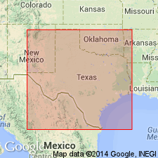
Chart 7 (col. 74). Clear Fork group. Correlation chart shows Clear Creek group in Texas comprises (ascending) Arroyo, Vale, and Choza formations; underlies Pease River group; overlies Wichita group. Name not used in Oklahoma. Age is Early Permian (Leonard).
Source: US geologic names lexicon (USGS Bull. 1200, p. 832-833).
- Usage in publication:
-
- Clear Fork Group
- Modifications:
-
- Areal extent
- AAPG geologic province:
-
- Bend arch
- Permian basin
Summary:
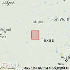
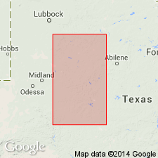
Area of report is central TX; in this area the Clear Fork Group consists of shale and sandstone, interbedded, with Merkel Dolomite near top and locally at top. The shale is sandy in part, alternating red and bluish green in color. The sandstone is composed of fine-grained quartz, calcareous in part, massive, moderately indurated, and gray in color. Top part only crops out within area of the geologic map, probably mostly Choza Formation. Mapped in Runnels, Taylor, and Jones Cos (on Bend arch) and Stonewall Co (in Permian basin). Underlies Permian San Angelo Formation. Clear Fork rocks are the oldest exposed in the map area. Geologic map. Of Permian age.
Source: GNU records (USGS DDS-6; Denver GNULEX).

- Usage in publication:
-
- Clear Fork Group
- Modifications:
-
- Revised
- Areal extent
- AAPG geologic province:
-
- Bend arch
- Palo Duro basin
- Permian basin
Summary:
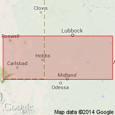
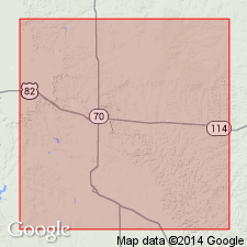
Clear Fork Group is revised in that it overlies Waggoner Ranch Formation of Bowie Group (both first used) in northeast part of map area, north-central TX. In map area the Choza, Vale, and Arroyo Formations of Clear Fork Group of the Colorado River Valley area of TX are not distinguishable. [The author maps Clear Fork Group undivided, except for "Merkel Dolomite" and "Bullwagon Dolomite", some sandstone beds, and "Lytle Limestone". Listed in descending order: Merkel is topmost member of Choza Formation, Bullwagon is topmost member of Vale Formation, and Lytle is a middle member of Arroyo Formation, all of Clear Fork Group of the Colorado River Valley area.] Clear Fork Group overlies the first used Waggoner Ranch of Bowie in northeast Baylor, eastern Wilbarger, and western Wichita Cos in Bend arch and Palo Duro basin (northeast part of map area). Overlies rocks of Albany Group in Haskell, Throckmorton, Baylor, and Wilbarger Cos, Bend arch and Palo Duro basin (southwest part of map area). Clear Fork Group is extensively covered by Quaternary deposits. Mapped areal limits of Clear Fork Group: Haskell and Knox Cos, Permian basin; Throckmorton and Baylor Cos, Bend arch; and Foard, Wilbarger, and Hardeman Cos, Palo Duro basin. Assigned to the Leonard Series (Early Permian). Geologic map.
Source: GNU records (USGS DDS-6; Denver GNULEX).
For more information, please contact Nancy Stamm, Geologic Names Committee Secretary.
Asterisk (*) indicates published by U.S. Geological Survey authors.
"No current usage" (†) implies that a name has been abandoned or has fallen into disuse. Former usage and, if known, replacement name given in parentheses ( ).
Slash (/) indicates name conflicts with nomenclatural guidelines (CSN, 1933; ACSN, 1961, 1970; NACSN, 1983, 2005, 2021). May be explained within brackets ([ ]).