The National Geologic Map Database is migrating to a new infrastructure. We apologize for any service disruptions during this process.
|
|---|


- Usage in publication:
-
- Clay Spur bentonite bed*
- Modifications:
-
- Named
- Dominant lithology:
-
- Bentonite
- AAPG geologic province:
-
- Powder River basin
Summary:
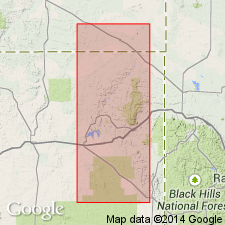
Named for exposures near Clay Spur, sec 30, T47N, R63W, Weston Co, WY in the Powder River basin. Assigned as a bed at top of the Mowry siliceous shale member of Graneros shale. Is 1 to 4 ft thick. Overlies a lower unnamed part of Gammon. Underlies Belle Fourche shale member of Graneros shale. Late Cretaceous age. Stratigraphic table.
Source: GNU records (USGS DDS-6; Denver GNULEX).
- Usage in publication:
-
- Clay Spur bentonite bed*
- Modifications:
-
- Revised
- Overview
- AAPG geologic province:
-
- Powder River basin
- Williston basin
Summary:
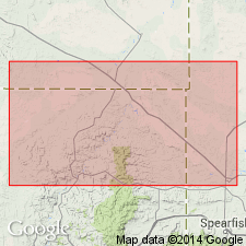
Revised as topmost bed of the Mowry shale. Overlain by the Belle Fourche shale. Map shows distribution in parts of Butte Co, SD, Crook Co, WY, and Carter Co, MT in Williston and Powder River basins. Commonly 2-4 ft thick becoming as thick as 7 ft. Gives numerous detailed measurements and the results of tests for use as sand bonding clay and drilling mud. Early Cretaceous in age.
Source: GNU records (USGS DDS-6; Denver GNULEX).
- Usage in publication:
-
- Clay Spur Bentonite Member
- Modifications:
-
- Revised
- AAPG geologic province:
-
- Williston basin
- Powder River basin
- Chadron arch
- Central Montana uplift
Summary:
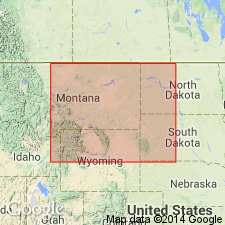
Raised to rank of member of the Mowry Shale in central and eastern MT, western ND, western SD, and northeastern WY in the Williston and Powder River basins, and on the Chadron arch and the central Montana uplift. Overlain unconformably by Belle Fourche shale. Early Cretaceous in age.
Source: GNU records (USGS DDS-6; Denver GNULEX).
- Usage in publication:
-
- Clay Spur Bentonite Bed*
- Modifications:
-
- Overview
- AAPG geologic province:
-
- Powder River basin
Summary:
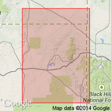
Topmost bed of the Mowry Shale at most places on northern and western flanks of the Black Hills, WY, MT, and SD. Gives measurements at several places in Crook and Weston Cos, WY in the Powder River basin. Overlain by the Belle Fourche Shale. Late Cretaceous in age.
Source: GNU records (USGS DDS-6; Denver GNULEX).

- Usage in publication:
-
- Clay Spur Bentonite Bed*
- Modifications:
-
- Areal extent
- AAPG geologic province:
-
- Powder River basin
Summary:
Identified as the uppermost bed of the Mowry Shale throughout the subsurface of the Powder River basin in MT and WY where it overlies main body of Mowry and underlies Frontier Formation on the west side of the basin and Belle Fourche Shale on the east side of the basin. Of Late Cretaceous age. [This nomenclature shown on 22 cross sections in this OC series.]
Source: GNU records (USGS DDS-6; Denver GNULEX).
- Usage in publication:
-
- Clay Spur Bentonite Bed*
- Modifications:
-
- Geochronologic dating
- AAPG geologic province:
-
- Wind River basin
Summary:
Is uppermost bentonite bed at the top of the Mowry Shale (Upper Cretaceous); sampled about 12.9 km west of Casper, Natrona Co, WY (Wind River basin). The 40Ar/39Ar laser fusion approach using sanidine from bentonite yields an age of 97.17 +/-0.69 Ma for the Clay Spur and thus for the top of the Mowry as well. The Albian-Cenomanian boundary is assigned an age 98.5 +/-0.5 Ma and the Cenomanian-Turonian boundary is assigned an age of 93.3 +/-0.2 Ma.
Source: GNU records (USGS DDS-6; Denver GNULEX).
For more information, please contact Nancy Stamm, Geologic Names Committee Secretary.
Asterisk (*) indicates published by U.S. Geological Survey authors.
"No current usage" (†) implies that a name has been abandoned or has fallen into disuse. Former usage and, if known, replacement name given in parentheses ( ).
Slash (/) indicates name conflicts with nomenclatural guidelines (CSN, 1933; ACSN, 1961, 1970; NACSN, 1983, 2005, 2021). May be explained within brackets ([ ]).