The National Geologic Map Database is migrating to a new infrastructure. We apologize for any service disruptions during this process.
|
|---|


- Usage in publication:
-
- Clallam formation*
- Modifications:
-
- Named
- Biostratigraphic dating
- Dominant lithology:
-
- Sandstone
- Conglomerate
- Coal
- AAPG geologic province:
-
- Olympic Mountains province
Summary:
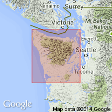
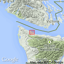
Named for exposures that extend from Clallam Bay eastward to Pillar Point on south shore of Strait of Juan de Fuca, Clallam Co, WA. [Type not designated.] Extends east to Freshwater Bay and west to Cape Flattery [a distance of about 50 mi]. Consists of alternating conglomerate, sandstone and shale, laminated and grading to almost marine clay. Coal beds occur in upper and lower parts east of Clallam Bay. Is as much as 15,000 ft thick. Unconformably overlies Crescent formation (Eocene age); with angular unconformity underlies Quinaielt [Quinault] formation (Pliocene age). Is rich in fossils which indicate upper part is Miocene age and lower part is Oligocene age.
Source: GNU records (USGS DDS-6; Menlo GNULEX).
- Usage in publication:
-
- Clallam formation
- Modifications:
-
- Revised
- Age modified
- AAPG geologic province:
-
- Olympic Mountains province
Summary:
Unit restricted to Miocene portion of stratigraphic section along north side of Olympic Peninsula. Limits formation to two areas: (1) ten-mile length between mouth of Clallam River eastward to town of Pysht and (2) [five-mile length] from west side of Clallam Bay westward to mouth of Sekiu River. Basal contact is with upper Oligocene rocks in north sides of valleys of Reed River and Pearson Rivers [rivers that parallel south coast of Juan de Fuca Strait but lie little more than a mile to the south]. Contact appears to be unconformable but is concealed. Clallam appears to be representative of a portion of Astoria formation as recognized in southwestern WA and coastal parts of OR [based on fauna].
Source: GNU records (USGS DDS-6; Menlo GNULEX).
- Usage in publication:
-
- Clallam Formation*
- Modifications:
-
- Age modified
- AAPG geologic province:
-
- Olympic Mountains province
Summary:
Abundant mollusks from lowest and highest parts of Clallam Formation along Juan de Fuca Strait are restricted to early Miocene age, thereby restricting age of Clallam to early Miocene. Small molluscan fauna had been previously correlated with middle Miocene Astoria Formation.
Source: GNU records (USGS DDS-6; Menlo GNULEX).
- Usage in publication:
-
- Clallam Formation*
- Modifications:
-
- Age modified
- AAPG geologic province:
-
- Olympic Mountains province
Summary:
Molluscan fauna in Clallam Formation along south shore of Strait of Juan de Fuca, north Clallam Co, northwestern WA, is basis for newly-defined Pillarian Stage (early Miocene age).
Source: GNU records (USGS DDS-6; Menlo GNULEX).
- Usage in publication:
-
- Clallam Formation*
- Modifications:
-
- Revised
- Areal extent
- Overview
- AAPG geologic province:
-
- Olympic Mountains province
Summary:
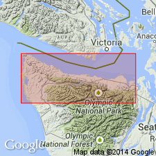
Uppermost part of Arnold's (1906) Clallam Formation is retained between Slip Point, at east end of Clallam Bay and Pillar Point [a distance of about 8 mi to the east] (which author states is Arnold's type locality). Unit is similar to Weaver's (1937) Clallam Formation, except that strata exposed along coast, west of Clallam Bay along a 5-km interval between village of Sekiu and mouth of Hoko River, is reassigned to upper member of Twin River Formation. Conformably and gradationally overlies Twin River Formation. Clallam Formation is 600 to 800 m thick of dominantly marine sandstone that contains sandy siltstone and granule to cobble conglomerate. Thin coal beds and carbonaceous siltstone in highest beds indicate nonmarine deposition. Molluscan fauna provide paleontologic base for Pillarian Stage, a time-stratigraphic unit of late early Miocene age.
Source: GNU records (USGS DDS-6; Menlo GNULEX).
For more information, please contact Nancy Stamm, Geologic Names Committee Secretary.
Asterisk (*) indicates published by U.S. Geological Survey authors.
"No current usage" (†) implies that a name has been abandoned or has fallen into disuse. Former usage and, if known, replacement name given in parentheses ( ).
Slash (/) indicates name conflicts with nomenclatural guidelines (CSN, 1933; ACSN, 1961, 1970; NACSN, 1983, 2005, 2021). May be explained within brackets ([ ]).