The National Geologic Map Database is migrating to a new infrastructure. We apologize for any service disruptions during this process.
|
|---|


- Usage in publication:
-
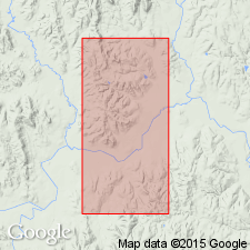
- Cheyenne sandstone*
- Modifications:
-
- Original reference
- Dominant lithology:
-
- Sandstone
- AAPG geologic province:
-
- Anadarko basin
Summary:
Pg. 65. Cheyenne sandstone. Obliquely laminated, mostly incoherent (rarely hard) sandstone, 20 to 40 feet thick, often gray but in large part gorgeously decorated with crimson, purple, scarlet, orange, yellow, brown, and other colors. Forms bed No. 6 of section at Belvidere, Kansas. Supposed to be referable to Trinity division of Texas and Arkansas. Age is Early Cretaceous.
[Named from Cheyenne Rock, at Belvidere, Kiowa Co., central southern KS.]
Source: US geologic names lexicon (USGS Bull. 896, p. 424-425).
- Usage in publication:
-
- Cheyenne sandstone*
- Modifications:
-
- Age modified
- Dominant lithology:
-
- Sandstone
- AAPG geologic province:
-
- Anadarko basin
- Sedgwick basin
- Central Kansas uplift
Summary:
Cheyenne sandstone of southern Kansas underlies Neocomian shales and rests unconformably on Triassic. [Neocomian is a European time term for basal Lower Cretaceous deposits.]
Source: US geologic names lexicon (USGS Bull. 896, p. 424-425).
- Usage in publication:
-
- Cheyenne sandstone*
- Modifications:
-
- Areal extent
- AAPG geologic province:
-
- Anadarko basin
Summary:
Pg. 49. Introduced Kiowa shale for the formation overlying Cheyenne sandstone.
Source: US geologic names lexicon (USGS Bull. 896, p. 424-425).

- Usage in publication:
-
- Cheyenne sandstone*
- Modifications:
-
- Overview
- AAPG geologic province:
-
- Anadarko basin
Summary:
In 1895 Cragin divided Cheyenne sandstone into the several "members" mentioned under Elk Creek beds. All of these "member" names were discarded by the USGS in 1921, being applied to local facies of the Cheyenne.
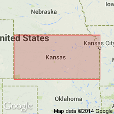
The commonly accepted definition of Cheyenne is that it underlies Kiowa shale and rests unconformably on Permian, the Triassic and Jurassic being absent. Present in central southern Kansas. Age is Early Cretaceous (Comanche).
Source: US geologic names lexicon (USGS Bull. 896, p. 424-425).

- Usage in publication:
-
- Cheyenne formation
- Cheyenne sandstone*
- Modifications:
-
- Areal extent
- AAPG geologic province:
-
- Anadarko basin
Summary:
Cheyenne formation (Cheyenne sandstone). Writer does not consider it possible definitely to recognized any member of Cheyenne formation beyond limits of one locality. Cragin's divisions are considered to have no validity for more than local applications, and as his 3 members were not differentiated in same section it is possible 2 of them may be one. Cheyenne sandstone appears to be confined to eastern part of area of Kiowa shale. Age is Early Cretaceous (Comanche).
Source: US geologic names lexicon (USGS Bull. 896, p. 424-425).
- Usage in publication:
-
- Cheyenne sandstone*
- Modifications:
-
- Areal extent
- AAPG geologic province:
-
- Anadarko basin
Summary:
Pg. 75-86. Cheyenne sandstone. In Kiowa County, Kansas, Cheyenne sandstone unconformably overlies Permian Whitehorse sandstone and conformably underlies Kiowa shale. Thickness 32.5 to 94 feet. Age is Early Cretaceous (Comanchean).
Source: US geologic names lexicon (USGS Bull. 1200, p. 757).
- Usage in publication:
-
- Cheyenne sandstone member*
- Modifications:
-
- Areal extent
- AAPG geologic province:
-
- Anadarko basin
Summary:
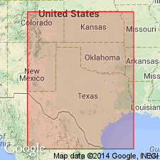
Pg. 17 (table 3), 97-99. Cheyenne sandstone member of Purgatoire formation. Extended into Baca County, Colorado, where it is lower member of Purgatoire formation. Underlies Kiowa shale member; overlies Morrison formation. Thickness 50 to 134 feet. Age is Early Cretaceous (Comanchean).
Source: US geologic names lexicon (USGS Bull. 1200, p. 757).
- Usage in publication:
-
- Cheyenne sandstone member*
- Modifications:
-
- Mapped 1:500k
- AAPG geologic province:
-
- Palo Duro basin
Summary:
Cheyenne sandstone member of Purgatoire formation. Mapped in Cimarron County, Oklahoma, as member of Purgatoire formation. Age is Early Cretaceous (Comanchean).
Source: US geologic names lexicon (USGS Bull. 1200, p. 757).
For more information, please contact Nancy Stamm, Geologic Names Committee Secretary.
Asterisk (*) indicates published by U.S. Geological Survey authors.
"No current usage" (†) implies that a name has been abandoned or has fallen into disuse. Former usage and, if known, replacement name given in parentheses ( ).
Slash (/) indicates name conflicts with nomenclatural guidelines (CSN, 1933; ACSN, 1961, 1970; NACSN, 1983, 2005, 2021). May be explained within brackets ([ ]).