The National Geologic Map Database is migrating to a new infrastructure. We apologize for any service disruptions during this process.
|
|---|


- Usage in publication:
-
- Chepultepec formation*
- Modifications:
-
- Original reference
- Dominant lithology:
-
- Limestone
- Dolomite
- Chert
- AAPG geologic province:
-
- Appalachian basin
Summary:
Pg. 549, 638-640, pl. 27. Chepultepec dolomite. In Alabama (Murphrees, Birmingham, and Cahaba Valleys) another formation, about 1,000 feet thick, characterized by abundant soft mealy chert, for which Chepultepec is proposed, is intercalated between top of typical Knox and overlying Canadian [Beekmantown] limestone and dolomite. At Chepultepec the Canadian limestone and dolomite are absent and the Chepultepec is unconformably overlain by the Stones River. The Chepultepec is a highly cherty magnesian limestone, the chert always soft and more or less mealy. Fossils common in upper 300 feet. Not recognized in Tennessee. Rests on beds younger than Copper Ridge chert, which are supposed to represent "Upper Knox" of Tennessee. Represents last of Ozarkian deposits in this province. Correlates with Gasconade of Missouri. Basal part is = upper part of Little Falls dolomite of New York, and rest of formation is younger than Little Falls dolomite and is not present in either east-central New York [typical Little Falls region] or in Champlain Valley. Correlates with part of Oneota dolomite of upper Mississippi Valley.
Source: US geologic names lexicon (USGS Bull. 896, p. 413-414).
- Usage in publication:
-
- Chepultepec limestone*
- Modifications:
-
- Areal extent
- AAPG geologic province:
-
- Appalachian basin
Summary:
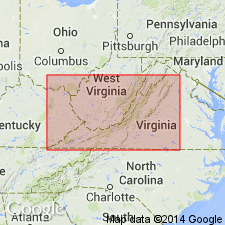
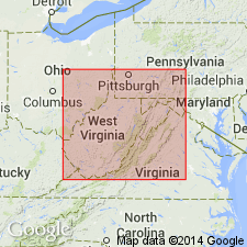
Geographically extended to Virginia. Formation is a rather pure medium thick-bedded limestone in southeastern belts of the Valley of Virginia. Contains chert. Approximately 500 feet thick. Overlies Copper Ridge dolomite; underlies Beekmantown dolomite. Ozarkian age (confusion at that time if Ozarkian was a system or series or a part of the Cambrian or Ordovician).
Source: GNU records (USGS DDS-6; Reston GNULEX).
- Usage in publication:
-
- Chepultepec limestone*
- Modifications:
-
- Age modified
- AAPG geologic province:
-
- Appalachian basin
Summary:
Age changed to Early Ordovician. Correlated Frederick limestone with Chepultepec and classified to Lower Ordovician based on fossils. Before this time, there was much confusion about an Ozarkian System (see memo file under Ozarkian).
Source: GNU records (USGS DDS-6; Reston GNULEX).
- Usage in publication:
-
- Chepultepec
- Modifications:
-
- Areal extent
- AAPG geologic province:
-
- Appalachian basin
Summary:
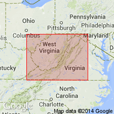
Geographically extended to West Virginia. Used in eastern panhandle.
Source: GNU records (USGS DDS-6; Reston GNULEX).
- Usage in publication:
-
- Chepultepec dolomite*
- Modifications:
-
- Areal extent
- AAPG geologic province:
-
- Appalachian basin
Summary:
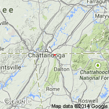
Geographically extended to TN. Consists of well-bedded to massive gray dolomite commonly with silty laminae that show only on weathered surfaces. Lower third of formation has layers of sandstone with dolomite cement. Chert is common. Approximately 750 feet thick. Overlies Copper Ridge dolomite; underlies Longview dolomite. Geologic map and unit description included in report.
Source: GNU records (USGS DDS-6; Reston GNULEX).
- Usage in publication:
-
- Chepultepec formation
- Modifications:
-
- Areal extent
- AAPG geologic province:
-
- Appalachian basin
Summary:
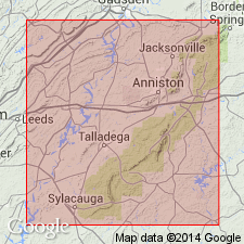
Geographically extended to GA. Formation is predominantly dolomite, medium to light gray, fine- to coarse-grained and massive, some scattered limestone beds. Bedded chert is distinctive of formation. Approximately 1400 feet thick in northwest GA. Overlies Copper Ridge formation; underlies Longview formation. Publication includes a partial measured section.
Source: GNU records (USGS DDS-6; Reston GNULEX).
- Usage in publication:
-
- Chepultepec Dolomite
- Modifications:
-
- Areal extent
- AAPG geologic province:
-
- Appalachian basin
Summary:
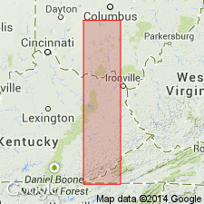
Geographically extended to the subsurface of KY and OH. 378 feet thick in northeast KY and 180 feet thick in south-central OH. Consists of a lower sandy member and an upper argillaceous member. Overlies Copper Ridge Dolomite; underlies Lambs Chapel Dolomite. Chepultepec is considered lowest formation in Beekmantown Group and a part of the Knox Dolomite Supergroup.
Source: GNU records (USGS DDS-6; Reston GNULEX).
- Usage in publication:
-
- Chepultepec Dolomite Member
- Modifications:
-
- Revised
- AAPG geologic province:
-
- Appalachian basin
Summary:
Reduced the rank of the Chepultepec to the Chepultepec Dolomite Member of the Beekmantown Formation. Revision shows up on figure 3 for the southern Appalachian region but is not discussed in text. Unit overlies the Copper Ridge Dolomite and underlies the Longview Dolomite Member of the Beekmantown Formation.
Source: GNU records (USGS DDS-6; Reston GNULEX).
- Usage in publication:
-
- Chepultepec Dolomite
- Modifications:
-
- Areal extent
- AAPG geologic province:
-
- Appalachian basin
Summary:
Although Butts (1926) suggested that the Knox Group in this area [Talladega and Calhoun Cos, AL] included Copper Ridge and Chepultepec Dolomites, criteria used to define these units in adjacent areas cannot be applied. Therefore, this nomenclature should not be used in report area.
Source: GNU records (USGS DDS-6; Reston GNULEX).
- Usage in publication:
-
- Chepultepec
- Modifications:
-
- Not used
- AAPG geologic province:
-
- Appalachian basin
Summary:
The Chepultepec is not used in the subsurface of central-western VA in section F-F'. Authors feel that unit cannot be recognized in the part of the Appalachian basin; the dolomite that usually makes up the upper part of the unit cannot be distinguished from the dolomite of the rest of the upper part of the Knox Group. The lower dolomite and sandstone usually assigned to the Chepultepec is considered as the upper part of the Copper Ridge Dolomite.
Source: GNU records (USGS DDS-6; Reston GNULEX).
For more information, please contact Nancy Stamm, Geologic Names Committee Secretary.
Asterisk (*) indicates published by U.S. Geological Survey authors.
"No current usage" (†) implies that a name has been abandoned or has fallen into disuse. Former usage and, if known, replacement name given in parentheses ( ).
Slash (/) indicates name conflicts with nomenclatural guidelines (CSN, 1933; ACSN, 1961, 1970; NACSN, 1983, 2005, 2021). May be explained within brackets ([ ]).