- Usage in publication:
-
- Cedar Gulch Formation
- Modifications:
-
- Named
- Dominant lithology:
-
- Gneiss
- Granite
- AAPG geologic province:
-
- Southern Rocky Mountain region
Summary:
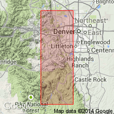
Name taken from first minor south drainage (Cedar Gulch] upon entering Golden Gate Canyon. Type area is along mountain front and in SW1/4 sec 20 and NE1/4 sec 29, T3S, R70W, Golden quad, Jefferson Co, CO in Southern Rocky Mountain region. Called microcline-quartz-plagioclase gneiss in earlier reports. Forms craggy, rugged topography. Is 4,000 ft thick in the type area. Thins to west and northwest. Is 4,000 ft thick in type area. Thins to west and northwest. Consists mainly of medium-textured, biotitic granite gneiss to gneissic granite. Coarse-grained, concordant and discordant pegmatites occur throughout; some as much as 50 ft thick. Lenses and expanded pods of quartz occur in granitic phases. Overlies Golden Gate Canyon Formation (new). Underlies Clear Creek Canyon Formation (new). Geologic map. Cross section. Precambrian in age.
Source: GNU records (USGS DDS-6; Denver GNULEX).

- Usage in publication:
-
- Cedar Gulch Formation
- Modifications:
-
- Overview
- AAPG geologic province:
-
- Southern Rocky Mountain region
Summary:
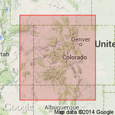
Is one of several units defined in a narrow belt along the east-central Front Range, near Golden, Jefferson Co, CO in Southern Rocky Mountain region. Of doubtful use elsewhere. Assumed direction of stratigraphic sequence is debatable. Belongs with pre-1,700 m.y. metamorphic complex, or of Precambrian X age.
Source: GNU records (USGS DDS-6; Denver GNULEX).
For more information, please contact Nancy Stamm, Geologic Names Committee Secretary.
Asterisk (*) indicates published by U.S. Geological Survey authors.
"No current usage" (†) implies that a name has been abandoned or has fallen into disuse. Former usage and, if known, replacement name given in parentheses ( ).
Slash (/) indicates name conflicts with nomenclatural guidelines (CSN, 1933; ACSN, 1961, 1970; NACSN, 1983, 2005, 2021). May be explained within brackets ([ ]).

