

- Usage in publication:
-
- Cave Hill Member
- Modifications:
-
- Named
- Dominant lithology:
-
- Shale
- Limestone
- AAPG geologic province:
-
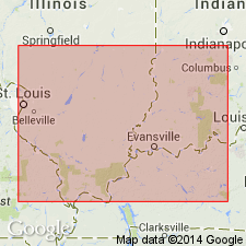
- Illinois basin
Summary:
Named as middle member of Kinkaid Formation. Named for Cave Hill, about 4 mi northeast of Rudemont, Saline Co., southeastern IL. Consists of shale and limestone with shale beds at its boundaries. Unit is 85 to 90 ft thick near type but is thickened to 108 ft by tectonic squeezing in type section, which is in synclinal axis of drag of large fault. Overlies Negli Creek Member; underlies Goreville Member. Age is Late Mississippian (Elviran) age.
Source: GNU records (USGS DDS-6; Reston GNULEX).

- Usage in publication:
-
- Cave Hill Member
- Modifications:
-
- Overview
- AAPG geologic province:
-
- Illinois basin
Summary:
Authors here revise Grove Church Shale (of Swann, 1963) as Grove Church Member of Kinkaid Limestone as it does not meet the test of mappability required by the 1983 Code. Interbedded shale and limestone of the Grove Church are lithologically similar to the rest of the Kinkaid and therefore unit is assigned as upper member. Kinkaid then is subdivided into (ascending) Negli Creek Limestone, Cave Hill, Goreville Limestone and Grove Church Members. Cave Hill is divisible into three lithologic units in the study area and elsewhere in southern IL. Lower unit is greenish gray shale and siltstone; middle unit is predominantly sublithographic to fine-grained limestone, interbedded with shale; and upper unit is red and green, variegated claystone, interbedded with thin limestone. Cave Hill ranges from 55 ft, where eroded, to 75 to 95 ft thick. Age is Chesterian.
Source: GNU records (USGS DDS-6; Reston GNULEX).
For more information, please contact Nancy Stamm, Geologic Names Committee Secretary.
Asterisk (*) indicates published by U.S. Geological Survey authors.
"No current usage" (†) implies that a name has been abandoned or has fallen into disuse. Former usage and, if known, replacement name given in parentheses ( ).
Slash (/) indicates name conflicts with nomenclatural guidelines (CSN, 1933; ACSN, 1961, 1970; NACSN, 1983, 2005, 2021). May be explained within brackets ([ ]).