The National Geologic Map Database is migrating to a new infrastructure. We apologize for any service disruptions during this process.
|
|---|


- Usage in publication:
-
- Catron formation*
- Modifications:
-
- Original reference
- Dominant lithology:
-
- Shale
- Sandstone
- Coal
- AAPG geologic province:
-
- Appalachian basin
Summary:
Pg. 33, 41, 207, and pl. XLA. Catron formation of Pottsville group. Shales, sandstones, and coals, 300 to 400 feet thick, overlying Mingo formation and underlying Hignite formation in Cumberland Gap coal field. In Log Mountains top of formation is defined by bottom of Lower Hignite coal and base by bottom of Poplar Lick coal. In Black Mountains the Hignite coal is missing and top of formation is defined by top of Jesse sandstone member and base by base of Wallins Creek coal (may = Poplar Lick coal). Probably included in Lower Kanawha of New River. Age is Pennsylvanian.
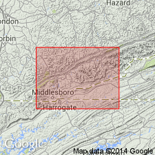
[Named from Catron Creek, Bell Co., southeastern KY. Extends into northeastern TN.]
Source: US geologic names lexicon (USGS Bull. 896, p. 373).
- Usage in publication:
-
- Catron formation*
- Modifications:
-
- Areal extent
- AAPG geologic province:
-
- Appalachian basin
Summary:
Pg. 96-99, 138. Catron formation. Underlies Hignite formation; overlies Mingo formation. Report contains measured section, correlation charts, and plates.
Source: US geologic names lexicon (USGS Bull. 1200, p. 677).

- Usage in publication:
-
- Catron formation*
- Modifications:
-
- Overview
- AAPG geologic province:
-
- Appalachian basin
Summary:
USGS currently [ca. 1960] classifies the Catron as a formation in Breathitt Group on the basis of a study now in progress. [See K.J. Englund and others, 1961, USGS Geol. Quad. Map GQ-172, 1 sheet, scale 1:24,000 (http://ngmdb.usgs.gov/Prodesc/proddesc_620.htm); K.J. Englund and others, 1963, USGS Bull. 1142-B (http://ngmdb.usgs.gov/Prodesc/proddesc_20876.htm).] Age is Middle Pennsylvanian.
Named from exposures on Coon Branch of Catron Creek in Black Mountains, Harlan Co., southeastern KY.
Source: US geologic names lexicon (USGS Bull. 1200, p. 677).
- Usage in publication:
-
- Catron Formation*[†]
- Modifications:
-
- [Abandoned]
- AAPG geologic province:
-
- Appalachian basin
Summary:
[See p. A38-A39, A43 (fig. 9). †Catron Formation of Breathitt Group. In middle part of Breathitt Group, between the †Hignite (above) and †Mingo Formations, along Pine Mountain Fault, in southeasternmost Kentucky, and bordering area of Tennessee and Virginia. Is not formally abandoned herein but its use is clearly discontinued; it is not distinguishable on basis of lithic character and cannot be traced laterally with consistency. As originally defined, base was placed at base of Poplar Lick coal in the west and base of Wallins Creek coal in the east, which were thought to be correlative, but the Poplar Lick is as much as 350 feet lower in section (see Rice and Smith, 1980). The top has been placed at several stratigraphic levels (Jesse Sandstone Member, Magoffin beds of Morse (1931), and Limestone, Pardee, and Hignite coal beds). Rocks of the †Catron are transferred to the Breathitt Formation (reduced in rank to conform with USGS usage elsewhere).
The Catron was formally abandoned by Rice and others in their glossary (1994, GSA Spec. Paper 294, p. __, citing McDowell and others, 1985).]
Source: Publication.
For more information, please contact Nancy Stamm, Geologic Names Committee Secretary.
Asterisk (*) indicates published by U.S. Geological Survey authors.
"No current usage" (†) implies that a name has been abandoned or has fallen into disuse. Former usage and, if known, replacement name given in parentheses ( ).
Slash (/) indicates name conflicts with nomenclatural guidelines (CSN, 1933; ACSN, 1961, 1970; NACSN, 1983, 2005, 2021). May be explained within brackets ([ ]).