

- Usage in publication:
-
- Catoctin schist*
- Modifications:
-
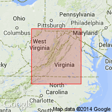
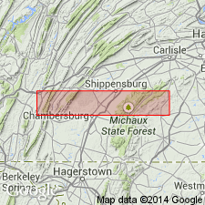
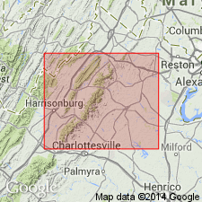
- Areal extent
- Dominant lithology:
-
- Schist
- AAPG geologic province:
-
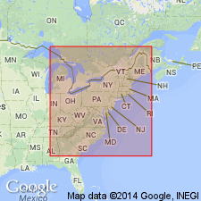
- Appalachian basin
Summary:
Pg. 155-164. Catoctin schist underlies Shenandoah limestone. No fossils found. [Age is pre-Cambrian.]
Source: US geologic names lexicon (USGS Bull. 896, p. 373).
- Usage in publication:
-
- Catoctin schist*
- Modifications:
-
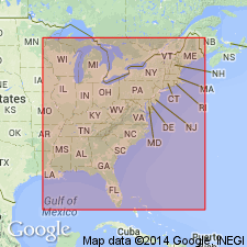
- Areal extent
- AAPG geologic province:
-
- Appalachian basin
Summary:
Pg. 306 and map. Catoctin schist, Algonkian, 1,000 feet thick. Occupies three-fifths of area of Catoctin belt thus far mapped and a considerable portion of South Mountain belt in Pennsylvania.
[According to map Catoctin Mountain, Virginia, is composed of this schist.]
Source: US geologic names lexicon (USGS Bull. 896, p. 373).
- Usage in publication:
-
- Catoctin schist*
- Modifications:
-
- Principal reference
- Dominant lithology:
-
- Diabase
- Granite
- Schist
- AAPG geologic province:
-
- Piedmont-Blue Ridge province
Summary:
Pg. 2. Catoctin schist. Altered diabase, with lenses of epidote and quartz, and associated with great masses of interbedded eruptive granite. Three varieties of schist are recognized: one of coarser texture, associated with the granite, one of fine grain, with large lenses of epidote and quartz, and one with quartz and epidote amygdules, occurring along the boundaries of the other two varieties. Light bluish green when fresh, dull grayish yellow when weathered. Thickness more than 1,000 feet. Oldest exposed formation in region. Underlies Loudoun formation. [Age is pre-Cambrian (Algonkian).]
[Also called Catoctin greenstone.]
Source: US geologic names lexicon (USGS Bull. 896, p. 373).

- Usage in publication:
-
- Catoctin schist*
- Modifications:
-
- Overview
- AAPG geologic province:
-
- Appalachian basin
Summary:
Catoctin schist (also called Catoctin greenstone). Recognized in northeastern West Virginia, northern Virginia, and western Maryland. Age is pre-Cambrian.
Named from Catoctin Mountain, Loudoun Co., VA, and Frederick Co., MD.
Source: US geologic names lexicon (USGS Bull. 896, p. 373).
- Usage in publication:
-
- Catoctin metabasalt*
- Modifications:
-
- Age modified
- AAPG geologic province:
-
- Appalachian basin
Summary:
Summarizes historical arguments about age of Catoctin and granitic rocks (termed an injection complex by the authors) in Catoctin Mountain-Blue Ridge anticlinoria. Keith (1894) believed the granitic rocks were younger than lava flows of Catoctin metabasalt. This view was also expressed on the geologic map of Virginia (Virginia Geological Survey, 1928). Jonas (1933, 1935) stated that metabasalt was poured out over granodiorite (part of injection complex) and that metadiabase dikes genetically related to metabasalt cut injection complex. Furcron (1934) concluded metabasalt was older than granite and granodiorite and cites a locality where granodiorite appears to intrude the flows (Shenandoah National Park Highway, 1.1 mi east of Swift Run Gap). Authors found no such relationship at that locality. Their conclusion is that the older injection complex was metamorphosed and folded during granite invasion. The younger Catoctin metabasalt was extruded on a floor made up of injection complex rocks. Sills and dikes of ferromagnesian rocks paragenetic with the flows intrude volcanic series. Metadiabase dikes related to basalt, and dikes related to rhyolite cut injection complex with sharp contacts.
Source: GNU records (USGS DDS-6; Reston GNULEX).
- Usage in publication:
-
- Catoctin metabasalt*
- Modifications:
-
- Age modified
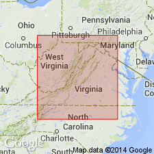
- Areal extent
- AAPG geologic province:
-
- Piedmont-Blue Ridge province
Summary:
Catoctin metabasalt is exposed in mountainous area between South and Catoctin Mountains in Frederick Co., north-central MD. In northern half of county, forms one belt 5-6 mi wide; south of US Hwy 40, forms two narrow belts adjacent to South and Catoctin Mountains. Includes green lava flows, hornblende schist, and tuffaceous beds. Injection complex (basement rocks) are intruded by metadiabase dikes thought to be genetically related to Catoctin metabasalt. Catoctin completely surrounds bodies of aporhyolite that crop out in two north-trending belts. Loudoun formation overlies Catoctin in northern VA; north of Potomac River, Loudoun unconformably overlies Catoctin and Swift Run tuff. Swift Run tuff underlies Catoctin. Relative age of aporhyolite and metabasalt is unclear; in places, it seems aporhyolite intrudes metabasalt; in other places, structural relations indicate it may have preceded metabasalt. Authors believe that volcanic rocks were deposited and extruded on a floor made up of much older injection complex. Volcanic rocks are not intruded by granite. Swift Run tuff rests on injection complex with sedimentary contact east of Swift Run Gap, VA and in Frederick Co., MD, and remains at constant horizon at contact of Catoctin with injection complex throughout VA. Age of Catoctin is late Precambrian; it is younger than injection complex and older than Loudoun.
Source: GNU records (USGS DDS-6; Reston GNULEX).
- Usage in publication:
-
- Catoctin formation
- Modifications:
-
- Age modified
- Areal extent
- AAPG geologic province:
-
- Piedmont-Blue Ridge province
- Appalachian basin
Summary:
Study of Catoctin formation between Botetourt and Nelson Cos., central VA, disclosed evidence indicating Cambrian age. In northeast part of Buena Vista quad, Catoctin is underlain by conglomerate, arkosic sandstone, tuff, and andesite, all metamorphosed to the southwest into quartzite, phyllite, and slate. These rocks were termed Oronoco formation by Bloomer (1942, unpub. data); they in turn overlie Precambrian basement rocks (hypersthene granodiorite). Where Oronoco is absent, Catoctin overlies granodiorite. In northern VA, Catoctin is overlain by Lower Cambrian Loudoun formation, in part equivalent to Unicoi formation of central and southern VA. In study area, however, Unicoi rests on basement complex, not on Catoctin. Oronoco underlies Catoctin in study area except where overthrust onto Unicoi. Oronoco thins northwestward until Catoctin rests directly on basement complex. Overlapping relationship between Oronoco, Catoctin, and Unicoi is implied. In addition, authors note constrainment of age of Unicoi by Early Cambrian fossils in overlying Erwin formation. Age constrainment, lithologic similarity between parts of Catoctin and underlying Oronoco, and observation that each of the three formations rests over basement complex in various areas leads authors to suggest that all three formed under similar conditions, are a continuous stratigraphic series interrupted in places by basement rocks, and are thus probably the same age.
Source: GNU records (USGS DDS-6; Reston GNULEX).
- Usage in publication:
-
- Catoctin formation
- Modifications:
-
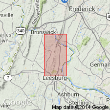
- Areal extent
- AAPG geologic province:
-
- Piedmont-Blue Ridge province
Summary:
Catoctin formation is exposed in two parallel belts that extend into central Virginia. One belt caps main mass of the Blue Ridge, and the other occurs in an alignment of ridges about 20 mi to the southeast. In central Virginia, northwestern belt of Catoctin is thrust upon Chilhowee group, but farther northeast it underlies the Loudoun. In some places, the Catoctin in northwestern belt overlies the Swift Run or granitized complex. Elsewhere, the granitized complex has been thrust upon the Catoctin and base is unexposed. Catoctin in central Virginia is exposed on both limbs of major anticlinal fold that has been truncated by erosion, at least, to combined thickness of Catoctin and Lynchburg formations. Generally believed that there is significant hiatus between Catoctin and Chilhowee. The Catoctin and concordantly underlying Lynchburg and Swift Run formations are defined as late Precambrian and the Chilhowee as Lower Cambrian. However, there is evidence of continuous sequence from the base of the Lynchburg into Chilhowee.
Source: GNU records (USGS DDS-6; Reston GNULEX).
- Usage in publication:
-
- Catoctin formation*
- Modifications:
-
- Age modified
- Areal extent
- AAPG geologic province:
-
- Appalachian basin
Summary:
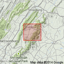
Report covers Luray area, Page Co., northwest VA. Catoctin formation is well exposed on western slopes of Blue Ridge and in deep stream canyons on gentler eastern slopes. Catoctin is absent for 5 mi between Thornton Gap and Stony Man due to erosion. Catoctin described as fine-grained green, blue, purple, or gray greenstone with interbeds of arkose, graywacke, and conglomerate derived from underlying granitic rocks and sericite phyllites derived from volcanic ash layers. Catoctin overlies either hypersthene granite (Stose and others, 1928) or Old Rag granite (Furcron, 1934). Catoctin flows rest on eroded surface of these basement rocks, some of which have relief of up to 1000 ft. Hills of granitic stocks buried by Catoctin and exposed in valleys of Whiteoak Run and Rose Run superficially resemble stocks intruding Catoctin, but widespread basal sedimentary layer of Catoctin, containing gneiss and granite pebbles, shows contact to be sedimentary. Previous workers in region described localities where they believed granitic rocks intruded Catoctin; author was not able to find them, but did see several places where hurried examination might suggest this relationship. Although several workers have suggested an unconformity at top of Catoctin, recent work provides evidence that there was no time break between deposition of Catoctin and overlying Chilhowee rocks. Catoctin may be as young as early Cambrian, but evidence is still inconclusive.
Source: GNU records (USGS DDS-6; Reston GNULEX).
- Usage in publication:
-
- Catoctin greenstone
- Modifications:
-
- Areal extent
- AAPG geologic province:
-
- Piedmont-Blue Ridge province
Summary:
Although Catoctin greenstone and Lynchburg gneiss are designated as late Precambrian by the author, he also emphasizes that they are rock units with general time connotations. Catoctin, although a relatively discrete unit in Blue Ridge and northwestern Piedmont, is transgressive and intertonguing elsewhere in Piedmont. In Lynchburg quad, where interlayered metasediment locally predominates over greenstone, the name Catoctin is restricted to greenstones; metasediments are assigned to either Lynchburg or Candler, depending on lithology. Catoctin of Carter Mountain belt extends, with breaks, diagonally across Lynchburg quad and crops out along west flank of James River synclinorium. From there, it dips southeastward beneath rocks of this synclinorium and emerges on the east flank, about the Sherwill anticline in southeast part of quad. On west flank of synclinorium, Catoctin is interlayered with Lynchburg rocks; on east flank, Catoctin occurs between Lynchburg and overlying Candler formation, as well as within broad belt of Candler on east flank. These relationships show that 1) Candler-type sedimentation took place to the southeast while Lynchburg-type sedimentation took place to the northwest, 2) Catoctin volcanism continued longer in the southeast than in the northwest, or 3) both conditions occurred.
Source: GNU records (USGS DDS-6; Reston GNULEX).
- Usage in publication:
-
- Catoctin greenstone
- Modifications:
-
- Age modified
- Areal extent
- AAPG geologic province:
-
- Appalachian basin
Summary:
Controversy in placement of Precambrian-Cambrian boundary in the Swift Run-Catoctin-Chilhowee sequence (King, 1950) or Lynchburg-Catoctin-Candler sequence (Brown, 1958), and the problems posed by lithologically similar Oronoco, Catoctin, and Unicoi formations (Bloomer and Werner, 1947, 1955) have led the author to assign an indefinite age of Cambrian or Precambrian to both Swift Run formation and Catoctin greenstone in this report in accordance with policy of Virginia Division of Mineral Resources. In Rockingham Co. (northwestern VA), Catoctin greenstone outcrops extend from crest of Blue Ridge down to the lower western slopes. Good exposure may be seen along US Hwy 33 about 0.75 mi west of Skyline Drive at Swift Run Gap. Report contains geologic map, structure sections, and detailed table of geologic formations in Rockingham Co.
Source: GNU records (USGS DDS-6; Reston GNULEX).
- Usage in publication:
-
- Catoctin greenstone
- Modifications:
-
- Age modified
- Mapped
- AAPG geologic province:
-
- Piedmont-Blue Ridge province
Summary:
In Albemarle Co., western VA, Catoctin greenstone is mapped in two belts. Northwestern belt follows crest of Blue Ridge, southeastern belt makes up Southwestern Mountain, and both belts occur on respective flanks of Southwest Mountain-Blue Ridge anticlinorium. Best exposure of entire Catoctin section is on US Hwy 250 from Tuckahoe Motor Court in Albemarle Co., to 100 yds west of Blue Ridge Parkway overpass in Rockfish Gap in Nelson Co. Formation is 6800 ft thick and is overturned. Good exposures occur along Skyline Drive from Scott Mountain to Calf Mountain, at Jarmans Gap, and 2.25 mi north of Browns Gap. Catoctin is deeply weathered in Southwestern Mountain belt, but best exposure may be seen along C and O Railway from Charlottesville to Shadwell where it follows Rivanna River as it cuts through Southwestern Mountain. Basal conglomerate is present in places. Although past workers have placed Catoctin at top of Precambrian section, recent work in Albemarle Co. and adjacent areas, as well as age determinations on different rocks in southern Appalachians indicate that top of Precambrian in this area is Virginia Blue Ridge complex, composing core of Blue Ridge Mountains; it in turn is overlain by Precambrian or Cambrian Swift Run formation, Catoctin greenstone, and Loudoun formation.
Source: GNU records (USGS DDS-6; Reston GNULEX).
- Usage in publication:
-
- Catoctin Greenstone
- Modifications:
-
- Revised
- AAPG geologic province:
-
- Piedmont-Blue Ridge province
Summary:
Vokes (1957) uses Swift Run as tuff member of Catoctin Greenstone in MD; however, green chlorite schist at or near base of Catoctin, as seen west of Middletown, MD, on US Hwy 40, may be found at almost any Catoctin locality and belongs to Catoctin rather than Swift Run. Some prefer to include lower Catoctin flows and interbedded arkose with Swift Run. Top of Swift Run and base of Catoctin may be difficult to establish in some localities. In Charlottesville, VA, sericite tuff under Catoctin, in turn underlain by tuffaceous arkose composed of fragmented Lynchburg over Lynchburg [Group] rocks establishes it as a definite formation.
Source: GNU records (USGS DDS-6; Reston GNULEX).
- Usage in publication:
-
- Catoctin Formation*
- Modifications:
-
- Age modified
- Geochronologic dating
- AAPG geologic province:
-
- Piedmont-Blue Ridge province
- Appalachian basin
Summary:
Five zircon samples from PA, VA, and NC yield discordant U-Pb ages suggesting original age of 820 m.y. Samples of felsic volcanic rocks were taken from Grandfather Mountain Formation in northwestern NC, Mount Rogers Formation in southwestern VA, and Catoctin Formation in southernmost PA. All in turn rest on billion-year-old rocks and are overlain by Lower Cambrian(?) rocks of Chilhowee Group. From the coherence of concordia of the samples, authors suggest that felsic volcanism in the Blue Ridge is essentially coeval and that the Grandfather Mountain Formation, Mount Rogers Formation, and Catoctin Formation north of Potomac River in MD and PA are Precambrian rather than Cambrian. A major hiatus is inferred between felsic volcanism and deposition of Chilhowee rocks. In addition, granitic basement of the Blue Ridge is everywhere older than 820 m.y. and, as a corollary, all stratified units unconformably overlying basement are younger than 1050 m.y. (based on two zircon samples from basement rocks under Grandfather Mountain Formation dated by Davis and others, 1962).
Source: GNU records (USGS DDS-6; Reston GNULEX).
- Usage in publication:
-
- Catoctin Formation
- Modifications:
-
- Geochronologic dating
- AAPG geologic province:
-
- Piedmont-Blue Ridge province
- Appalachian basin
Summary:
Isotopic ages of metarhyolite samples from Catoctin Formation are summarized in table 2. Three samples from South Mountain in Adams Co., dated by Pb-Pb or Pb-U methods, indicate probable actual age of 820 m.y. (Rankin and others, 1969) and indicate episodic Pb loss at 240 m.y. Another sample from South Mountain (probably right at Adams-Cumberland Co. line) yields an uncorrected probably actual age of 850(?) m.y. (Jaffe and others, 1959). The following are from unpublished data by the Pennsylvania Geologic Survey, are reported apparent ages only, and have not been evaluated: Catoctin metarhyolite from South Mountain, dated by Rb-Sr methods, yields an age of 324 +/-10 m.y. Three Catoctin metarhyolite samples from South Mountain in Adams Co. yield ages of 306 +/-4 m.y. (by K-Ar methods), 269 +/-3 m.y. (by K-Ar methods), and 261 +/-10 m.y. (by Rb-Sr methods). Two interpretations exist for the whole-rock metarhyolite dates at 324 and 326 m.y. They may represent an actual thermal event, possibly Acadian or Alleghanian, or they may be fictitious ages resulting from mixed mineral ages or from partially re-equilibrated minerals.
Source: GNU records (USGS DDS-6; Reston GNULEX).
- Usage in publication:
-
- Catoctin Formation*
- Modifications:
-
- Revised
- AAPG geologic province:
-
- Appalachian basin
- Piedmont-Blue Ridge province
Summary:
Catoctin Formation newly assigned to Crossnore Volcanic-Plutonic Complex, considered a formal name in this report. Zr from 5 samples of rhyolite give a discordia intercept age of 810 Ma.
Source: GNU records (USGS DDS-6; Reston GNULEX).
- Usage in publication:
-
- Catoctin Formation
- Modifications:
-
- Age modified
- Geochronologic dating
- AAPG geologic province:
-
- Piedmont-Blue Ridge province
Summary:
Robertson River pluton crystallized approx. 730 m.y. ago, based on U-Pb ages from zircons. This age conflicts with Mose and Nagel (1984; same volume) who report Rb-Sr age of 570 +/-15 m.y. Most problematic aspect of U-Pb dates is effect on age of Catoctin Formation. The 820 m.y. age reported by Rankin and others (1969) from Catoctin in PA and equivalent rocks in VA and NC has been corrected for differences in half-lives to yield an age of 790 m.y., definitely older than 730 m.y. age of Robertson River pluton and in conflict with most reasonable interpretations of field data for relative ages. Authors believe the 790 m.y. age for Catoctin is not representative because it is controlled largely by samples from rocks in VA and NC (Grandfather Mountain and Mount Rogers Formations) whose equivalence to Catoctin cannot be precisely established. Catoctin rocks from PA yielded a Pb-Pb age of 700 m.y.; adjustments for half-life values reduces it to 686 m.y., making the Catoctin more consistent with isotopic data from Robertson River pluton and age relationships determined from field evidence. In addition, cobbles and boulders similar to granite from Roberston River pluton are present near base of Fauquier (Lynchburg) Formation (which underlies Catoctin Formation) and its probable correlative, Mechum River Formation. This indicates Catoctin is younger than Robertson River pluton. [See Mose and Nagel, 1984, same volume.]
Source: GNU records (USGS DDS-6; Reston GNULEX).
- Usage in publication:
-
- Catoctin Formation
- Modifications:
-
- Age modified
- Geochronologic dating
- AAPG geologic province:
-
- Piedmont-Blue Ridge province
Summary:
Catoctin Formation is overlain by rocks of Chilhowee Group. Chilhowee consists of nonmarine clastics grading up to shallow marine rocks, and upper part of Chilhowee contains Early Cambrian fossils (Walcott, 1981; Woodward, 1949), so lower part is considered latest Precambrian or earliest Cambrian. Most recent work using accepted decay constants indicates Early Cambrian time began about 560 m.y. ago (Cowie and Cribb, 1978). Thus, stratigraphic relations between Chilhowee and Catoctin indicates Catoctin is no younger than 560 m.y. No widespread disconformity has been seen between Chilhowee and Catoctin, which indicates that age of lower Chilhowee and underlying Catoctin is latest Precambrian or Early Cambrian. However, U-Pb data from zircon in Catoctin from PA, and zircon ages from related rocks in southwest VA and western NC yield concordia U-Pb age of 820 m.y. (Rankin and others, 1969). Inferred Proterozoic age for Catoctin supports evidence for erosional unconformity between Catoctin and Chilhowee. Metabasalt dikes, interpreted as feeder dikes from Catoctin metabasalt flows, cut Robertson River pluton, dated at 570 +/-15 m.y. by Rb-Sr methods. In particular, metabasalt sample V-12 from dike in the pluton is isotopically and chemically identical to Catoctin; age of Robertson River pluton therefore provides maximum age of Catoctin. Chilhowee and Roberston River ages indicate age of Catoctin as 580 to 560 m.y. old. [See Lukert and Banks, same volume.]
Source: GNU records (USGS DDS-6; Reston GNULEX).

- Usage in publication:
-
- Catoctin Formation
- Modifications:
-
- Overview
- AAPG geologic province:
-
- Piedmont-Blue Ridge province
Summary:
Catoctin divided into seven mappable lithologic units in the Blue Ridge anticlinorium: metabasalt (most widespread unit), hyaloclastite pillow breccia, purple tuffaceous phyllite, metasedimentary rocks, metarhyolite, high-titanium metabasalt breccia, and low-titanium metabasalt breccia. Conformably underlies laminated metasiltstone of the Candler Formation. Age of the Catoctin shown as Late Proterozoic and Cambrian.
Source: GNU records (USGS DDS-6; Reston GNULEX).
- Usage in publication:
-
- Catoctin Formation*
- Modifications:
-
- Revised
- AAPG geologic province:
-
- Piedmont-Blue Ridge province
Summary:
Reed (1955) demonstrated that basalts of Catoctin Formation were erupted on an irregular erosion surface and that as much as 45 m of sedimentary rock, indistinguishable from basalt, locally underlies the basalt. Sedimentary rocks include poorly sorted arkose, conglomerate containing basement clasts, and purple and green phyllite. Gathright (1976), Gathright and other (1977) have mapped these sedimentary rocks as Swift Run Formation, but note that they grade into and interfinger with Catoctin. King (1970) points out that the sedimentary rocks are probably of different ages because of overlap onto the irregular erosion surface. Problems arise when one attempts to correlate rocks called Swift Run with sedimentary, or sedimentary and volcanic, units on southeast limb of Blue Ridge anticlinorium, because correlation commonly leads to unnecessary restrictions or ambiguities (Bloomer and Werner, 1955; Wehr, 1985). The preferable approach is that of Reed (1955) who included within Catoctin both basal sedimentary beds and sedimentary rocks interlayered with basalt. Report includes geologic maps, correlation chart, and isotopic data.
Source: GNU records (USGS DDS-6; Reston GNULEX).
- Usage in publication:
-
- Catoctin Formation*
- Modifications:
-
- Age modified
- Geochronologic dating
- AAPG geologic province:
-
- Appalachian basin
- Piedmont-Blue Ridge province
Summary:
Zircon U-Pb geochronology yields the following ages: 759+/-7 Ma for rhyolite of Mount Rogers Formation; 572+/-5 Ma for a hypabyssal felsic dike of Catoctin Formation; 564+/-9 Ma for rhyolite of Catoctin; and 1.1 Ga for detrital zircon in metarhyolite of Catoctin. Volcanic rocks of Mount Rogers and Catoctin differ in age by about 200 m.y., invalidating previous geochronology that combined U-Pb data to derive an upper intercept age of about 810 Ma (Rankin and others, 1983). Therefore, age of Catoctin is now considered Late Proterozoic and Early Cambrian.
Source: GNU records (USGS DDS-6; Reston GNULEX).
- Usage in publication:
-
- Catoctin Formation*
- Modifications:
-
- Geochronologic dating
- AAPG geologic province:
-
- Piedmont-Blue Ridge province
Summary:
Catoctin in these two quads is mostly metabasalt, but in its lower part (best exposed in lower Catoctin Creek), it also contains actinolitic metabasalt or metadiabase; white lustrous, fine-grained quartz-muscovite schist interpreted as metamorphosed tuff or tuffaceous metasediment; greenish or bluish-white, buff-weathering, fine- to medium grained calcite marble; and yellow, white-weathering, fine- to medium-grained plagioclase-quartz sandstone. Farther south, only marble and discontinuous horizons of metasandstone were mapped in lower part of the Catoctin, whereas tuffaceous horizons may have their lateral equivalent in the Swift Run Formation. Upper part of Catoctin contains a quartzose phyllite unit, best exposed in upper Limestone Branch. A rhyolite dike cutting adjacent greenstone dike yielded a U-Pb zircon age of 571 +/-5 Ma and helps establish a reasonable age for rhyolite flows of the Catoctin. Rhyolite flows within Catoctin Formation from Virginia and South Mountain, PA, yielded U-Pb zircon ages of about 600 Ma and 597 +/-18 Ma, respectively (Aleinikoff and others, 1991, GSA Abstracts with Programs, v. 23, no. 1, p. 2; and J.N. Aleinikoff, 1993, written commun.). Age is Late Proterozoic and Early Cambrian. Report includes geologic map, cross sections, and correlation chart.
Source: GNU records (USGS DDS-6; Reston GNULEX).
For more information, please contact Nancy Stamm, Geologic Names Committee Secretary.
Asterisk (*) indicates published by U.S. Geological Survey authors.
"No current usage" (†) implies that a name has been abandoned or has fallen into disuse. Former usage and, if known, replacement name given in parentheses ( ).
Slash (/) indicates name conflicts with nomenclatural guidelines (CSN, 1933; ACSN, 1961, 1970; NACSN, 1983, 2005, 2021). May be explained within brackets ([ ]).