

- Usage in publication:
-
- Carrizo sandstone
- Modifications:
-
- Original reference
- Dominant lithology:
-
- Sandstone
- AAPG geologic province:
-
- Gulf Coast basin
Summary:
Pg. 70, 73-74. Carrizo sandstone. A line drawn from point on Neuces River south of town of Uvalde to point 10 miles west of Carrizo Springs, thence south to Rio Grande, will represent outcrop of a very loose, coarse, friable sand bed nearly 200 feet thick. Supplies the numerous wells at Carrizo Springs. Lies conformably on late Cretaceous rocks. West line of Dimmit County passes near western limit of Carrizo sandstone. Top stratum, 40 feet of red sand; base, gray and brown sand; some of more indurated strata answer for building stone. [Age is middle Eocene.]
Source: US geologic names lexicon (USGS Bull. 896, p. 354).
- Usage in publication:
-
- Carrizo sands
- Modifications:
-
- Revised
- AAPG geologic province:
-
- Gulf Coast basin
Summary:
Pg. 924-932. Carrizo sands. Interbedded sands and sandy clays, of white or yellow color, containing ferruginous matter and nodules, strings of concretions and laminae. Sands somewhat calcareous and in places indurated to buff sandstone excellently adapted for building purposes. Included in top of Lignitic [Wilcox group]. Stratigraphic equivalent of Queen City beds of Kennedy. Overlie series of red and white clays with iron, forming middle part of Lignitic. In places overlap underlying Lignitic beds and Midway. Underlie Lower Claiborne stage. [In 1911 (Texas Acad. Sci. Trans., v. 11, p. 52-53) Dumble included these deposits in the Claiborne.] [Age is middle Eocene.]
Source: US geologic names lexicon (USGS Bull. 896, p. 354).
- Usage in publication:
-
- Carrizo sandstone
- Modifications:
-
- Principal reference
- Biostratigraphic dating
- AAPG geologic province:
-
- Gulf Coast basin
Summary:
The age of Carrizo sandstone has heretofore been somewhat uncertain. Referred originally to the Wilcox it has been considered by several Texas geologists to be of Claiborne age. The plants found in it, as well as those found above and below it near Rio Grande, definitely settle it upper Wilcox age, and show that it is in nature of a lens, which becomes thinner toward Rio Grande, where its upper part is replaced with more typical and more argillaceous. Wilcox deposits, also carrying characteristic fossil plants. [Age is middle Eocene.]
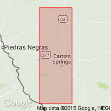
Type exposure: in quarries about 0.5 mi west of Carrizo Springs, Dimmit Co., southern TX.
Source: US geologic names lexicon (USGS Bull. 896, p. 354).
- Usage in publication:
-
- Carrizo sandstone*
- Modifications:
-
- Areal extent
- AAPG geologic province:
-
- Gulf Coast basin
Summary:
See also GSA Bull., v. 34, p. 75. Divided Wilcox group of southern Texas into (descending) Bigford formation, Carrizo sandstone, and Indio formation and stated that Bigford formation is in part contemporaneous with Carrizo sandstone and in part younger, and that the Carrizo rests on Indio formation with unconformity and overlap. Thickness of Carrizo 118 to 400+/- feet. [Age is middle Eocene.]
Source: US geologic names lexicon (USGS Bull. 896, p. 354).
- Usage in publication:
-
- Carrizo sands member
- Modifications:
-
- Revised
- AAPG geologic province:
-
- Gulf Coast basin
Summary:
Pg. 1339-1346. Carrizo sands member of Claiborne formation. In Texas, on western side of Sabine uplift, occurs a fine-textured, clean, white, micaceous sand below Reklaw member of Claiborne and above Wilcox formation. On the surface this sand can be traced into Carrizo sands of Milam County, eastern Texas. It is lithologically different from the Wilcox and separated from it by an unconformity. For these reasons it is placed in the Claiborne, rather than in the Wilcox. [Age is middle Eocene.]
Source: US geologic names lexicon (USGS Bull. 896, p. 354).

- Usage in publication:
-
- Carrizo sand
- Modifications:
-
- Principal reference
- AAPG geologic province:
-
- Gulf Coast basin
Summary:
Pg. 614. Owen did not designate type locality. Berry stated type locality is the outcrop in the quarries 0.5 mile west of Carrizo Springs. These quarries are now thought to lie in base of the Reklaw and not in the original series of underlying sands defined as Carrizo. Geologists working in district agree that if a type locality is to be designated, it should be the exposure known as Brand Rock on Pena Creek west of Carrizo Springs. The Carrizo sand is basal formation of Claiborne group. Grades into overlying Reklaw member of Mount Selman formation and is unconformable on Wilcox. So closely resembles the younger Queen City sand that for long time it was believed to be same as Queen City. [Age is middle Eocene.]
[GNC remark (ca. 1936, US geologic names lexicon, USGS Bull. 896, p. 354): The Carrizo sand is now assigned by most geologists to Claiborne group. (See under Mount Selman formation, 1932 and later entries.) It is treated by Texas Geol. Survey and USGS as a distinct formation underlying Mount Selman formation and overlying the Wilcox. But A. Deussen (1934 and 1936, AAPG Bull.) treated it as basal member of Mount Selman formation.]
Source: US geologic names lexicon (USGS Bull. 896, p. 354).
- Usage in publication:
-
- Carrizo sand
- Carrizo formation
- Modifications:
-
- Areal extent
- AAPG geologic province:
-
- East Texas basin
Summary:
Pg. 20 (table), 60-65 [1938]. Carrizo sand (Carrizo formation). Described in Leon County, eastern Texas, where it is about 60 feet thick. Underlies Newby glauconitic sand member (new) of Reklaw formation; overlies Sabinetown formation of Wilcox group. [Age is middle Eocene.]
Source: US geologic names lexicon (USGS Bull. 1200, p. 647-648).
- Usage in publication:
-
- Carrizo formation
- Modifications:
-
- Revised
- AAPG geologic province:
-
- Arkla basin
- East Texas basin
Summary:
Pg. 47 (fig. 1), 65-68, geol. map. In this report, Carrizo formation is considered uppermost formation in Wilcox group. Overlies Sabinetown formation; underlies Reklaw formation. [Age is middle Eocene.]
Source: US geologic names lexicon (USGS Bull. 1200, p. 647-648).
- Usage in publication:
-
- Carrizo sand*
- AAPG geologic province:
-
- Gulf Coast basin
Summary:
Pg. 37. Because of similarity of their stratigraphic position above Carrizo sand and similarity of the ferruginous beds partly composing them, Reklaw and Bigford members of Mount Selman formation have been regarded as contemporaneous. Geographic and stratigraphic positions of fossiliferous, ferruginous sandstones north of Leming, Atascosa County, southern Texas, suggest they represent eastward extension of the Bigford from Frio County. If the Leming and Scriggs Creek localities should prove to represent the same zone, then, on assumption that the conglomerate is basal part of Reklaw, it would appear that the Bigford is not exact equivalent of the Reklaw, but is older and intervenes between the Carrizo and the Reklaw. [Age is middle Eocene.]
Source: US geologic names lexicon (USGS Bull. 1200, p. 647-648).
- Usage in publication:
-
- Carrizo formation
- Carrizo sand
- Modifications:
-
- Areal extent
- AAPG geologic province:
-
- Gulf Coast basin
Summary:
Pg. 10 (fig. 3), 14 (fig. 5), 19-34. Carrizo formation (Carrizo sand). Described in Henrys Chapel quadrangle where it is 27 to 104 feet thick and consists of lower cross-bedded part and upper shaly level-bedded part. Overlies Wilcox group, locally, Henrys Chapel ball clay lentil (new); underlies Newby glauconitic sand member of Reklaw formation. [Age is middle Eocene.]
Source: US geologic names lexicon (USGS Bull. 1200, p. 647-648).

- Usage in publication:
-
- Carrizo Sand
- Modifications:
-
- Mapped 1:250k
- Dominant lithology:
-
- Sand
- AAPG geologic province:
-
- East Texas basin
Summary:
Carrizo Sand. Quartz sand, very fine- to medium-grained, silty, carbonaceous, weakly coherent, massive, locally cross-bedded, medium gray; weathers to various shades of brown and red, indurated ledges of ironstone common in upper part. Thickness 50 feet, feathers out eastward. Lies above Wilcox Group, undivided, and below Reklaw Formation. Age is Eocene.
[Mapped in Hopkins, Franklin, Camp, Titus, and western Morris Cos., northeastern TX.]
Source: Publication.
- Usage in publication:
-
- Carrizo Sand*
- Modifications:
-
- Areal extent
- AAPG geologic province:
-
- Gulf Coast basin
Summary:
Pg. D7. Carrizo Sand, basal formation of Claiborne Group. Massive to cross-bedded sand with a few partings of carbonaceous micaceous silty clay. Unconformably overlies Wilcox Group, undivided. North of Frio River, conformably underlies Reklaw Formation of Claiborne. South of the Frio, in Rio Grande embayment, underlies Bigford Formation of Claiborne. Interpreted to be nearshore fluvial deposits. Age is middle Eocene.
Traceable in Texas Coastal Plain, from a featheredge north of Sabine uplift southwestward into Rio Grande embayment, where it is 1,000+ feet thick.
Source: Publication.

- Usage in publication:
-
- Carrizo Sand
- Modifications:
-
- Mapped 1:250k
- Dominant lithology:
-
- Sand
- Clay
- AAPG geologic province:
-
- East Texas basin
Summary:
Carrizo Sand. Upper part, sand, very fine-grained, partings of silty clay, light- to dark-gray, and carbonaceous clay, black; weathers yellowish brown to dark reddish brown, some beds of ironstone, dark brownish red. Lower part, sand, fine- to medium-grained, thickly bedded, grayish brown, weathers gray to various reds and purples. Thickness 75 to 200 feet, characterized by ridges thickly forested with oak. Lies above Calvert Bluff Formation of Wilcox Group and below Reklaw Formation. Age is Eocene.
Mapped in Robertson, Leon, and Freestone Cos., eastern TX.
Source: Publication.

- Usage in publication:
-
- Carrizo Sand
- Modifications:
-
- Mapped 1:250k
- Dominant lithology:
-
- Sandstone
- AAPG geologic province:
-
- Gulf Coast basin
Summary:
Carrizo Sand. Sandstone, medium- to very coarse-grained up to size of rice, poorly sorted, friable, noncalcareous, thick-bedded, light yellow to orange and brown; weathers yellowish brown, locally iron-oxide banded; characterized by ridges thickly forested with oak. Thickness 100 to 140 feet. Overlies Wilcox Group; underlies Reklaw Formation. Age is Eocene.
Mapped in Wilson, Guadalupe, Gonzales, Caldwell, and Bastrop Cos., southeastern TX.
Source: Publication.
- Usage in publication:
-
- Carrizo Sand
- Modifications:
-
- Mapped 1:250k
- Dominant lithology:
-
- Sand
- Silt
- Clay
- AAPG geologic province:
-
- East Texas basin
Summary:
Carrizo Sand. Upper part, very fine sand, silt, clayey silt, silty clay, medium- to dark-gray, carbonaceous; weathers moderate yellowish brown to dark reddish brown, indurated ledges of dark brownish-gray ironstone common. Lower part, quartz sand, fine to medium-grained, light brownish gray, weakly cohesive, massive, locally cross-bedded; weathers light-gray to various shades of red. Thickness 20 to 100 feet. Overlies Wilcox Group, undivided, and underlies Reklaw Formation. Age is Eocene.
[Occurs in continuous and isolated outcrops throughout map sheet.]
Source: Publication.

- Usage in publication:
-
- Carrizo Sand
- Modifications:
-
- Mapped 1:250k
- Dominant lithology:
-
- Sandstone
- Shale
- AAPG geologic province:
-
- Gulf Coast basin
Summary:
Carrizo Sand. Sandstone and shale; sandstone, coarse- to fine-grained, generally loosely cemented, massive, cross-bedded, very well sorted, grains subangular to rounded, frosted to polished, locally well indurated with calcite or silica cement; shale, interbedded with thin sandstone beds; locally spherical concretions of sand cemented by siderite and concretions of limonite. Thickness about 200 feet. Lies above Indio Formation and below Bigford Formation. Age is Eocene.
[Mapped in Maverick, Zavala, Dimmit, and Webb Cos., southwestern TX.]
Source: Publication.

- Usage in publication:
-
- Carrizo Sand
- Modifications:
-
- Mapped 1:250k
- Dominant lithology:
-
- Sandstone
- AAPG geologic province:
-
- Gulf Coast basin
- Ouachita folded belt
Summary:
Pamphlet [p. 3]. Carrizo Sand. Sandstone, medium- to very coarse-grained up to size of rice, finer grained toward top, poorly sorted, friable to locally indurated, noncalcareous, thick-bedded, light-yellow to orange and brown; weathers yellowish brown, locally iron-oxide banded; characterized by ridges thickly forested with oak in eastern part of sheet; thickness 140 to 200 feet, thickens westward. Overlies Wilcox Group, undivided (east of Frio River), and Indio Formation of Wilcox Group (west of Frio River). Underlies Reklaw Formation (west of Frio River). Age is Eocene.
[Mapped in east-west trending belt across southern part of map sheet, through Uvalde, Zavala, Medina, Frio, Bexar, Atascosa, and Wilson Cos., southern TX.] The stippled area shows the site of the postulated astrobleme of Wilson and Wilson (Geology, v. 7, p. 144-146, 1979), who state: "Breccia" (of Carrizo Sandstone, according to text) "...is common over the entire area but some of it may have been reworked in lake deposits ..."
Source: Publication.
For more information, please contact Nancy Stamm, Geologic Names Committee Secretary.
Asterisk (*) indicates published by U.S. Geological Survey authors.
"No current usage" (†) implies that a name has been abandoned or has fallen into disuse. Former usage and, if known, replacement name given in parentheses ( ).
Slash (/) indicates name conflicts with nomenclatural guidelines (CSN, 1933; ACSN, 1961, 1970; NACSN, 1983, 2005, 2021). May be explained within brackets ([ ]).